|
|
|
|
|
|
|
 |
|
|
|
Elevation Map based on 150 ft contours, with
major roads and installations.
 (81KB)
 (1.0MB)
|
|
We no longer link the satellite photos as
these are now available via GoogleMap.
|
|

|
|
THE 1921
CORREGIDOR MAP
We no longer link this map and have replaced it
with
two DigiMap versions,
one of the eight 1921 Maps in a hot-link PDF Binder format,
and the other as a single-file Digital Map.
For Details,
visit our PX |
|

|
|
OPERATIONS MAP EMERGENCY DEFENSE 1941
We have withdrawn this
map from free-to-air and have replaced it with
a digital version.
For Details,
visit our PX
This Map is supplied free to New CHS Members.
|
|
|
|
|
|
 |
|
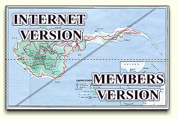
The 4th Marines Defense
Sector Map
*.jpg (54 Kb)(Internet Version)
*.jpg (468 Kb)(Members CD ROM Version) |
| |
|

|
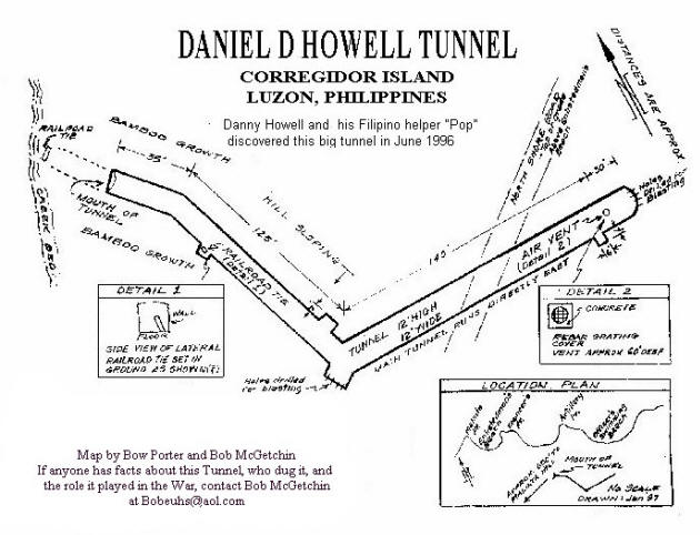
A detailed map of the
mysterious RJ-43 tunnel drawn by Bow Porter and Bob McGetchin.
(111K)
|
|
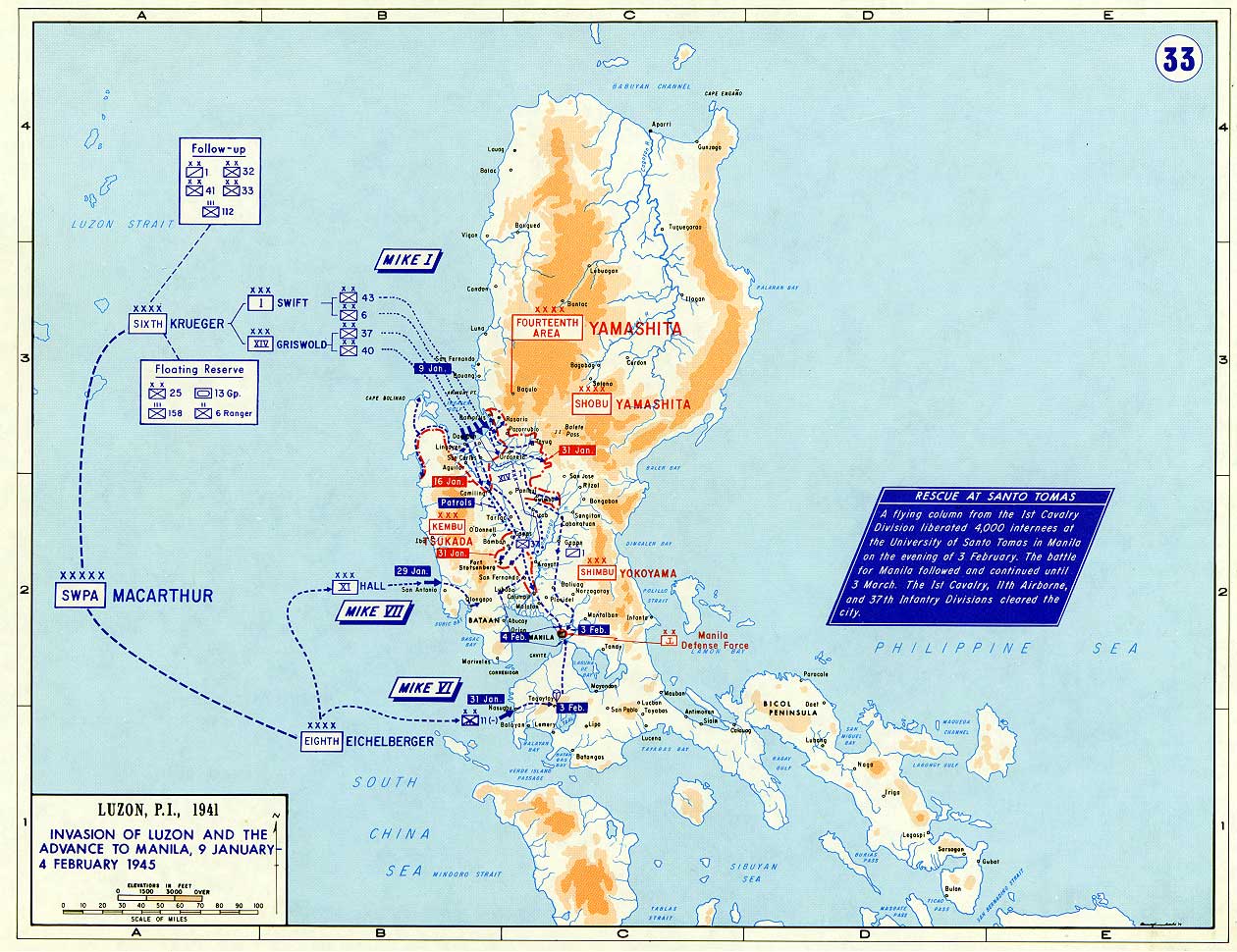
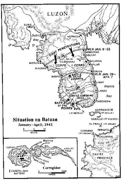
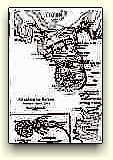
Details of the Situation on
Bataan January-April 1942, including the area of first
Japanese penetrations, Corps areas of responsibility, the Battle
of the Pockets, and the Battle of the Points.
(54.8K)
|
|
|
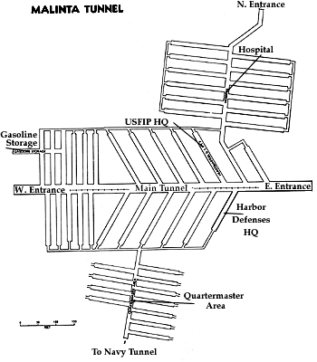
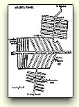
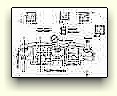
This widely reproduced drawing
of Malinta Tunnel, featuring the hospital and QM laterals.
(28.6K)
Our digital mapping
project has established that it is inaccurate.
|
|
|
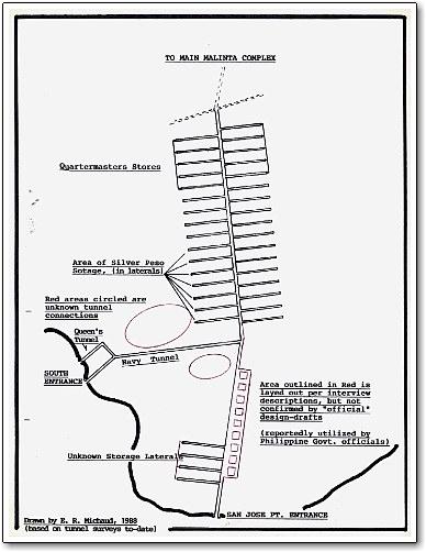
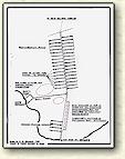
Beyond the QM laterals are
the NAVY Laterals. This map was drawn by Ed R. Michaud in 1983
based upon his research into the storage of silver and gold in the
1941-42 period, and cannot be vouched for, particularly in the now
collapsed areas. There are, in fact, four Navy tunnels on the
western side of Malinta Hill, named Queen, Roger, Sugar and Tare.
It's not known whether the Q-R-S-T lexicon is of any significance. Don Abbott has recorded 20 entrances of varying sizes which
exit and ventilate the Malinta Hill.
(40.6K)
Our digital mapping
project has established that it is inaccurate.
|

|
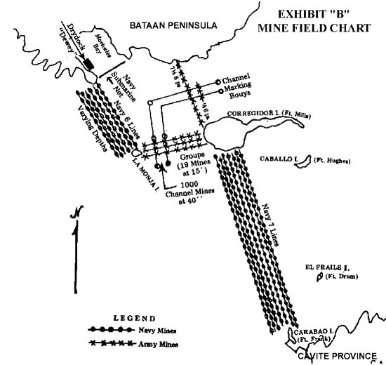
Exhibit "B" to the Moore
Report, this illustrates the mine fields which linked Corregidor
to Bataan to the north and Cavite in the south. Both the Army and
Navy minefields are shown. (50.1K)
|
|
|
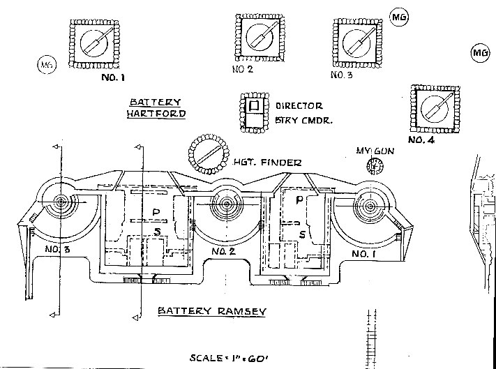
Battery Ramsay was virtually
obliterated when a direct aerial hit penetrated its
magazine, courtesy of The Jolly Rogers. During the siege in
1941-42, Al McGrew manned a MG pit in front of gun #1, and he's
applied his talents in illustrating the battery as it then was.
(79.7K)
|
|

|
Battery Way, plan view.
Fortunately for Corregidoros, Btty. Way has survived the war, the
scrappers, and the tourists. It remains the best example of
the battery architecture of the times.
(91.7K)
|
|
|
|
|
|
| |
|