|
FIELD NOTE:
|
| PLACE: |
CORREGIDOR |
DATE: |
22
NOV 2011 |
| LOCALE: |
MALINTA HILL |
| OBSERVATION: |
THE
NORTH SIDE OF MALINTA HILL |
| BY: |
JOHN MOFFITT |
| |
REF: FOTS2/111122-1 |
| |
|
In the past I had recorded the location of all entrances and airshafts
of the Malinta Tunnel with my GPS. Recently I noticed that somehow I had
deleted the co-ordinates of one airshaft on the north side of the hill
above the 1000 Bed Hospital (north-west corner). It is not important to
have this waypoint but it made my collection incomplete, I decided to
head up there again to fix this little problem and today would be that
day.
I made a GPS Track of my travels and planned to follow Karl’s great idea
of overlaying it onto Google Earth. Unfortunately the Google Earth
satellite photo of Corregidor Island is crap and it did not look very
good at all. For clarity I decided to use a map and manually label my
trip plus some points of interest. Using nearby references and map
contour intervals, the labels are quite accurate.
Map Legend
1 = 1000 Bed Hospital NW tunnel entrance
2 = Airshaft above the 1000 Bed Hospital, NW corner
3 = EG IV 3 (Emergency Gun Group Fire Command Station Supplemental
Sector 3)
4 = Searchlight #8 tunnel
5 = 75mm gun shelter
6 = Three structures opposite the Enlisted men’s Swimming Beach
Yellow line = North Shore Road
From the North Shore Road, the easiest way up the airshaft is to follow
a relatively steep ravine almost straight up the hill. Keeping a bit to
the left would bring me to the airshaft and going slightly to the right
would bring me to the tunnel entrance. This small tunnel connects the
north-west corner of the hospital to the outside hill.
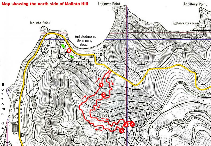
The start and end points of my Malinta Hill trek were on the North Shore
Road. At this location we are looking down the road towards the Enlisted
Men’s Beach.
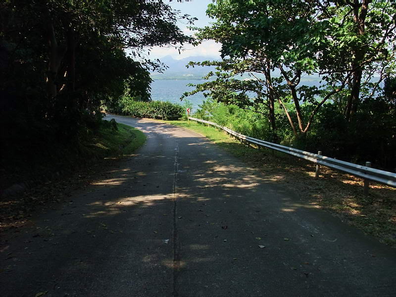
The airshaft itself was well hidden by big leafy vegetation but
fortunately I knew roughly where it was. A short while later I could
just make out the straight lines of concrete through the sea of green
plants. I made my way over to the airshaft to record the location (#2 on
the map).
You can just make out concrete straight ahead.

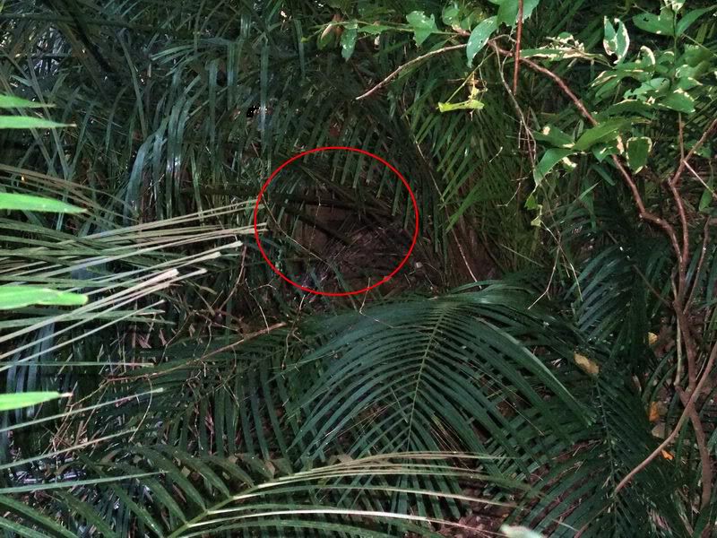
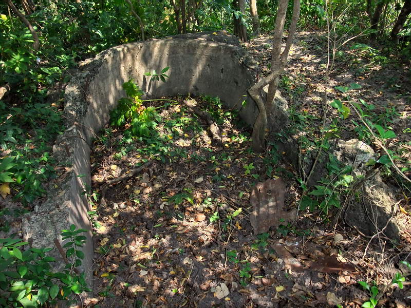
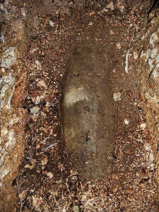
The damaged airshaft above the NW corner of the 1000 Bed Hospital.
Another view of the airshaft. Note the rear vents are nearly full of
soil that has slid down the hill over the years.
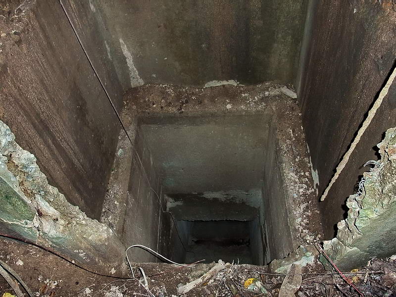
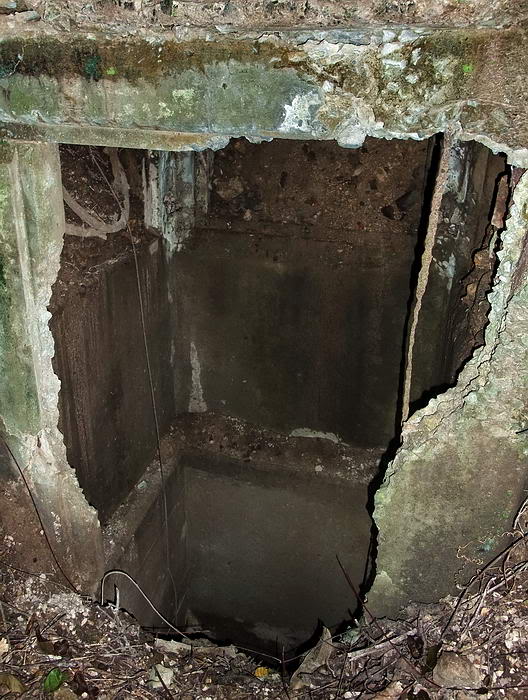
Looking down the airshaft. It drops vertically from the surface then
transitions to approximately a 45 degree slope down into the Hospital.
While the GPS was doing its thing, I wandered around a bit. Standing a
ways above the airshaft and looking uphill I noticed light filtering
through the base of the trees. This may have been just part of a cliff
visible higher up the hill however my trusty GPS told me that this was
actually the ridge between Malinta Point and the top of Malinta Hill.
I took some photos of the airshaft and headed further up the hill.
Straight up was getting a bit steep so I kept slightly to the right.
Within minutes I was standing on top of the ridge looking down on
Bottomside.
You may be wondering, that fots guy just climbed another hill, so what!
Well, at least for me, I did not think that it was possible to safely
get up the north side of Malinta Hill anymore. No one I know has ever
mentioned doing this before. If you stand on the North Shore Road and
look up Malinta Hill it looks too steep. I did have to hold onto trees
for balance much of the way but it was not a difficult climb at all.
In February of 1945, Japanese soldiers coming up this part of the hill
would have seen few standing trees but there would have been roots and
rocks to hold onto. The fact that they were probably less than half my
age and in good shape would have helped too.
Getting up here clearly demonstrates that Japanese soldiers coming from
the inside of Malinta Tunnel or other nearby tunnels would have had no
problem storming up to the top of Malinta Hill in force. Also it shows
that they could have climbed to the ridge above the Hospital Tunnel and
poured down onto Bottomside if they had chosen to do so. This never
happened either.
I wonder if one of the reasons this did not happen is hidden in Valtin’s
account of the battle regarding 3rd Platoon on Malinta Point. He wrote:-
"We
also kept wondering what had happened to the 3rd Platoon, marooned
out there on the promontory (Malinta Point). Contact was finally
made by radio.
"This is Joe Blow to King Three. King Three, tell me your
situation."
"King Three to Joe Blow...We're okay...Over," they answered.
"Joe Blow asks have you had any trouble...Over."
"Two attacks. We have three walking wounded. Not bad...Over."
"What are you firing at? What are you firing at? Over."
At the other end somebody chuckled.
"Just good clean fun, we've got..."
The 3rd Platoon explained: They had a bead on a distant water well,
on the eastern end of the island, and the Nips seemed to have become
mighty thirsty. They kept dashing up to the well with jugs and the
marksmen of the Third Platoon were picking them off.
(When Valtin mentions “on the eastern end of the island”, I assume he
means ‘east’ of Third Platoon. Malinta Point is actually far from the
eastern end of Corregidor Island).
Since the Japanese were shot at every time they dashed to the water
source, did they incorrectly assume that a large US force was just down
the hill? Did this affect their decision to not attack up the hill in
force?
The distance from 3rd Platoon in the concrete defensive position on top
of Malinta Point to the NW Hospital Tunnel entrance is 156 metres (170
Yards). This is a nice ‘sporting’ distance and yes, the tunnel is east
of 3rd Platoon. Note that 5 ft contour interval maps ‘do’ show a clear
line of sight between these two locations. Could this tunnel be from
where the Japanese were coming from? Thirty feet or so away from the
tunnel is a steep ravine eroded by rain water. It is mostly dry now but
like many similar dry streams, if you dig down bit you can often find
water. Perhaps a crude water source existed there somewhere but is
filled in today. I can’t say for sure.
Where I was standing on the ridge I do see a few old foxholes but
nothing like the quantity that exists on the two hills to the north-east
down below me. Since it was a nice day and I had lots of time left, I
decided to walk up the ridge to the top of Malinta Hill. This is an easy
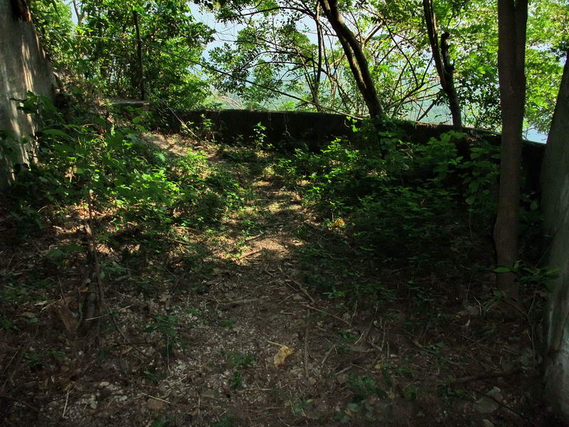
walk and I reached the crest in front of an Emergency Command Station
(#3 on the map). I spent some time up here just looking at the view and
enjoying the nice breeze.
Emergency Command Station (#3 on the map).
The entrance to Searchlight #8 tunnel (#4 on the map).
This photo was taken from the tunnel entrance looking out to where the
searchlight would have been positioned when in operation.
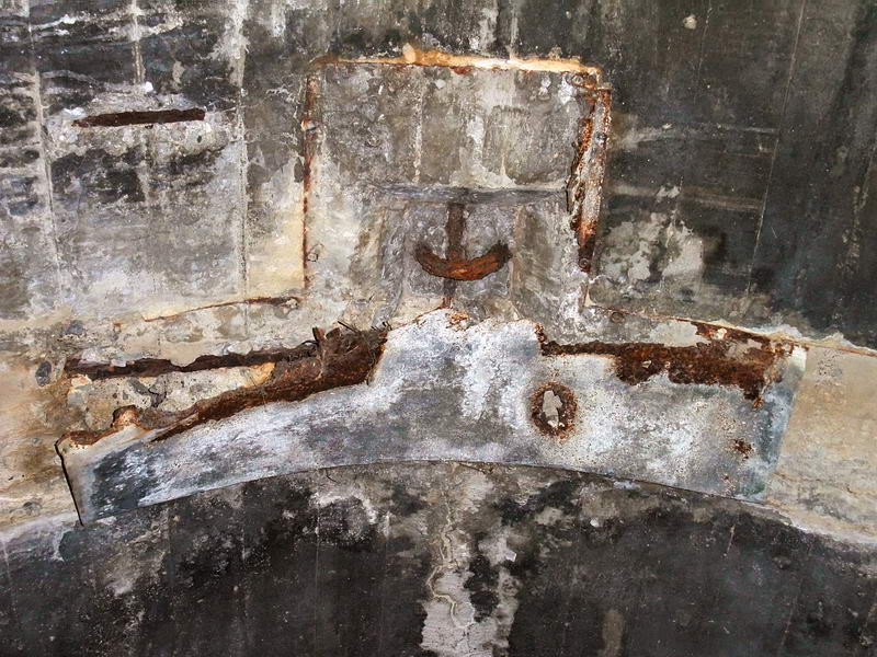
I never noticed this before. If you look straight up near the tunnel
entrance you will see this loop embedded in the concrete.
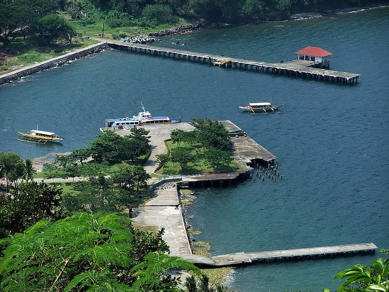
A recent typhoon has removed a tree on top of Malinta Hill so you now
have a great view of the 92nd Garage area and the eastern tip of the
island.
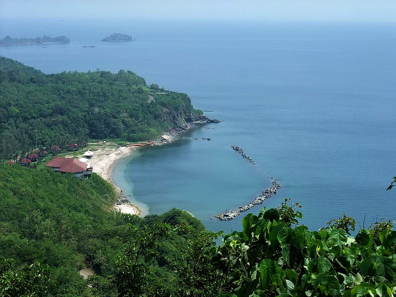
At the 75mm gun shelter (#5 on the map), the view is as good as ever.
Here we are looking westward down onto the north side docks. From top to
bottom they are Engineer Dock, North Dock and Lorcha Dock.
For my return path I decided to walk down the ridge towards Malinta
Point. From there it is a short slope down to the North Shore Road and
then around the hill to Bottomside. For something different I kept to
the left side of the ridge looking for anything new. There is a
horizontal trench that goes almost 1/4 of the way down the ridge but not
much else of interest.
When I got to a narrow section of the ridge, I went over to the north
side to look at the view of Engineer Point. Looking down the hill
through the trees I saw something that I had not seen in the past. Going
straight down the north side of Malinta Hill is a noticeable ridge. This
is not shown on the map. To make it even more interesting, my GPS showed
the tunnel entrance to be right down the center line of the ridge.
Well, it was time for a change of plans. I had just come up this side of
the hill so going back down it should not be a great problem. Again I
held onto trees for balance but this was easy. Soon I saw a mini cliff
in front of me and I was looking down at the tunnel entrance (#1 on the
map). The steepest part of the whole ascent was here as I held onto tree
roots to get about 15 feet or so down to the level of the entrance.
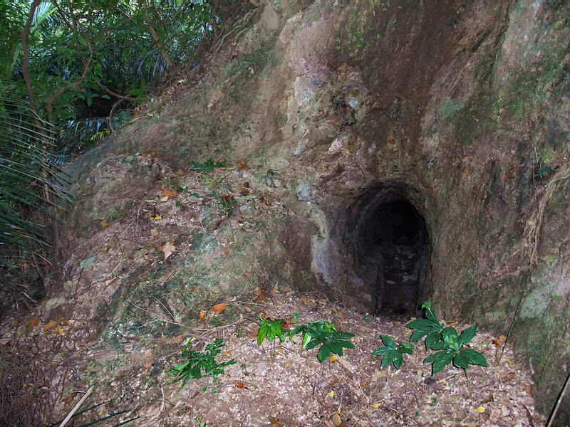
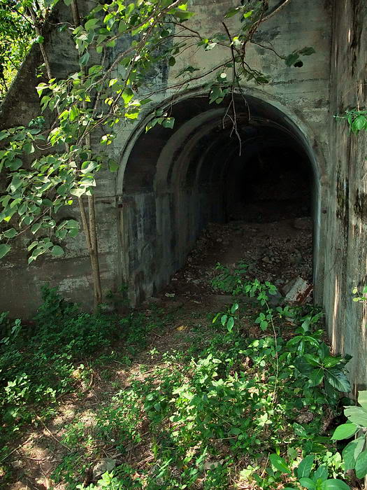
1000 Bed Hospital NW tunnel entrance (#1 on the map).
This tunnel is quite long and seems to have been constructed as a
drainage path for a sewage pipe coming from the Hospital toilet. You
have to crouch over quite a bit to get through there.
In places, a concrete pipe can still be seen in the floor of the tunnel.
For a moment I considered going into the tunnel, through the Hospital
laterals and over to the main Malinta Tunnel shaft to sneak up behind
the guard. I was joking a bit with him yesterday but wisely give up on
the idea. First, I don’t know him that well and two, he is armed. This
is more fun anyway.
At the tunnel entrance, I am now not far above the North Shore Road. I
can see the silver guard rails through the trees. After taking a few
more photos I continued down the hill. Back out on the North Shore Road,
I am amazed at how easy that was. If I ever did this again I would go up
the same way I just came down.
THE RETURN JOURNEY
GO TO PAGE 2