|
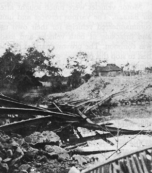
BRIDGES
ON BATAAN.
Remains of a steel bridge. |
| |
Formed by the southern heights of the
Zambales Mountains, the Bataan peninsula juts out from the mainland of
Luzon between Subic and Manila Bay like a huge thumb pointing at the
shore of Cavite Province only twelve miles away. Between Bataan and the
Cavite shore lie Corregidor and several smaller islands, guarding the
entrance to Manila Bay.
Only twenty-five miles long and twenty
miles wide across its base, Bataan is ideally suited for defensive
warfare. It is jungled and mountainous, cut by numerous streams and deep
ravines, and has only two roads adequate for motor vehicles. Dominating
the peninsula are two extinct volcanoes: the 4,222-foot high Mt. Natib
in the north and, to the south, the Mariveles Mountains whose highest
peak, Mt. Bataan, towers to a height of 4,722 feet. Along the east
coast, on the Manila Bay side, the peninsula is flat and swampy near its
base but becomes hilly and rugged to the south. The coastal plain on the
west is extremely narrow. Here the mountains extend almost to the sea;
high cliffs guard the shore and toothlike promontories jut into the
water. Radiating from the two volcanic masses flow many streams which
wind their way through steep ravines and gullies toward the bay and the
sea.
Bataan is crisscrossed by a large number
of trails, quickly overgrown by the tropical vegetation and rarely
suitable for vehicular traffic. Across the base of the peninsula is
Route 7, lost to the Americans by their withdrawal from Layac. South of
Layac, paralleling the east coast down to Mariveles at the tip of the
peninsula, then turning north to parallel the west coast as far as
Moron, is Route 110. The east coast portion, called the East Road, is a
single-lane, all-weather road; the stretch from Mariveles to Moron on
the opposite coast, the West Road, is not as well surfaced. The only
other road of importance is an east-west road from Pilar to Bagac,
midway down the peninsula and across the saddle between Mt. Natib and
the Mariveles Mountains. This road, called the Pilar- Bagac road and
cutting Bataan like a waist belt, was the only vehicular road providing
lateral communication for the forces divided by the rugged heights of
central Bataan.
No better place than Bataan could have
been chosen for a final stand. There were compensations for the
inhospitable countryside. "Taking it all in all," noted Colonel Skerry,
the North Luzon Force engineer, "the rugged terrain of the Bataan
Peninsula, covered as it was by a thick jungle, concealed the works of
the defender even when the enemy had constant air superiority and air
observation."2
And after two weeks of withdrawal the men were glad to reach a position
that was not to be abandoned the next day. Morale was good. "The general
feeling seemed to be," wrote Colonel Collier, the assistant operations
officer of USAFFE, "we have run far enough; we'll stand now and take 'em
on."