|
|
|
|
|
|
|
|
|
|
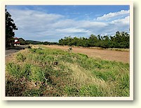
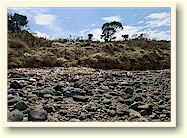
A. Kindley Field drop-off point. This is the view looking north-west. The little terminal building and control tower can be seen to the left.
A WALK ON THE TAILSIDE
(North of Kindley Field)
Text and Photos by John Moffitt
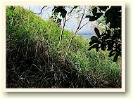
For some reason, this part of Corregidor Island on Tailside seems remote to me. No one I know has mentioned exploring in this area so it was a bit of an unknown. Maps do show some points of interest there.
Ron, the CFI island manager, tells me that there are lots of snakes (especially Philippine Cobras) on the east end of Corregidor. I have never seen one yet, but I cut a big stick and walked slow anyway. I noticed that the ground vegetation seemed deader that usual for this time of the year, so walking was noisy anyway.
My plan this day was to get a ride to Kindley Field and walk to the eastern end of it. From there I would turn north and basically zip-zag (north of Kindley) in a westerly direction looking for some of Corregidor’s original fortifications and any traces of the 1942 Japanese invasion or the subsequent 1945 US mop-up. When I was in-line with the western end of Kindley Field, I would call it a day.
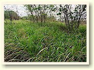
Soon I came across the old road which was overgrown with grass. Past the road it looked ok so I moved into the tree line to start my plan. Awhile later on one pass back near the road was a big crater in front of me. Across the crater was a sudden noisy movement. At first I didn’t see it but there was a snake.
Since it was about 20 ft away I froze and tried to look through the vegetation for a better view. In about 5 seconds, what I saw slither away was approximately 2 to 3 inches at the widest part and 4 ft long. It was obviously a bit longer since I never saw its head.
Whatever that was, it blended in very well with the dead branches and leaves and moved quite fast. Snakes must be smart since they know enough to run away quicker than some humans do.
On return to a near normal heard beat, I moved on.
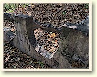
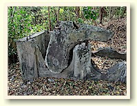
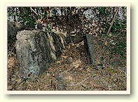
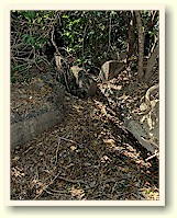
The first structure I encountered was Unit Command Station #1 which is totally destroyed. (Photo D.) As the map shows, it must have been a very small building as there is not much broken concrete lying around. Due to vegetation only a corner of the floor is still visible at the top of the ridge.
When I arrive at any location, I first set my GPS to average its position to get the most accurate reading. This takes time so while it is doing that, I clear vines and branches etc and then take some photos.
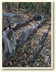
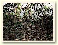
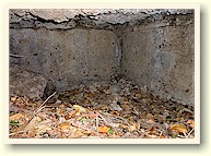
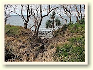
Heading north along the ridge it takes only a few minutes to reach I-F-2 (Sector 1, Field Gun, Position #2) which is located up above the rocky beach. Now this place is interesting. I consisted of two gun positions with a centre underground magazine. (Photo E.)
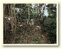
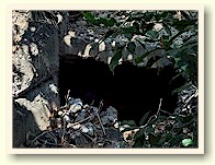
I found no trace of the “Mobile Searchlight Shelter” shown on the map but there is a structure here that I need you guys to identify for me. It is rectangular in shape, no roof and has six semi-circular grooves facing upwards in the sides. (Photo F.) This actually looks similar to the concrete forms for holding fuel tanks you see near Morrison Hill but why would fuel be stored within feet of gun positions and a magazine? There are also two low concrete walls just outside the two longer walls of this structure.
page 2
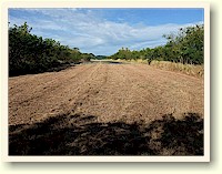
B. View from the eastern edge of the airstrip looking west. I headed right (north) into the jungle from here.
Malinta Gasoline
Storage System |
Middleside Officer's Qtrs |
Btry Denver Tunnel |
The Final Line of
Defense | Not Finding
RJ-43 |
Btry Chicago
Malinta's Navy
Tunnels (Part 1)
(Part 2) |
Type 96 AA Gun
| A Walk
on Tailside |
G-1 Command Post