|
FIELD NOTE:
|
| PLACE: |
CORREGIDOR |
DATE: |
20 AUGUST 2009 |
| LOCALE: |
TAILSIDE |
| OBSERVATION: |
INFANTRY TRENCHES |
| BY: |
JOHN MOFFITT |
| |
REF: FOTS2/090408 |
| |
|
I remember speaking a few years ago to a day tourist while waiting for the
boat back to Manila. He had had a good tour and seen everything Corregidor
had to offer.
I was like that on my first couple of trips until I started to do some
research. Today, after eleven trips my list of places to visit is as long as
ever.
Today I took the
morning boat to Corregidor so by the time I was ready to walk it was nearly
11am. Since only a half day remained, I wanted to take some current photos
of the Tailside trenches for okla that were mentioned in a recent bulletin
board thread. The weather is very hot now but I have never had such good
visibility on the ground due to baked dead grass.
After walking around Malinta Hill via the south road, I decided to take a
short-cut through the jungle heading towards RJ-43. I was walking downhill
on the east side of Malinta Hill. Later I was farther south between Malinta
Hill and the 92nd Garage area.
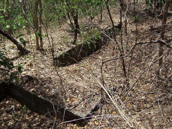
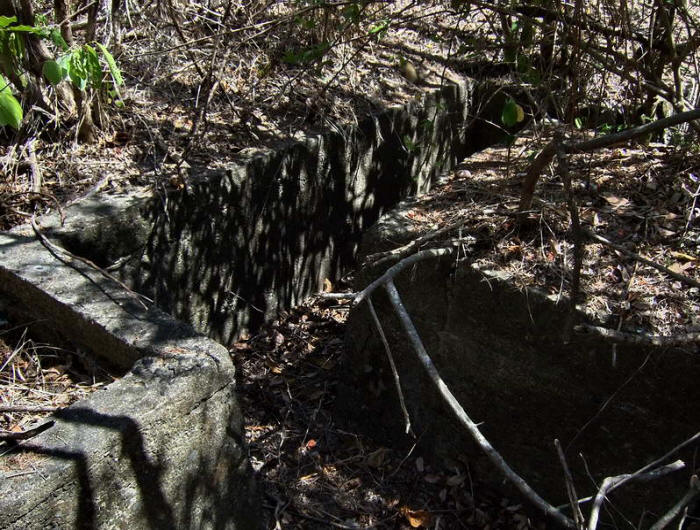
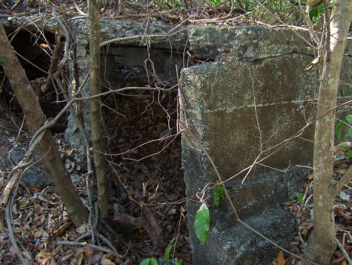
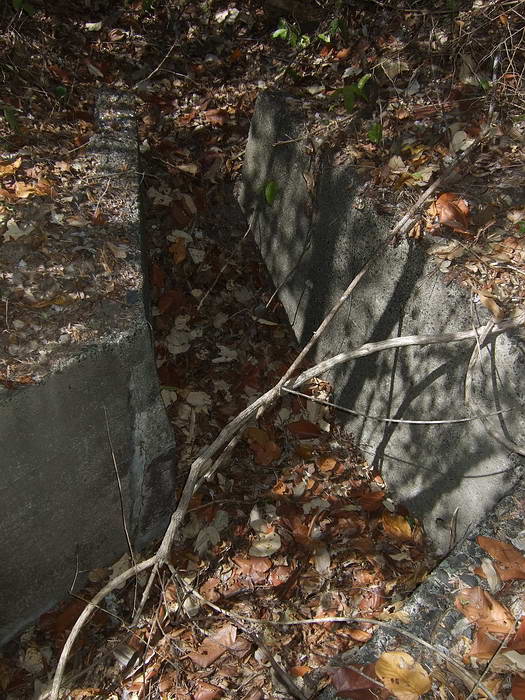
After only one
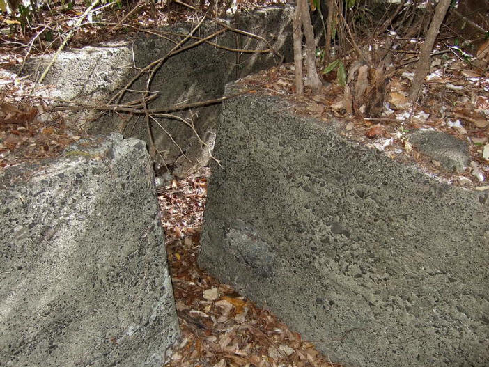
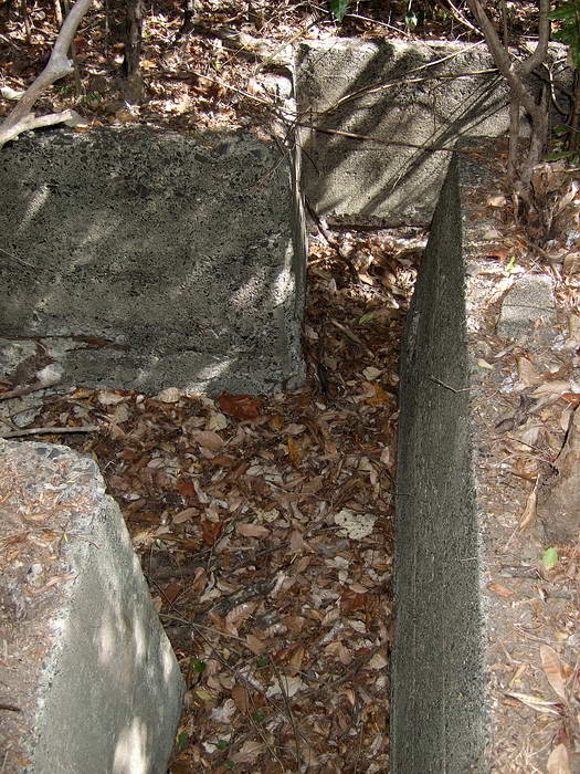
minute I came across a concrete structure facing north-south. It is 38
meters long in three connected sections. The downhill side has a prominent
gravel mound all along it and there is an old road below, perfect view and
position.
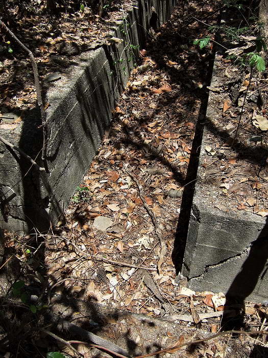
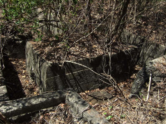
Since this structure reminded me a one I had not seen for years, I walked a
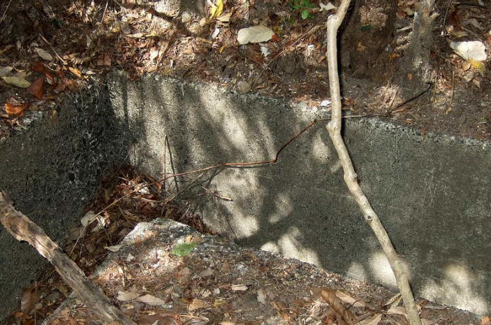
little north to the other one. It is above part of the North Shore Road and
is a total of 25 meters long. The shape is irregular and the east end is
partially destroyed.
Wandering around this area I saw lots of big craters and also a couple of
semi-circular elongated shapes in the ground similar to crude defensive
positions.
Continuing on I came to the water tank which is above the pump station. This
station is beside the road heading to the Malinta Tunnel East entrance.
Since I could see quite well through the undergrowth I walked west along the
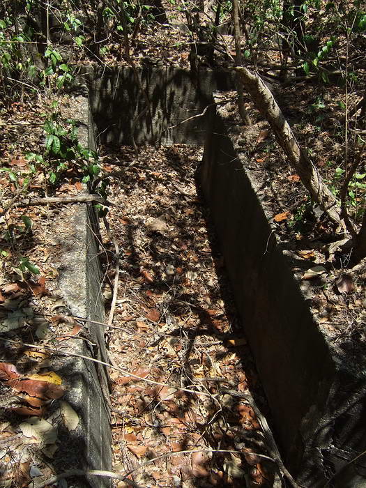
road even though it was not my intended direction. Beside the trail heading
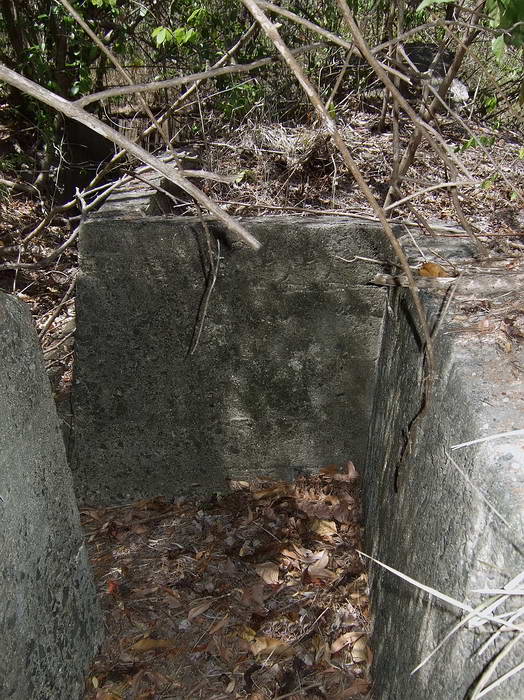
down to the 92nd Garage area is a long third structure. This one is slightly
curved but roughly similar to the second one. It is 37 meters long. A small
portion of one wall has collapsed.
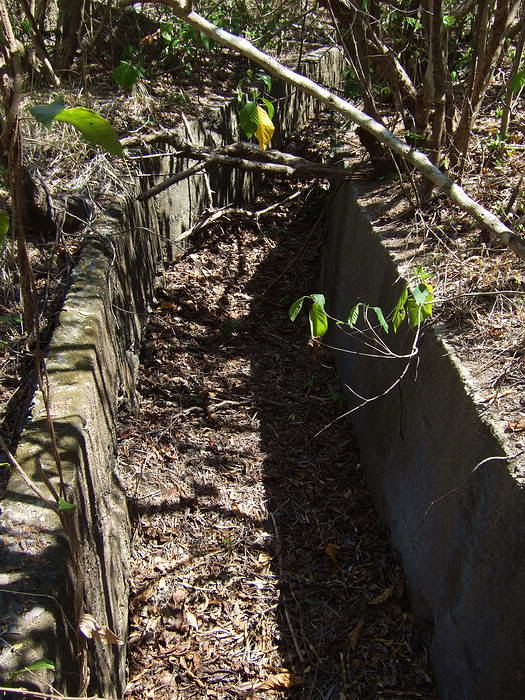
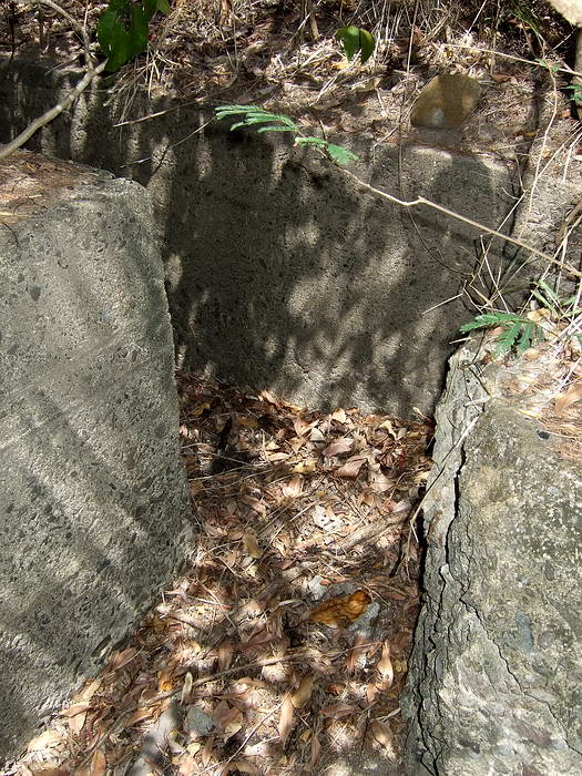
I was ready to turn around when I noticed an old road going south that you
would never see if the undergrowth was green and alive. I walked in here a
short distance and guess what, a fourth structure. The undergrowth here is
thick with those bushes with needles that rip the flesh from your bones.
This one is long, 58 meters and almost a ‘J’ shape with much of it along the
top of a ridge. The structure runs south and then east. It ends parallel to
the coastal cliff between 92nd garage area and Malinta Hill south east
corner. It took me almost forty-five minutes to cut my way to the end above
the cliff…damn bushes!
There are a couple unusual features here including one fourteen meter
section with a roof. There are openings in the wall facing north.
I must admit that exploring this area seemed pointless in the past as I did
not think anything of interest would be here. Not so. None of these
structures may be new to some of you but I had fun exploring them.
At the time I was guessing these were some of the old 1920s and 30s ‘X-X-X’
positions you see all over the island. I was surprised to find out tonight
that I cannot find any of these structures marked on the maps I have.
Now I am thinking they were part of an elaborate drainage system but there
is no visible system feeding them plus the first one has the ends blocked.
If even simple road crossings are recorded then why not these elaborate
structures. Why the roof on top of a ridge? So the rain water does not get
wet? 
Does anyone know for sure? They would make good defensive positions.
I took GPS waypoints of the ends of all the structures and I will ask
Mapmaster to place them on a map we can all see after I get back home.
Someday when I have time I will create a post with photos, sketches of each
structure and the map. Ignore the poor quality of many photos as it was mid
day with harsh light. I am just trying to capture what I saw for you guys.
Today I never made it to even RJ-43. The next two days I have other plans
but I will continue to the trenches for okla this trip.
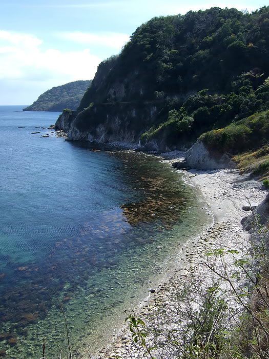
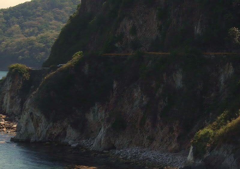
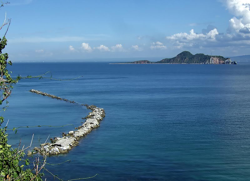
Here are a few coast views you don’t see very often.
I located both trench systems for you okla. If the shape of them is correct
on the 1932 map, then the southern trench has quite a chunk of its northern
portion missing. The trolley line/road between Malinta Tunnel’s east
entrance and the last trolley station seems to cut it off abruptly.
The northern trench is in the shape depicted on the map. One surprise is
that it’s most western leg is not concrete but just earth. There is no
concrete rubble lying around to indicate it was ever more than earth but
after all these years that section is still very clearly a trench.
I cleared away some branches and vines to take better photos. I’ll attach a
few soon.
While in the area I went to 92nd Garage looking for a well that is on the
old maps. There is a post in the ‘map’ sub-board about this.
Finally I walked down to the beach that is directly south of Malinta
Tunnel’s east entrance. Going down I was on the east slope. I later followed
a dry brook so as to hit the beach away from the cliffs. Walking was easy
until the last 10 meters where the vines, tall grass and bushes looked like
a thatched wall. It took me 30 to 40 minutes of cutting to go that last
short distance.
The view was fine but heading back up farther west was a disappointment. The
vegetation was so thick I did not find any structure I was looking for. I
saw no trace of the road above the beach either. Does EXO or Karl know if
S.M.S.H No.3 or II-M-I still exists?
On the way back I decided to go up the western slope. I did come across the
road going to the east entrance but it was quite overgrown also. I continued
straight up and reached the Malinta Hill south road. From there, easy
walking back to a cold drink at the Cove Café.
Tomorrow I will go to Middleside to take some photos of the former Officer’s
Quarters.
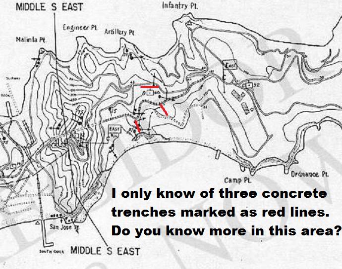
This map (above) is via Karl Welteke.
It shows the location of three of the
five structures
I came across a few days ago. The top one I knew of before, but did not know
what it was. One trench not shown on it is a concrete trench system 38m long
in three sections. It is north of the bottom one marked on the map. The
second structure (small and mostly concrete ruins) is marked on the 1941
Emergency Defense map as a machine gun position. It is between the bottom
one on the map and the missing one I just mentioned.
One comment about the bottom trench on this map. A section of it does go
fairly north-south, but almost two thirds of it continues east along a
ridge above the south coast. Part of this portion has a rectangular platform
(possible machine gun position) and a 14m roof over part of the trench.
Here are sketches of the four trench systems mentioned above. (NOTE:
distance figures are rough, 'paced off' measurements)
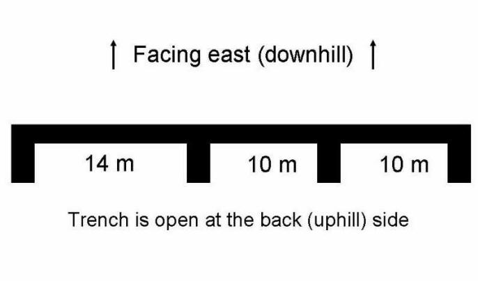
TRENCH NO. 1
Trench #1 is unique in that it only has one wall facing east
(downhill) towards a potential enemy. It is in three inter-connected
sections. Trenches #1 appears to be a post-1932 trench.
_____________________________________________________________
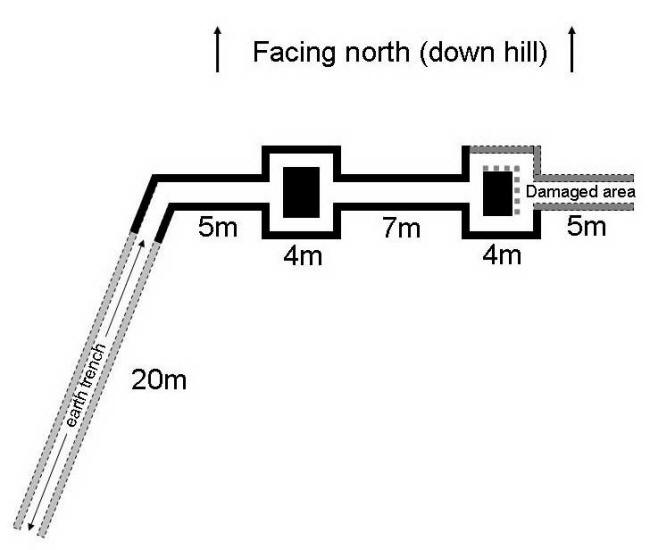
TRENCH NO.
2
Trench # 2 appears to be the 1932 mapped trench.
_____________________________________________________________
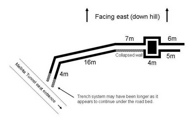
TRENCH NO.
3
Trench number 3 does not appear to be part of the 1941 defenses.
_____________________________________________________________
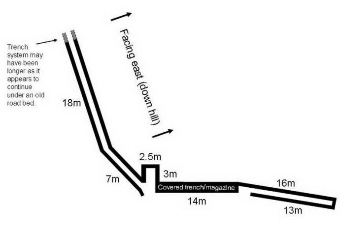
TRENCH NO.
4
Trench #4 has a feature which the other trenches do not - a section of it
has a rectangular area, possibly for a larger gun or CP, plus an adjacent
covered trench. It appears to be a post-1932 trench.
_____________________________________________________________
I cross-referenced eleven April 2009 GPS waypoints, marking each by an 'X'
on 1932 Corregidor map.
My
GPS readings and the original maps concur, somewhat surprisingly.
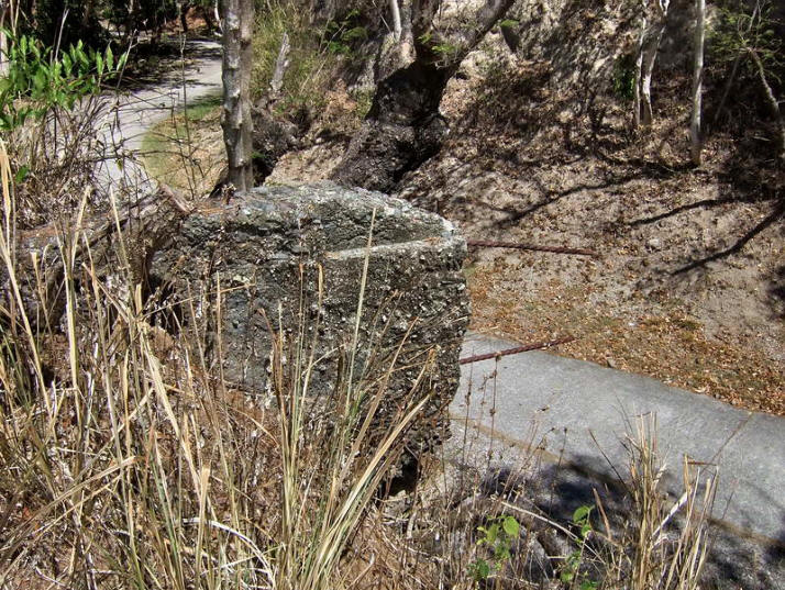
The machine gun position just above the present day road to the Malinta
Tunnel east entrance. This position is shown on the 1941 Emergency Defense
map.
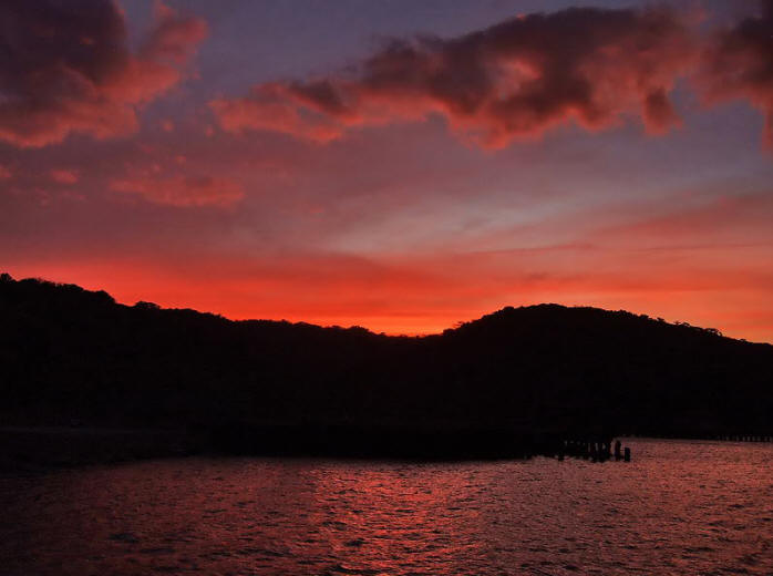
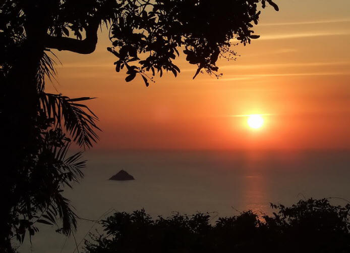
If someone has no
interest in the history of Corregidor,
there is still a lot of beauty there today.
|