|
Most guys who
are intrigued by Corregidor history have always been interested in
this WWII top secret station. To them, Station
CAST and Tunnel
Afirm are not new
subjects. As for others including the thousands of yearly visitors
to the island, few even know if its existence. The day tour buses
rarely make it as far east as Kindley Field and if they do, little
or nothing is told to them as they pass by this tunnel.
Imagine the possible outcome to the battles of the Coral Sea and
Midway if the US did not know the Japanese plans in advance. Highly
classified Japanese military and diplomatic messages were received,
decoded, translated and then forwarded to US brass from this
facility located near Monkey Point. Is this not worthy of even
passing mention during a day tour? There is much more to Corregidor
than the big guns.
I won’t go into much detail on the history of this station. Detailed
information is easily available from books and on Internet sites
such as Corregidor.org.
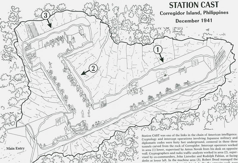
Today, the remnants of Station CAST are a bit of a mystery to many.
Adding to the mystery is that none of the structures are shown on
any of the detailed Corregidor maps. The reason is simple, the
latest map was produced in 1936 and the Navy radio project was not
started until 1939. Station CAST became operational on October 17th
of that year.
Hotel guides tell me that the tunnel and area are very rarely
visited. They know of no one in the tunnel for a of couple years
now. Perhaps this is due in part to the tunnel being one of the more
difficult ones to get in, and more importantly, to get out of. The
rumour of cobras inside seems to also keep some people away. Even
the surrounding area is not friendly to the occasional visitor.
Trees, vines and thorny plants are everywhere. With the exception of
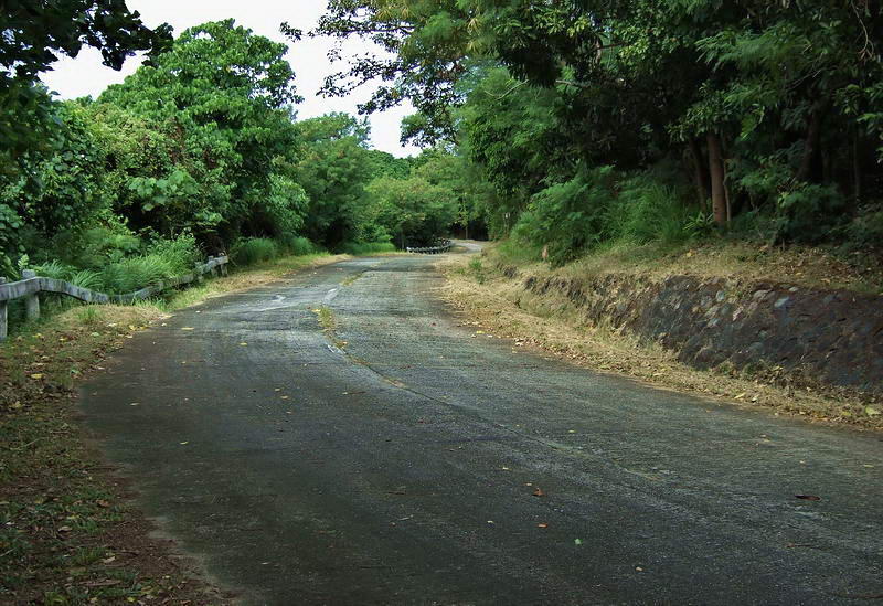
the South Shore Road, none of the roads and paths are clear anymore.
The massive tunnel explosion on Feb.26 1945 did destroy much of the
tunnel plus virtually strip the surrounding area. Photos from that
time show some large antenna poles and shattered trees to be the
only objects still standing. Although much was destroyed, in this
trip report I will show you what remains of this important site in
Corregidor history.
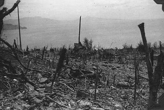
1945 photo of the devastated Monkey Point. Caballo Island and
the coastline of Cavite are in the background.
(Photo courtesy Corregidor.org)
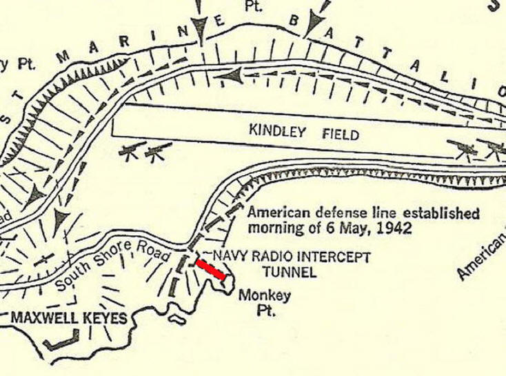
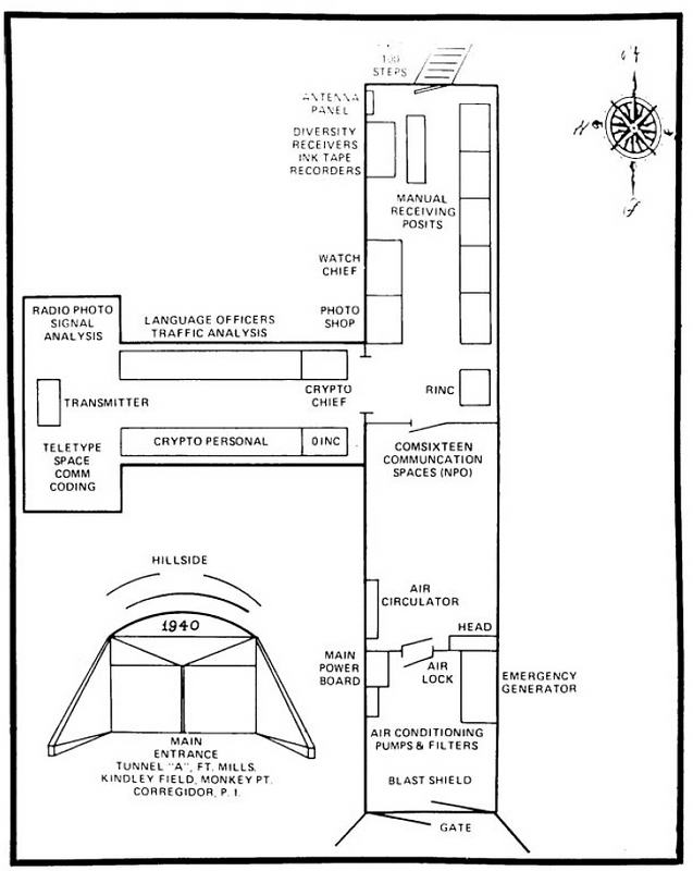
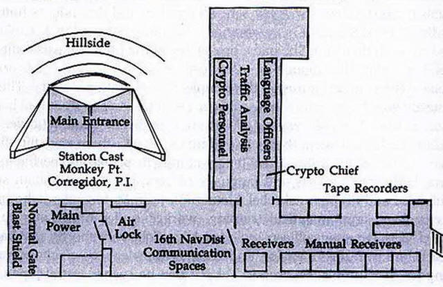
So where is this this tunnel actually located? Here are few maps
from various publications.
Map from “Saga
of a Fortress”
Map from “American Defenses of Corregidor and Manila Bay 1899-1945”
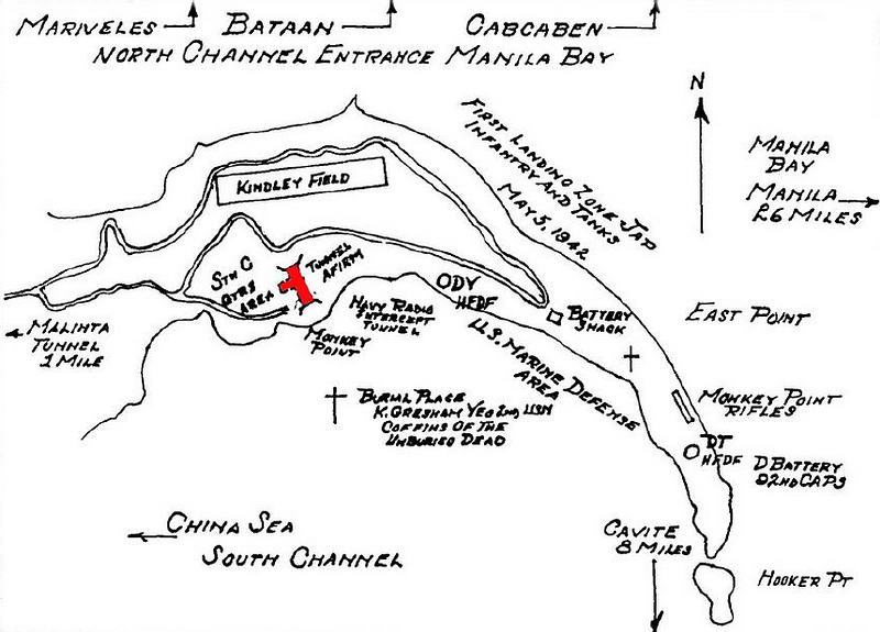
Map from “Intercept Station ‘C’ From Olongapo
through the Evacuation of Corregidor 1929-1942”
Map source unknown
The above maps
from these highly regarded books all have something in common, they
are all WRONG. The
tunnel is actually located further north and passes under the South
Shore Road.
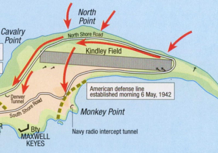
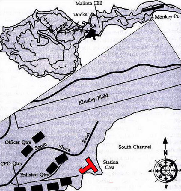
In 1990, Don Abbott and Ed McCarthy produced a map after completing
their extensive explorations. By far, this is the most accurate
tunnel map of what exists today. I would recommend reading their
account posted on Corregidor.org at:
http://www.corregidor.org/heritage_battalion/abbott/navytunnel.html
The 1990 map. (Don Abbott and Ed McCarthy)
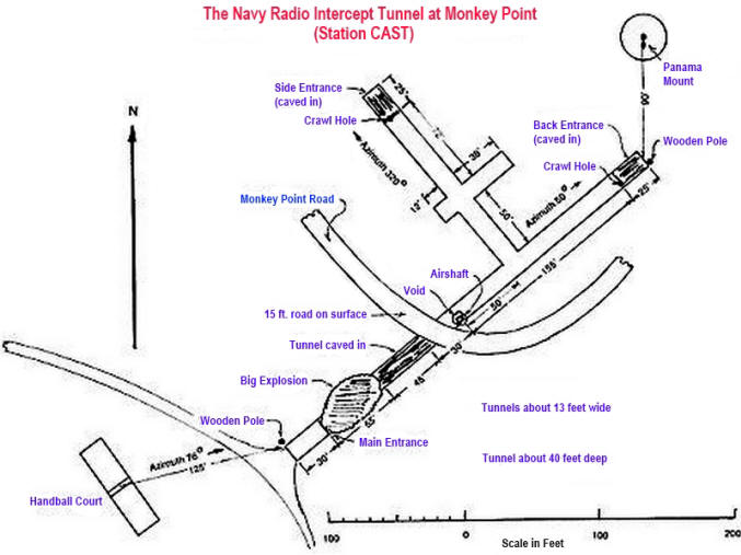
On a few occasions I have wandered around the Monkey Point area
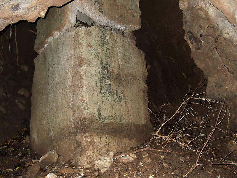
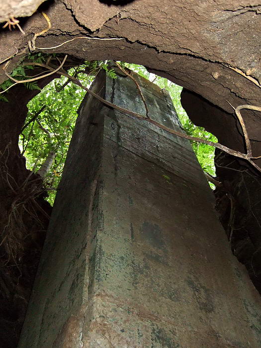
exploring and collecting GPS waypoints for each item of interest.
What remains today basically encompasses the tunnel, remnants of
quarters buildings and the bases of large antenna poles. To date, I
have located 17 of these poles but more probably exist. This
hillside must have looked like a pin cushion from the air. The
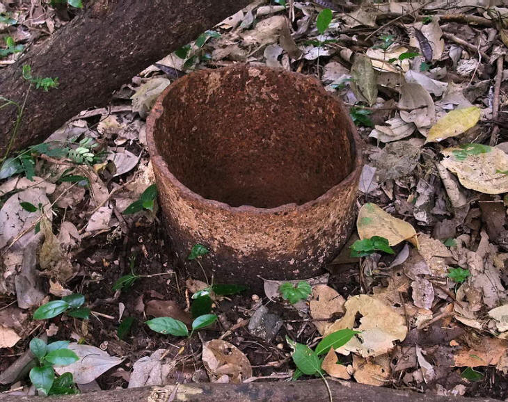
handball courts, a brick/concrete oven from a field kitchen and
traces of a road can still be seen also. Not much else remains
unless you count broken chunks of concrete.
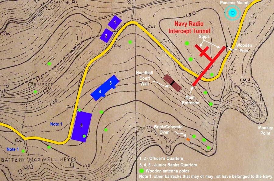
2011 labeled
map. Although the location of each item is accurately recorded via
GPS, I have no way to place the waypoints on this old map. Using
reference points, this was done manually but the results are
reasonably accurate.
As usual,
various drawings of the actual Tunnel Afirm interior do not
completely agree. I can confirm the general tunnel shape but the
only object remaining inside is a mangled steel doorway. Here are
some tunnel interior drawings.
Drawing from
“Intercept Station ‘C’ From Olongapo through the Evacuation of
Corregidor 1929-1942”. The short laterals at the far left are not
drawn to scale
Drawing source
unknown. The short (top left) lateral is missing.
Drawing from
”Day of Infamy”. (Thanks to okla for sending this to me).
Here is a link
to a large readable version of the above drawing.
http://www.pbase.com/fots2/image/134157863/original
Although this is the most detailed drawing, the tunnel section from
the “Main Entry” to the lateral on the left is definitely too short.
Other drawings have this shown correct. The road passes over this
section of tunnel.
Driving east towards Kindley Field on the South Shore Road
(sometimes called the Monkey Point Road), few people notice a little
dip in the road. You have just passed over a collapsed portion of
the Navy Radio Intercept tunnel between the Main entrance and the
big air shaft.
Notice the dip
in the road and guardrail. This view is looking west.
I’ll start at the top of the 1990 map and we will work our way down
to the two Handball Courts. You may find it useful to refer to that
map when looking at these photos.
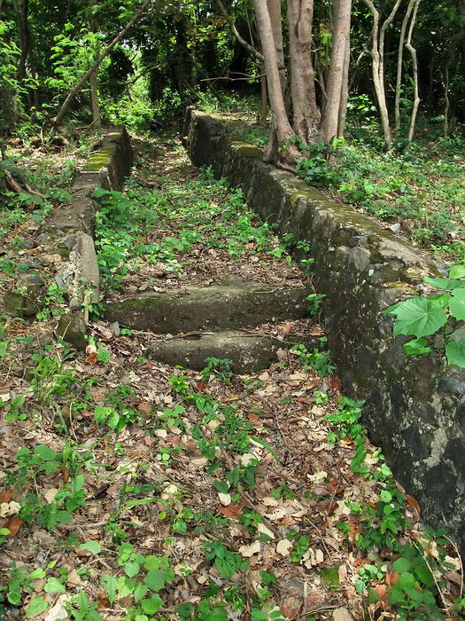
First is the Panama mount of Battery Levagood. It was a concrete
mount for the 155mm (6.1 inch) GPF coastal defense gun. The wheels
of the gun sat on the inner ring and the rear of the gun sat on the
outer ring. A rail embedded in the concrete assisted in positioning.
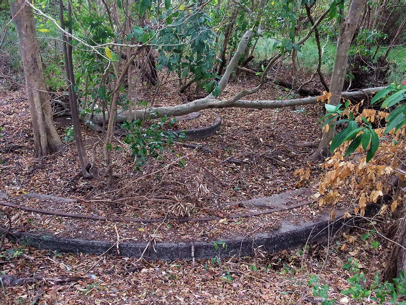
Looking across Battery Levagood’s Panama mount.
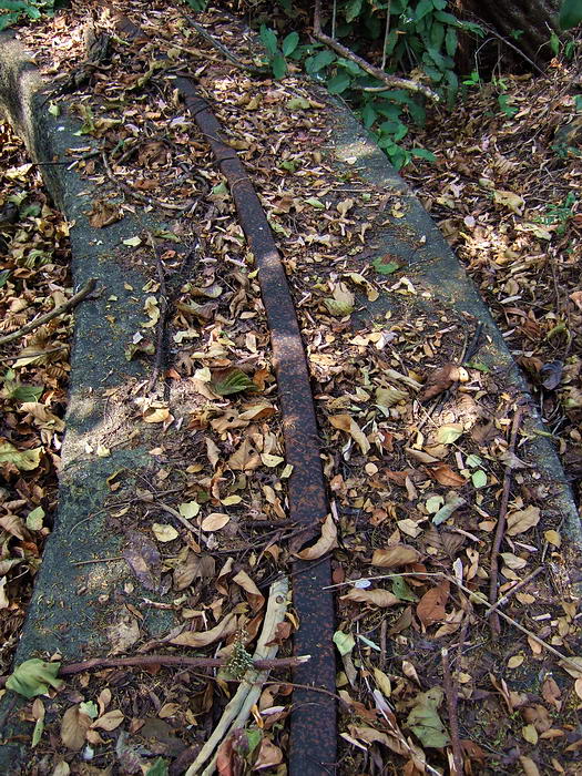
Close-up view of the rail embedded in the outer ring.
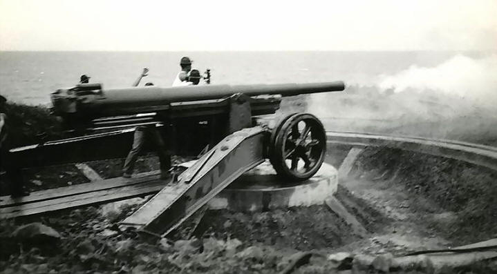
This old photo shows the gun being fired as it sits on its mount.
It is less than a one minute walk to the destroyed back entrance of
the tunnel. A portion of two slanted walls of the walkway can be
seen here but mostly you just see chunks of broken concrete. The map
shows a wooden pole which is still there. A small crater at the base
of more concrete is the actual collapsed entrance. The crawl hole is
long gone.
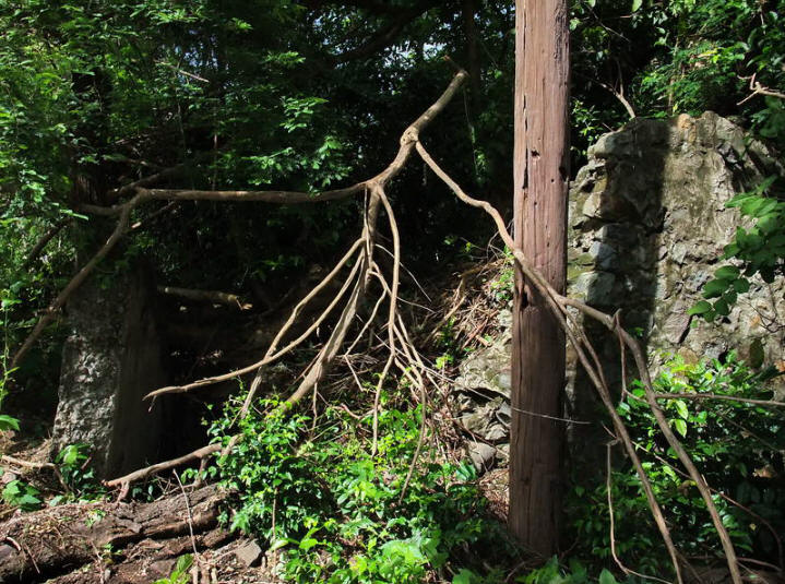
Wooden pole and chunks of concrete.
The little crater and former
crawl hole is further to the left.
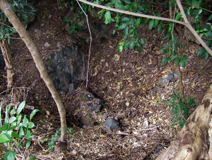
The crawl hole was here.
It is time to enter the tunnel so let’s walk over to the side
entrance. Today this is the only access point to the tunnel. Walking
down the road and up the concrete walkway is the easiest way to get
there.
The walkway up to the side entrance.
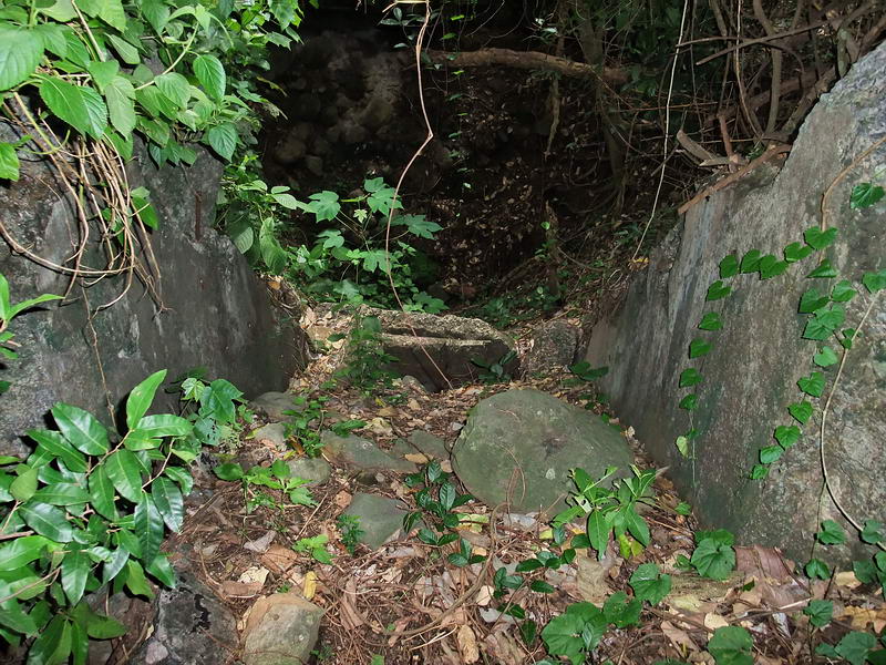
At the top of the steps, turn right and you will see this walled
walkway heading down into a crater at the base of the hillside.
On approaching the crater you will see a hole not much higher than a
man’s chest at the base of the cliff. This is the entrance we will
slide in today. Karl and ExO are my companions; I would not enter
this tunnel alone.
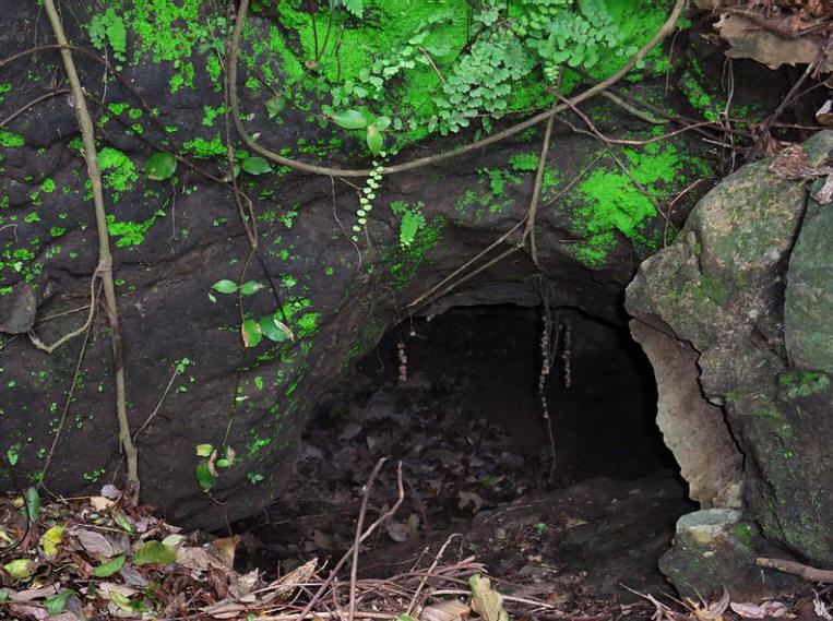
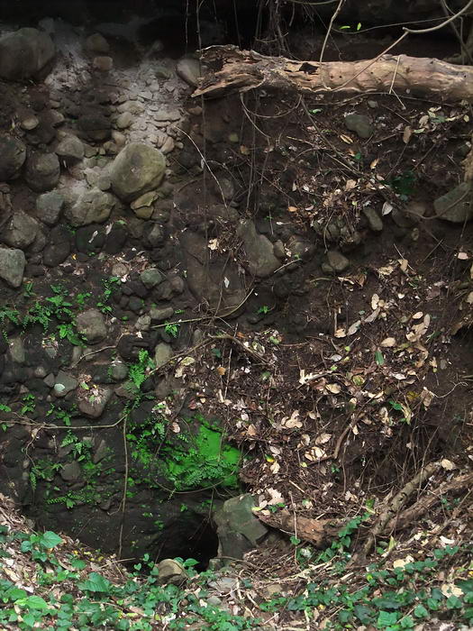
Looking straight down the hole into the tunnel.
The vertical drop from the entrance is approximately five feet.
Slide in and when your feet touch the leaves you are at the top of a
long 45 degree downward slope. Using a rope will help a lot to get
you down and back up the loose rock safely. Anyone at the bottom had
better take cover from falling debris if someone is above them. This
long rocky slope is the collapsed roof of the steep staircase from
the side entrance down to tunnel level.
(N.B. The rope
should be one hundred feet. ExO)
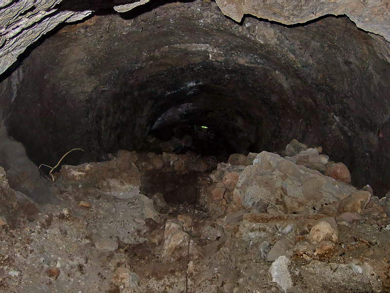
View up the long rocky slope from the bottom. Light from the
entrance can be seen at the top. It does not look very steep in this
photo but it is. Note the rope at the bottom.
I am now standing above what would have been the base of the
staircase. I say “above” because the roof has collapsed and I am
standing on rubble that is several feet above the original tunnel
floor. This is obvious as I have to look down at the concrete arches
of two short laterals that are on both sides of me. The tunnel is
dry and the air is good so no problems so far.
I moved down a few feet to get this photo of the short lateral on
the right.
The view further down looking into the lateral.
The rear is intact.
It is empty now except for a few rocks.
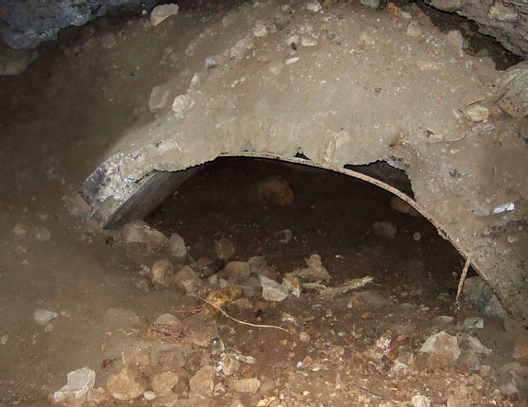
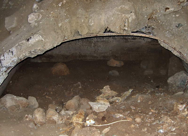
The longer lateral on the left is well below the level of the
debris. A slit entrance is narrow but I see no problem to prevent me
from entering. After hearing and reading what people had said about
this “totally destroyed” tunnel, again, I am surprised to see a
mostly intact lateral. Imagine the top secret activity in here when
CAST was fully operational. On the floor lies a mangled metal door
frame.
Looking straight down into the longer lateral on the left.
Inside this lateral is a metal door frame. You can see a hinge on
the top.
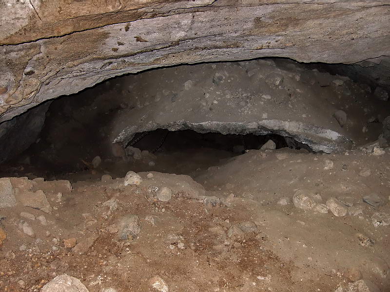
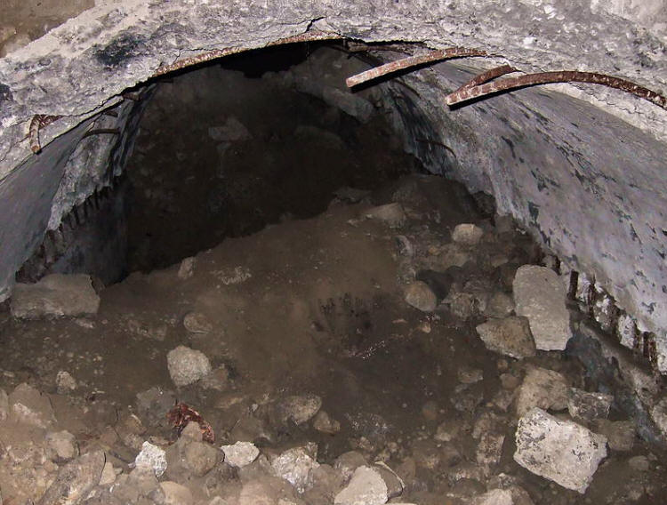
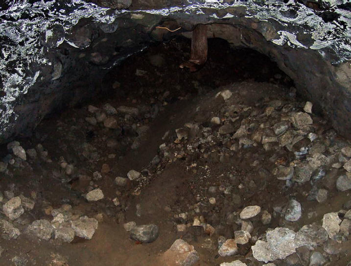
Back out in the big lateral, I move forward towards the main tunnel.
The amount of fallen debris has decreased so I am walking just above
the tunnel floor; the concrete arch in front of me is almost at eye
level now.
Damaged tunnel
roof.
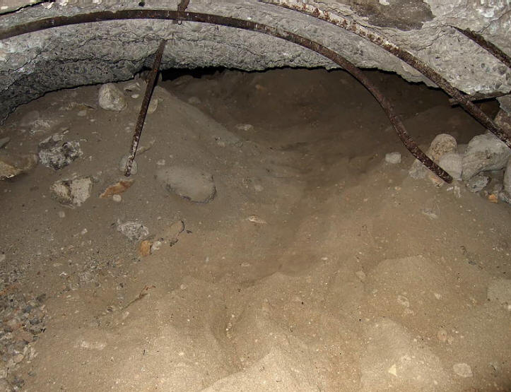
The walking is uneven but easy. The hazard at
the moment is lots of sharp rebar sticking out. Remember it is pitch
black in these tunnels, camera flash photos are deceiving.
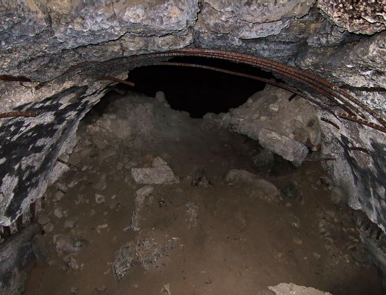
This is the end
of the side lateral.
The main tunnel is just past
the little mound of debris.
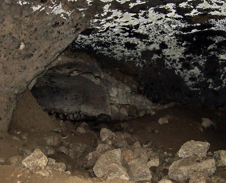
The view when standing in the main tunnel looking in the direction
of the back entrance. To the left is the intersection of the main
tunnel and the concrete lined lateral. The concrete lining of the
main tunnel is gone and the ceiling now has a barbequed look to it.
The view when walking towards the rear entrance.
Further on, some of the concrete lining is still there but broken in
many places. You can slide through this narrow spot into another
open area but the tunnel soon ends abruptly in a full collapse. I
cannot see any remnants of the rear entrance or where a crawl space
noted on the 1990 map used to be.
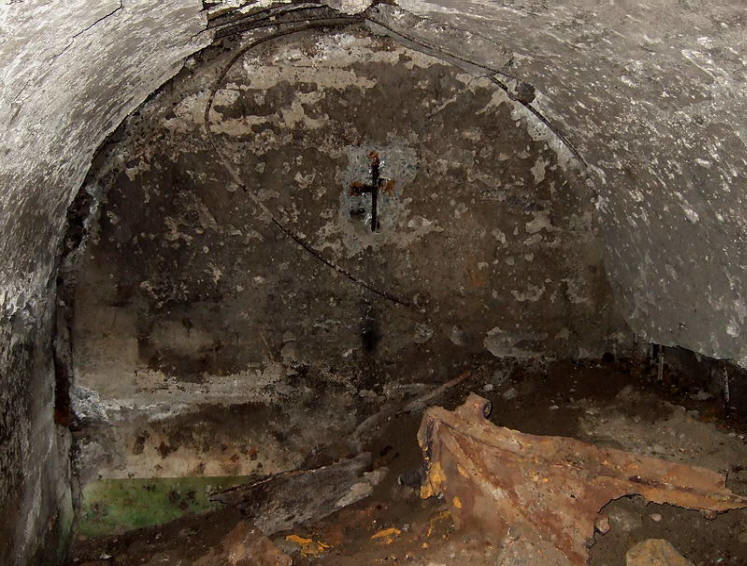
Back at the main tunnel/lateral intersection, here is a look at what
we see looking towards the main entrance. Note the bent metal
sticking down from the ceiling.
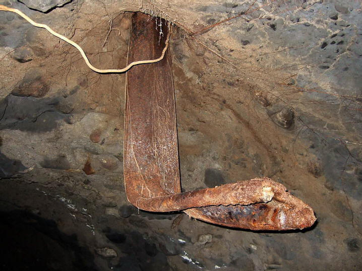
Close-up view of the bent metal.
The Don Abbott article (link up above) says this bent metal was the
diesel exhaust vent, but I don’t buy that. I see two solid metal rods
connected by a piece of metal. (Note the two rods at the end of it).
The blast coming from the main entrance would have been from left to
right in the photo. Why not a sharp bend if it is just crumpled
pipe? The 90 degree bend looks like what I would expect to see if
metal rods were bent, not a hollow pipe. On the surface near where
this piece of metal would appear is a metal pipe. Perhaps this is
why Don thinks what is down below is the remains of it. I may be
wrong, what do you guys think?
The metal pipe on the surface.
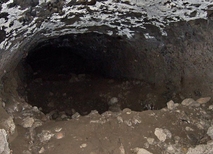
Going a bit further you see some light and feel a breeze. Here is
the
large airshaft. It is impossible to know how much deeper it
goes.
Standing near the base of the tall shaft and looking up.
The “void”
around the shaft being caused by blast pressure blowing out loose
fill is quite believable.
-FIELD NOTE PAGE TWO-gGO
TO PAGE TWO
|