|
FIELD NOTE:
|
| PLACE: |
CORREGIDOR |
DATE: |
29 JAN 2011 |
| LOCALE: |
NORTH OF KINDLEY
FIELD |
| OBSERVATION: |
'NO MANS LAND' AREA |
| BY: |
JOHN MOFFITT |
| |
REF: FOTS2/110129 |
| |
|
For some reason, this part of Corregidor Island on Tailside seems remote to
me. No one I know has mentioned exploring in this area so it is a bit of an
unknown. Maps do show some points of interest there.
Ron, the CFI island manager, tells me that there are lots of snakes
(especially Philippine Cobras) on the east end of Corregidor. I have never
seen one yet but I cut a big stick and walked slow anyway. I noticed that
the ground vegetation seemed deader that usual for this time of the year so
walking was noisy anyway.
My plan this day was to get a ride to Kindley Field and walk to the eastern
end of it. From there I would turn north and basically zip-zag (north of
Kindley) in a westerly direction looking for some of Corregidor’s original
fortifications and any traces of the 1942 Japanese invasion or the
subsequent 1945 US mop-up. When I was in-line with the western end of
Kindley Field, I would call it a day.
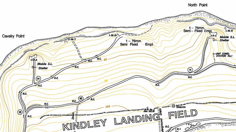
Map of Tailside area north of Kindley Field. (map courtesy of mapmaster)
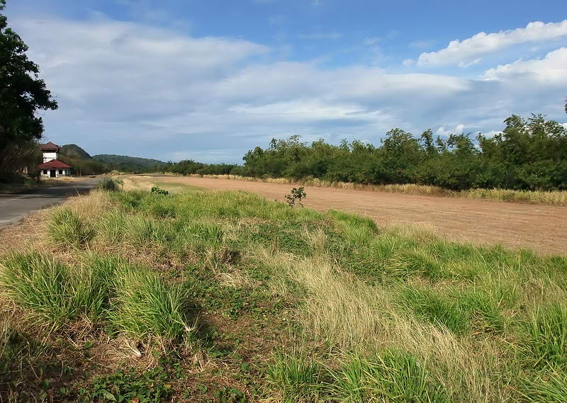
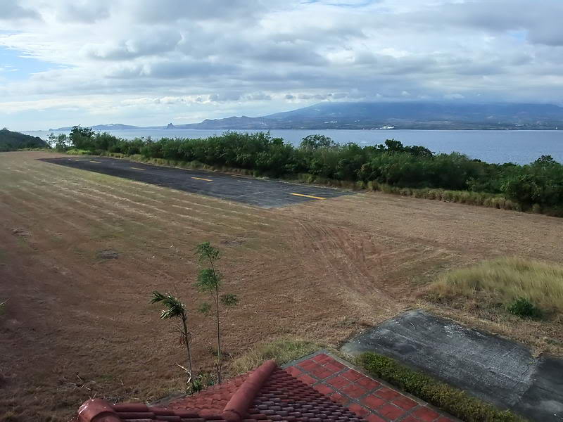
Kindley Field drop-off point. This is the view looking north-west. The
little terminal building and control tower can be seen to the left.
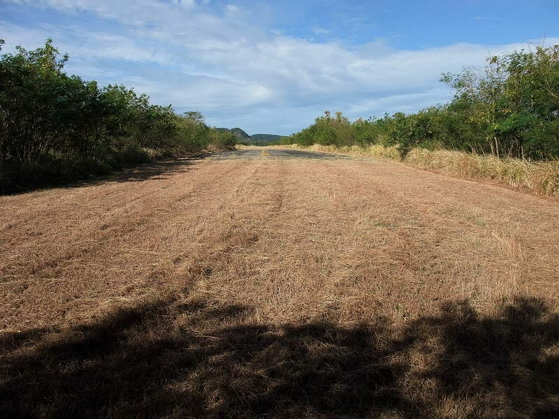
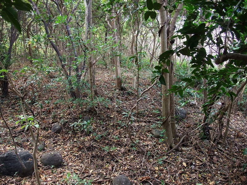
View from the eastern edge of the airstrip looking west. I headed right
(north) into the jungle from here.
Soon I came across the old road which was overgrown with grass. Past the
road it looked ok so I moved into the tree line to start my plan. Awhile
later on one pass back near the road was a big crater in front of me. Across
the crater was a sudden noisy movement. At first I didn’t see it but there
was a snake.
Since it was about 20 ft away I froze and tried to look through the
vegetation for a better view. In about 5 seconds, what I saw slither away
was approximately 2 to 3 inches at the widest part and 4 ft long. It was
obviously a bit longer since I never saw its head.
Whatever that was, it blended in very well with the dead branches and leaves
and moved quite fast. Snakes must be smart since they know enough to run
away quicker than some humans do.  On
return to a near normal heart beat, I moved on. On
return to a near normal heart beat, I moved on.
This part of my walk was quite easy.
The first structure I encountered was Unit Command Station #1 which is
totally destroyed. As the map shows, it must have been a very small building
as there is not much broken concrete lying around. Due to vegetation only a
corner of the floor is still visible at the top of the ridge.
When I arrive at any location, I first set my GPS to average its position to
get the most accurate reading. This takes time so while it is doing that, I
clear vines and branches etc and then take some photos.
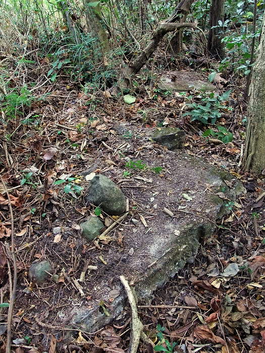
A corner of the floor at Unit Command Station #1
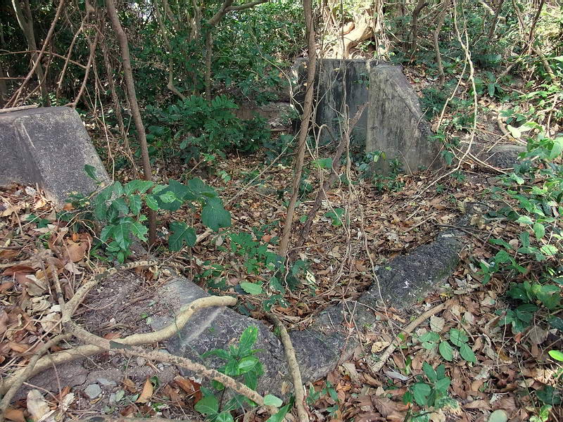
Heading north along the ridge it takes only a few minutes to reach I-F-2
(Sector 1, Field Gun, Position #2) which is located up above the rocky
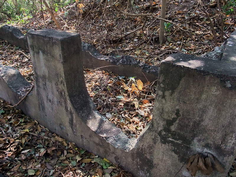
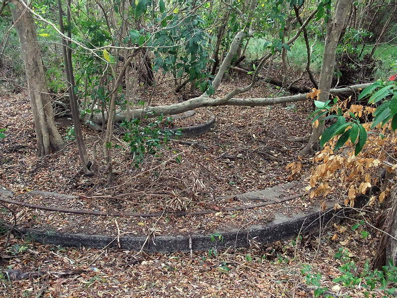
beach. Now this place is interesting. I consisted of two gun positions with
a centre underground magazine.
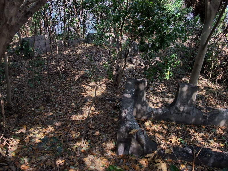
Looking down at I-F-2.
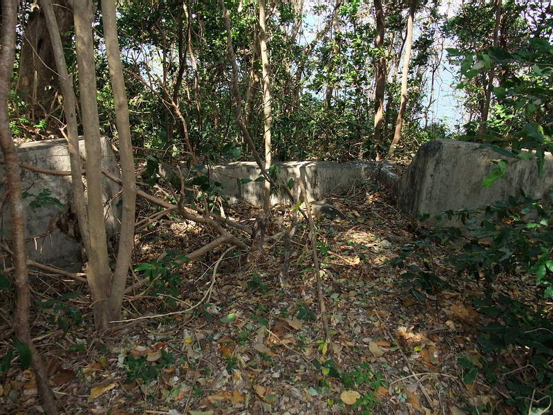
I found no trace of the “Mobile Searchlight Shelter” shown on the map but
there is a structure here that I need you guys to identify for me. It is
rectangular in shape, no roof and has six semi-circular grooves facing
upwards in the sides. This actually looks similar to the concrete forms for
holding fuel tanks you see near Morrison Hill but why would fuel be stored
within feet of gun positions and a magazine? There are also two low concrete
walls just outside the two longer walls of this structure.
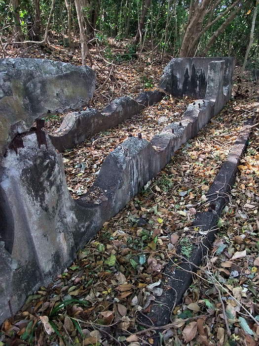
The long narrow rectangular structure.
Another view of it.
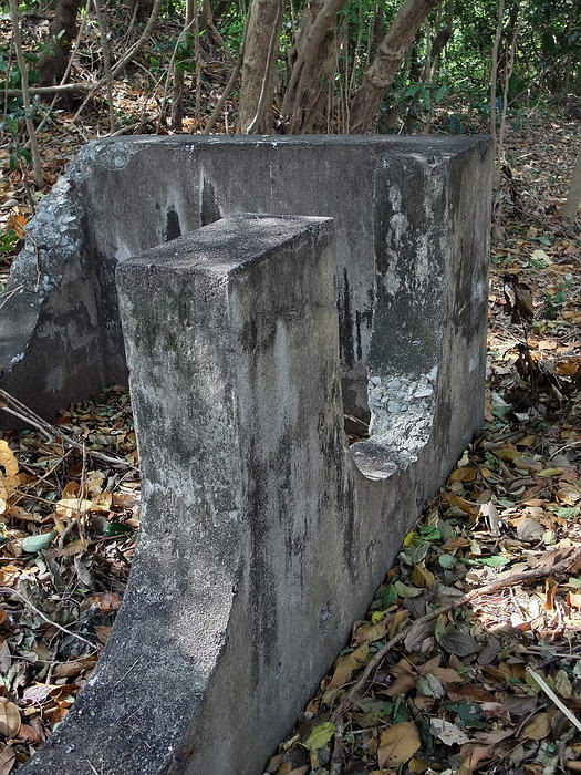
Another view of it.
Another view of it.
Looking out Gun #1 position
View of the Gun #1 position taken from in front of I-F-2.
Looking out Gun #2 position
At Gun #2 position looking towards the centre magazine.
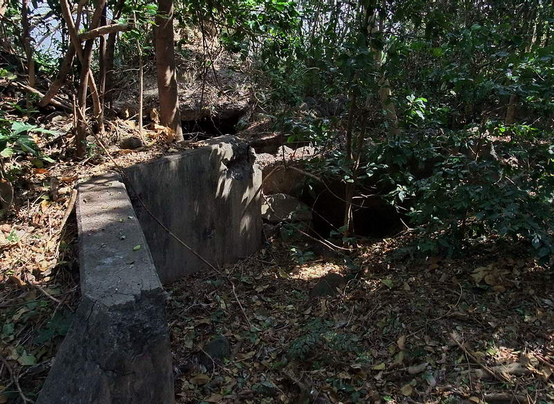
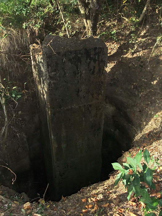
The centre magazine had an east and west entrance (near each gun) with the
middle portion being underground. Nearly all the roof of this middle portion
has been blown off. Large chunks of concrete are lying all around here.
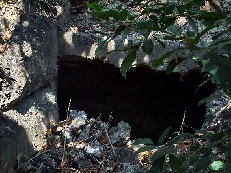
Entrance to the magazine adjacent to Gun #1.
Interior view looking towards the entrance in the previous photo.
Part of the walkway into the magazine adjacent to Gun #2.
All that remains of the interior of the magazine from the Gun #2 entrance.
Looking down into the middle of the magazine where the roof was destroyed.
Looking across the magazine’s destroyed roof.
Looking across the magazine’s destroyed roof towards the walkway adjacent to
Gun #2.
Just east of here, the map shows I-M-6 (Sector 1, Machine gun, gun #6). The
low cliff consisting of sand and loose rock has eroded all along this area.
Small trees and vines are growing in the slope but the concrete position is
now missing. I went well past where it should be and returned twice to be
sure.
The map’s contour intervals show a fairly steep slope just down from Gun #1
and then the terrain levels out before the low cliff to the beach. Today the
low cliff is down the slope from Gun #1 and continues east.
Now that I was finished in this area, I headed west towards the other
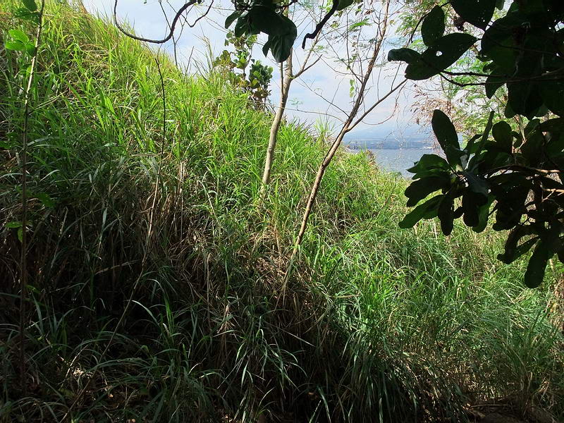
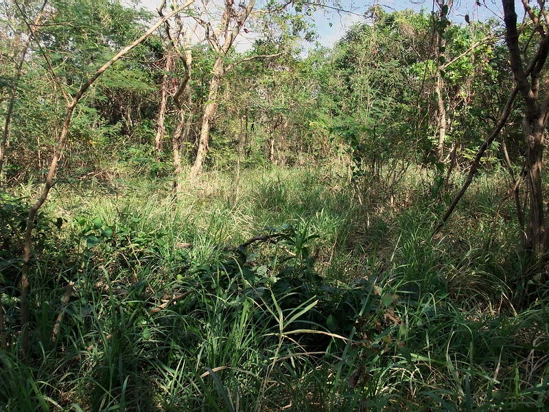
positions on the map. Here is where the going got slow and more difficult.
The canopy overhead disappeared giving way to mostly high grasses and
sporadic trees.
More grass to wade through.
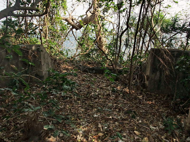
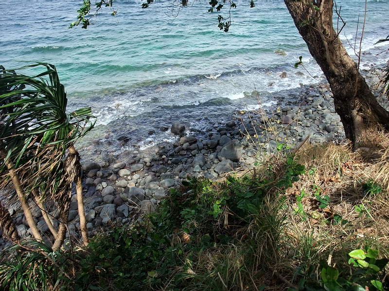
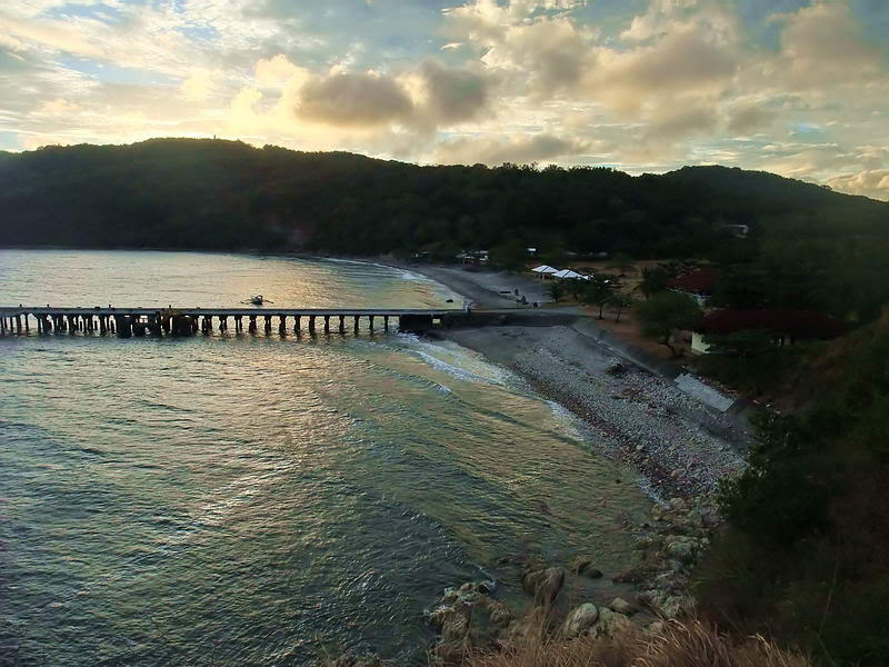
Easy access up from the beach.
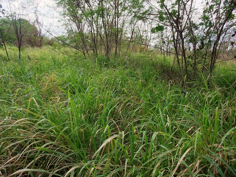
There were a few short stretches of good walking but when I came to this I
gave up. Some of this grass is over my head and it is very thick.
It has been the dry season for awhile now so I had hoped it would have died
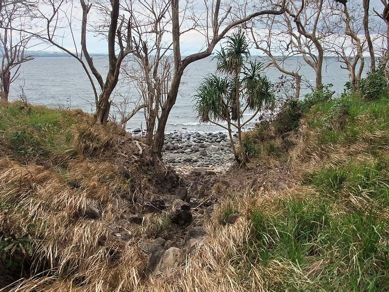
off. No such luck. I headed down to the beach.
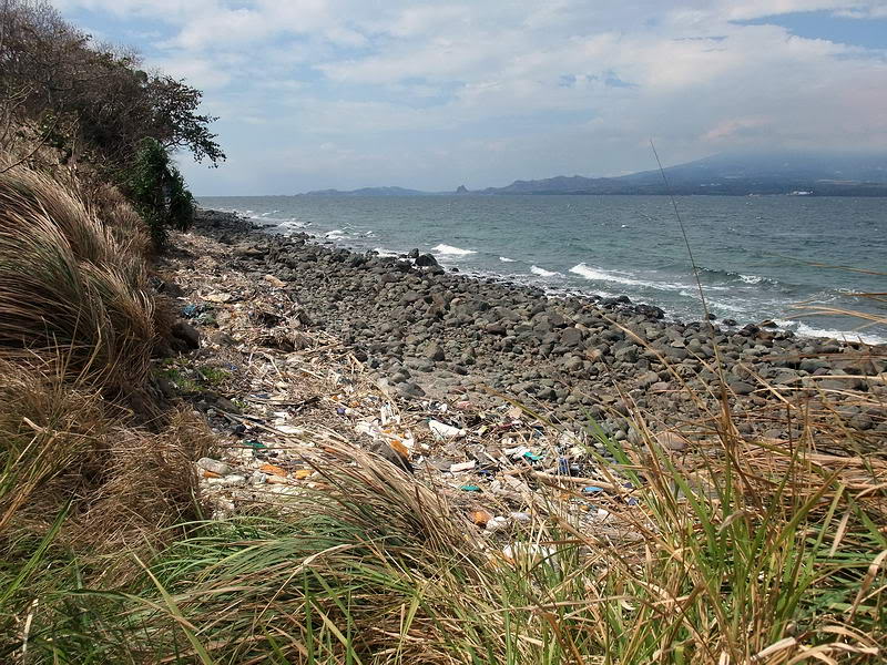
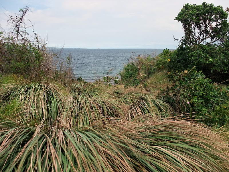
View when I reached the beach looking towards Bataan.
One thing I noticed is that the low cliff had disappeared quickly so that
the terrain was just a gentle slope from the beach up towards the airfield.
Imagine the grass burnt away. Japanese troops or tanks would have no
'terrain' problems here.
The tide was low so walking was not a problem. Awhile later I came to a
little point where my GPS told me the next position was located. After
climbing a 10 foot slope and heading a bit east I was at I-M-3. It consisted
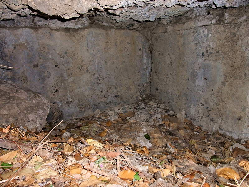
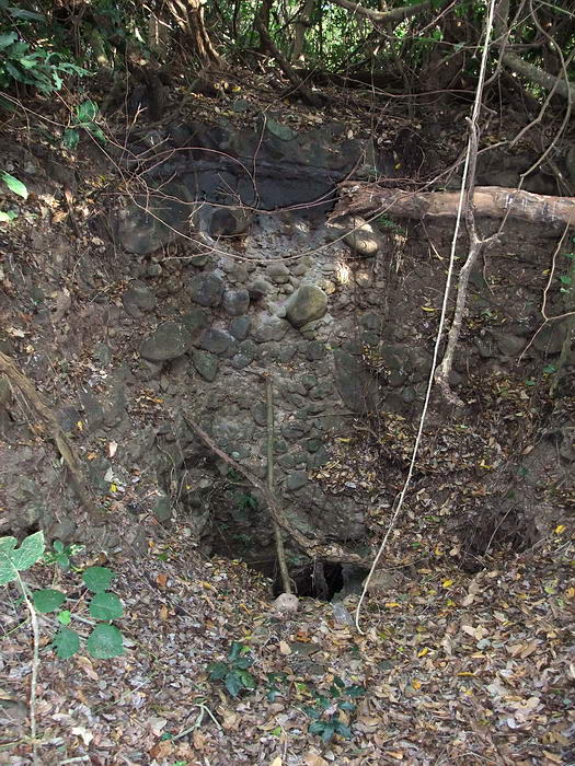
of one machine gun position and one underground magazine.
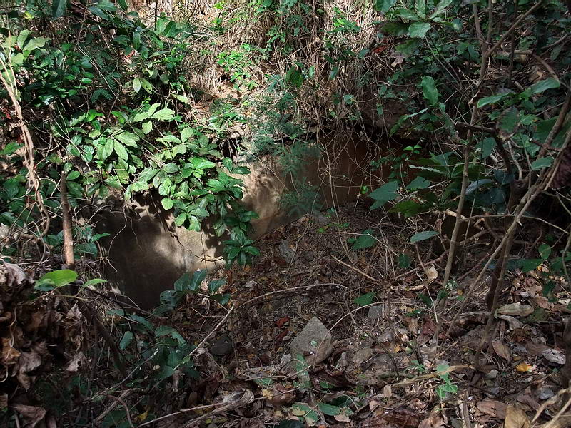
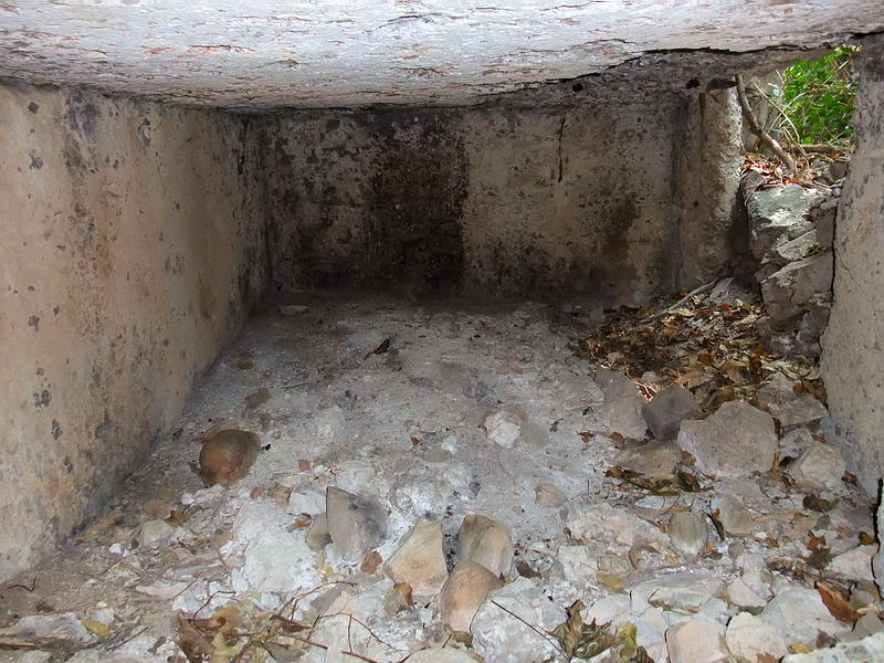
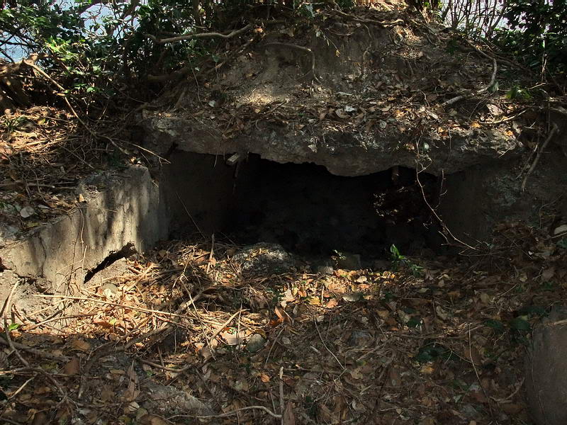
The first structure I noticed through the vegetation was the magazine. This
is what it looked like before I cleared the brush and vines away. The roof
is also missing here.
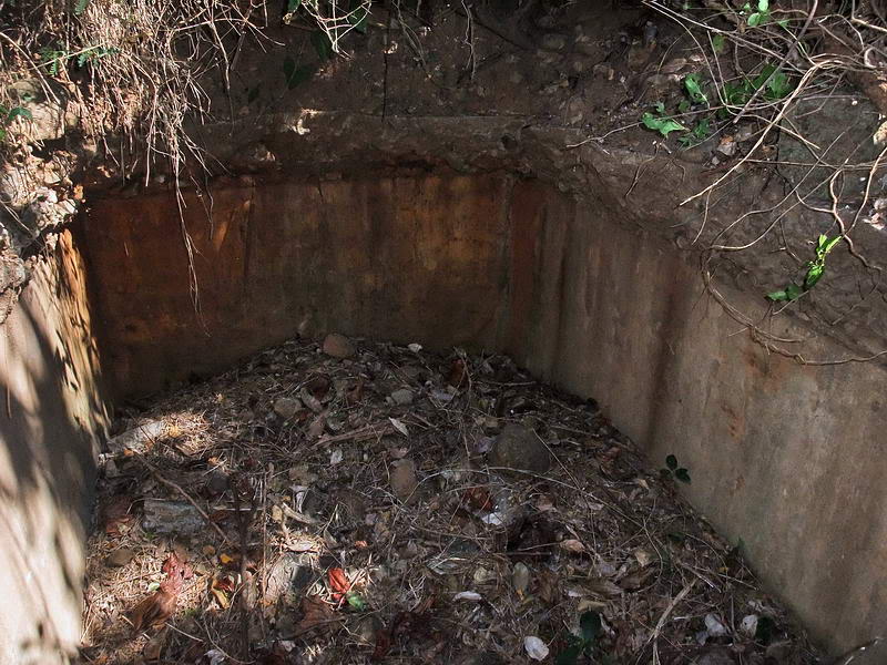
View of the magazine taken from above the doorway.
I suspect that the cause of this roof collapse is not directly battle
related. It may have been damaged during the war and by time but appears to
have just fallen under the weight of the soil and concrete. This is the
first time I can remember seeing no rebar being used in a magazine’s
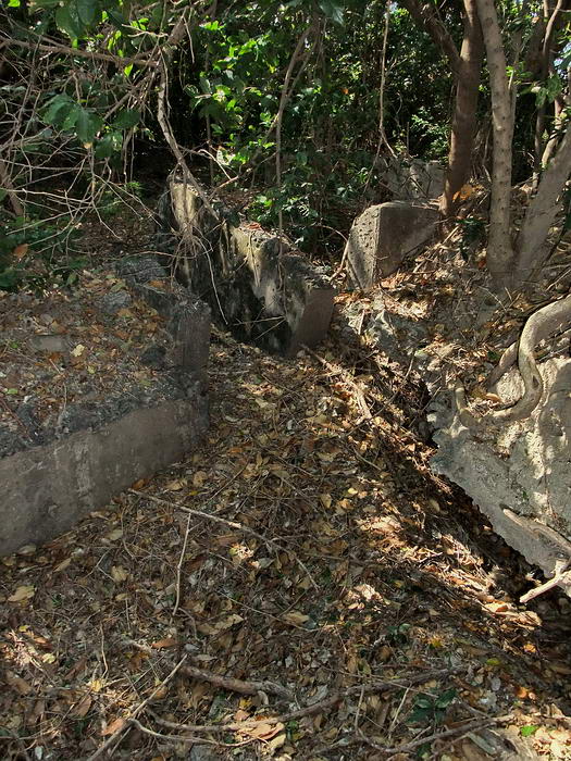
construction.
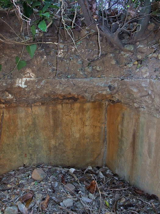
Note the horizontal strip of concrete above the walls that was part of the
roof. No rebar can be seen.
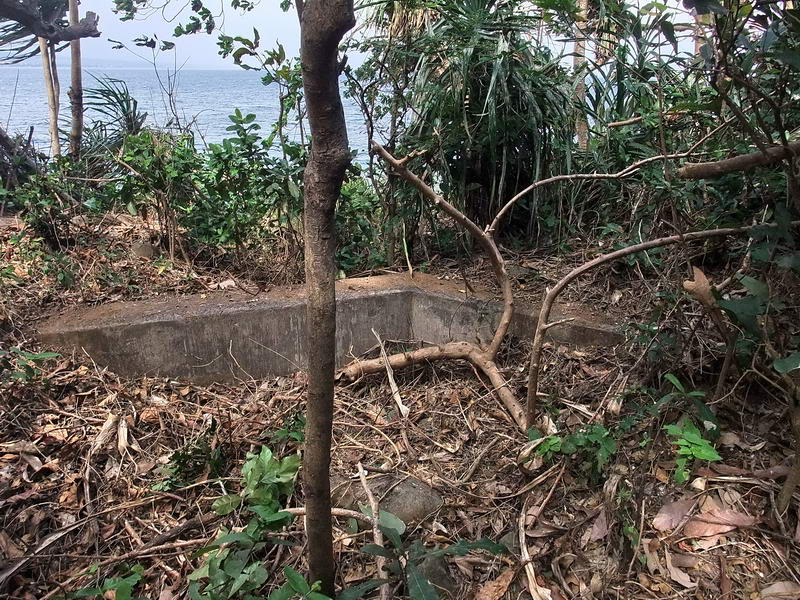
The gun position is mostly covered in vegetation now.
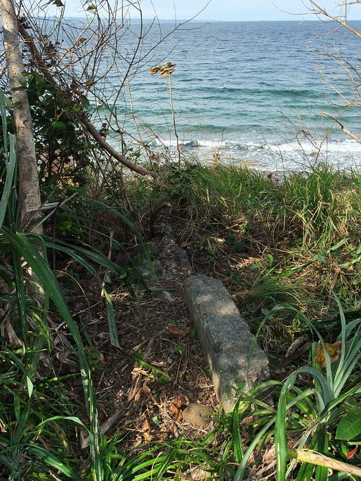
View of the beach taken just in front of the gun position.
Continuing on, a mix of trees and grass was not too difficult to get
through.
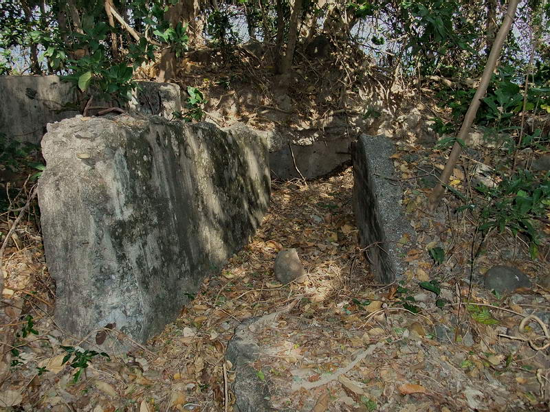
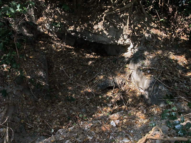
The next position was I-M-7 (Sector 1, Machine gun, Gun #7).
Under the vegetation and some broken concrete,
this is all I found at I-M-7.
Before I reached my final destination of I-F-3, it started to rain. I packed
my valuables in zip lock bags and waited awhile but it did not stop. Due to
it already being past mid afternoon I decided to head for home. I-F-3 will
be a future trip. (of course it stopped raining soon after that).
The closest path back to civilization was to head south and pop up on the
airfield.
I had to cut some vines and branches for the first few minutes however the
walking was not too bad. I came across some grassy sections and skirted
them. Soon I came to numerous bamboo trees. Normally this would be
impassable but this must be another species of bamboo with a smaller
diameter. The ground has very little vegetation due to the thick canopy
above but walking between the clumps of trees only involved cutting thorny
vines.
This area is the strangest forested section of Corregidor I have ever
experienced. Since the weather here has been quite windy the past few days,
the tops of the bamboo trees were swaying heavily in the wind. Imagine
hundreds of bamboo trees hitting each other to make loud hollow sounds.
You should hear the sound of bamboo trees “rubbing” across one another. That
is difficult to explain. It is a mix of a squeal, a bark or an elephant in
the throws of death. Add the dark clouds and that was one spooky place
there!!!
Just when I thought I had had enough fun for one day, I heard and saw
something off to the right. Damn, another snake. Out of the corner of my eye
I saw it brush some branches as it dropped down out of a bamboo tree and
quickly slither away to the nearby grass.
This time I got a good look at it. The snake was about 3 ft long, very
skinny and dark in color. There was no flared neck like a cobra. That guy
was also fast. (Postscript: the next day, the head of security told me that
those black snakes live in the bamboo trees and are VERY poisonous). 
As I type this two things come to mind. One, regardless what some people on
this island say, at least one type of snake drops from trees. Second, if he
chose to come towards me, there is no way in hell I could outrun him with
those vines grabbing at me. I don’t think I will dwell on those thoughts.
The bamboo eventually gave way to terrain of about half trees and half
grass. A few minutes later I was up on the west end of the airstrip. Some
clouds were still around but it was mostly clear skies now. The wind felt
great. I was in no hurry to get back to the Corregidor Inn so I took some
photos along the way. For the rest of this trip report I will show you some
of these views.
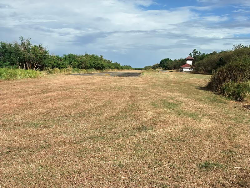
At the western of the airstrip looking east.
View from the western of the airstrip looking towards Bataan.
Ahead is the Terminal building and I headed down the south side of the
airfield towards it. The perimeter grasses are dead and I could see a
concrete drainage ditch all along this side of the airfield that I never
noticed before. It reminded me of okla’s comment regarding the amount of
concrete used in construction all over this island.
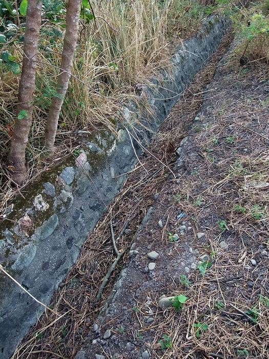
Concrete drainage ditch.
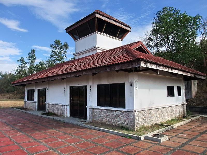
The Terminal building has seen better days.
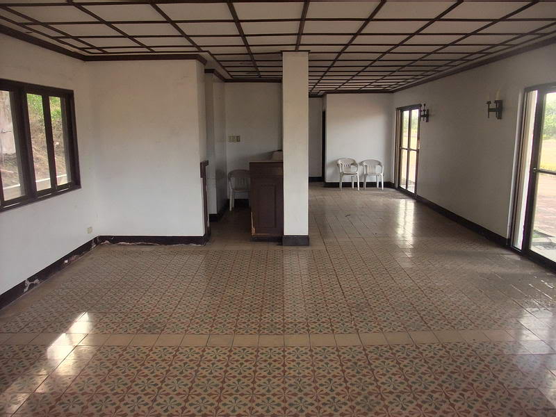
Terminal interior. Washrooms are at the far end.
View looking north-west across the airfield towards Bataan.
Mount Mariveles is hidden in the clouds.
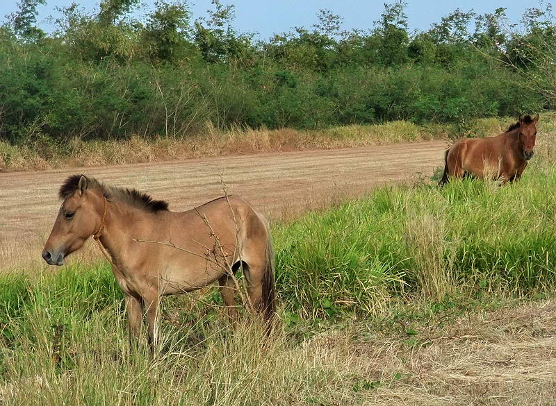
Airfield residents
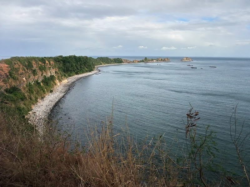
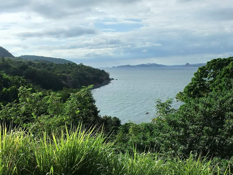
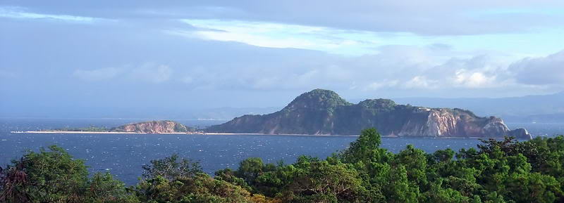
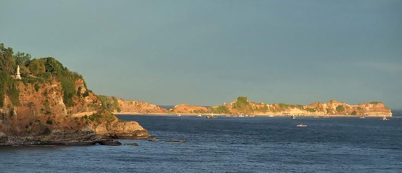
After leaving Kindley airfield you soon pass a great viewpoint for seeing
the curved tail of Corregidor Island.
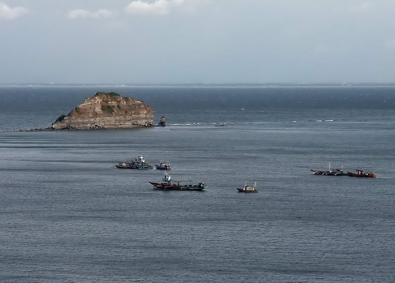
Closer view of fishing boats sheltering from the north-east wind and waves.
That big chunk of rock is called Hooker Point. Across Manila Bay the
province of Cavite is in the distance.
Just off the road on the north side is the Panama mount for a 155mm gun.
This was Battery Levagood.
Down around the next corner I am now inland from Monkey Point. If you look
at the right moment you can see the ventilation shaft of the Navy Intercept
Tunnel through the vegetation.
Fifty feet or so off the road is the only remaining accessible entrance to
this tunnel. It is quite steep down to what remains of the tunnel and much
more difficult to get out of than to get in.
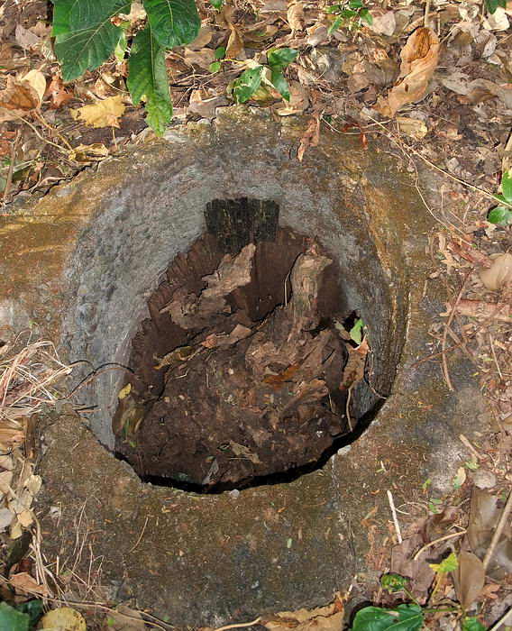
Nearby is a concrete ring around what used to be a wooden pole. Considering
the location, I assume this was part of the Navy Intercept Tunnel’s antenna
system.
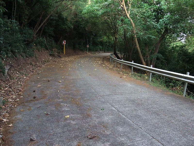
A view of the road as I continue past the tunnel.
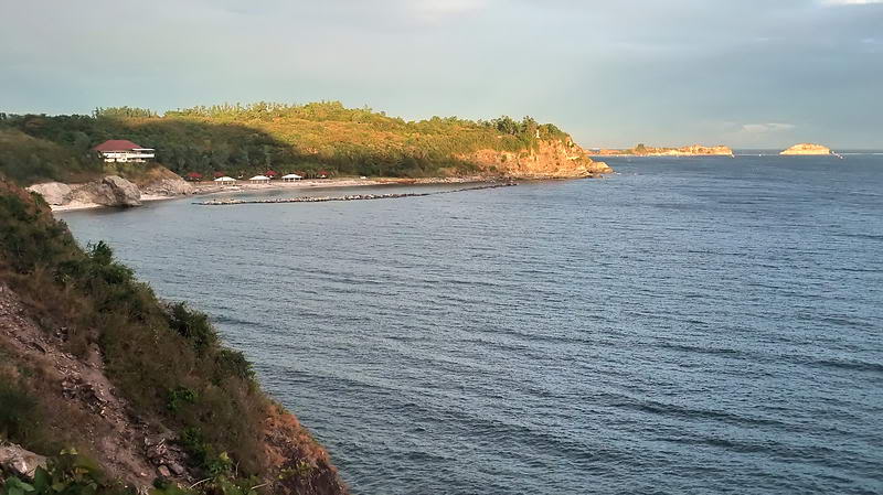
There is a spot for a good view to the south where you can see nearby
Caballo Island in the late afternoon sun.
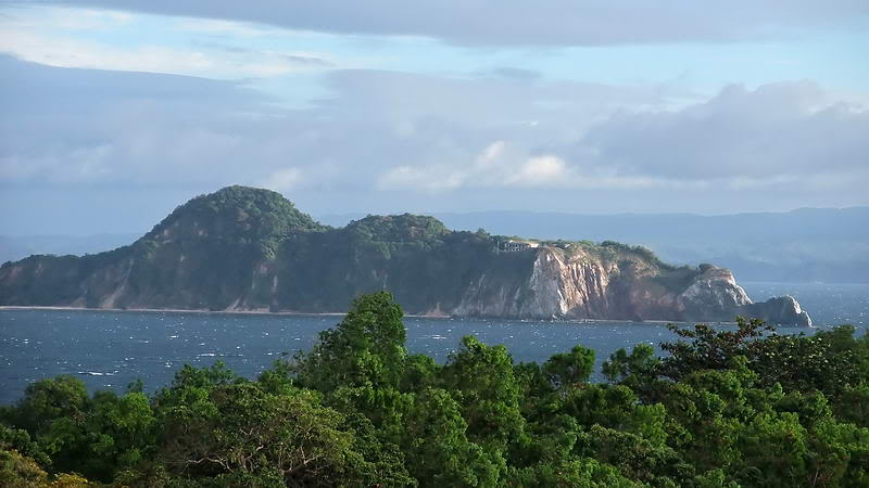
A closer view of Caballo Island.
As I passed the Filipino Heroes Memorial I noticed a faint rainbow. I moved
a bit further to catch a photo of it over the stature honoring the “Filipino
Woman”.
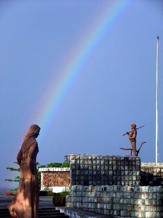
Statue of the Filipino Woman
The sun had already set over Malinta Hill so I decided to take the direct
way back to the Corregidor Inn via the tunnel. It usually is not closed
until 6pm when the guard finishes his duty. I turned left and headed towards
the Malinta Tunnel east entrance.
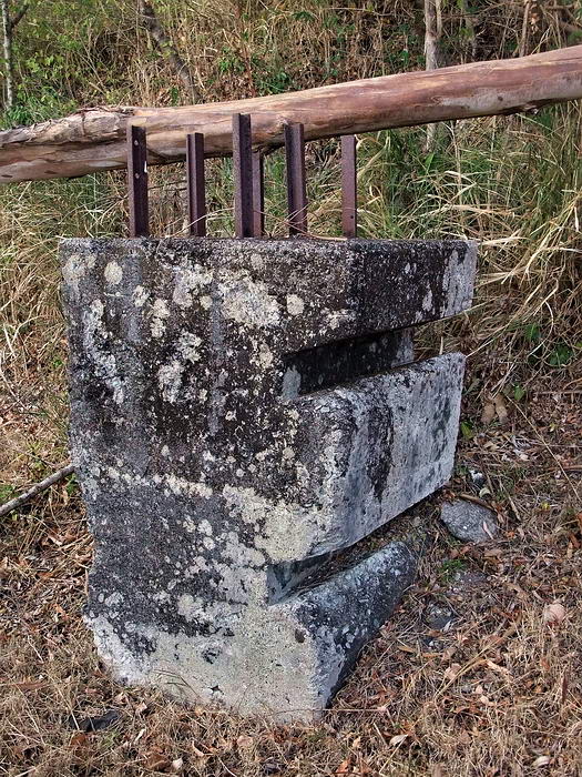
I have been told that these chunks of concrete are anti-tank barriers. Two
of them are on each side of the road just before the last turn to the tunnel
entrance.
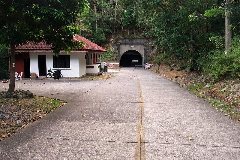
Approaching the Malinta Tunnel east entrance. The building to the left has
toilets and gift shops.
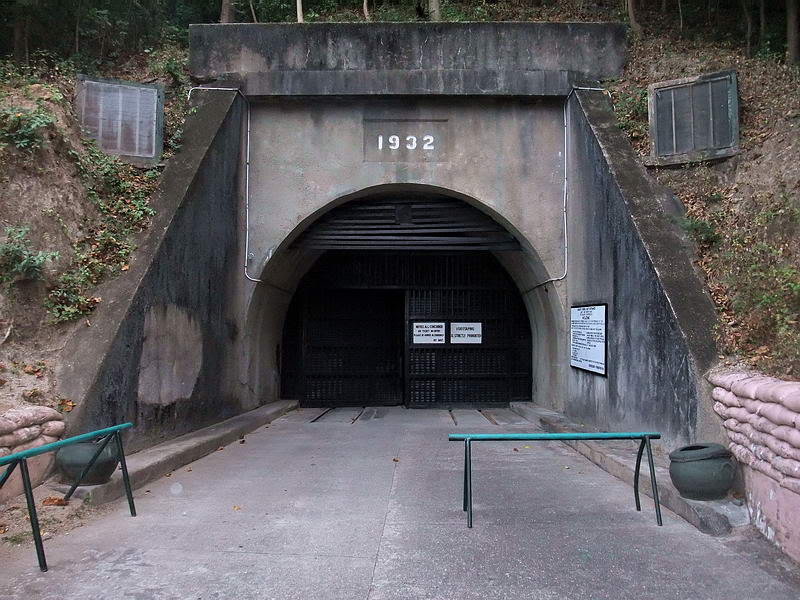
Malinta Tunnel east entrance
As I was wandering around I heard the sound of ‘two big metal doors being
closed’ echoing down the tunnel towards me. No light at the far end now so I
would have to find another route home. Actually that was easy. I climbed up
the left side of the east entrance to the South Shore Road and headed south
around Malinta Hill.
Due to Malinta Hill, sunset comes early to the 92nd Garage area.
Zoomed in view of part of Corregidor Island’s tail.
View of Bottomside south with Black Beach straight ahead. The sun has just
set over Topside which causes an early sunset on Bottomside also.
At 5:40pm I was on Bottomside at the intersection of the South Shore Road
and the road the Malinta’s western entrance. The first stop was the south
side Cove Café for a cold drink. It was dark as I headed up the hill to the
Corregidor Inn.
Summary:
The 1917 era fortifications were not ‘too’ hard to find. For the most part,
the only way someone would ever find any remnants of the 1942 and 1945
battles would be to trip over them. I had hoped for better hiking conditions
and visibility.
From the time I left Kindley Field and later returned to it, my GPS track
Log says the elapsed time was 6 hours 3 minutes covering a distance of 2.5
kilometers. It was obviously a slow trip in the area. It took another 2+
hours to get back to Bottomside but only because I kept stopping to take
photos along the way. The machine gun position I-M-6 is gone and I just
missed seeing I-F-3.
After the morning drop off at Kindley Field I never saw one other soul
(human anyway) until I got back to Bottomside. For the past couple hours
along the road I was under monkey surveillance. Whether it is the views or
the history, something interesting on this island always seems just around
the next corner.
|