|
|
|
|
|
|
MISCELLANEOUS TRAVELS
ON CORREGIDOR
1 |
|
MISCELLANEOUS TRAVELS
ON CORREGIDOR - 1 |
|
VARIOUS SCENES - PART 1
THEN AND NOW |
|
ENGINEER RAVINE
THEN AND NOW |
|
BATTERY GEARY
AIR RAID SHELTER PART 1 |
|
BATTERY GEARY
VINTAGE IMAGES PART 2 |
|
BATTERY GEARY
TODAY - PART 3 |
|
GOAL-POST RIDGE |
|
BATTERY RJ-43 |
|
NAVY RADIO INTERCEPT TUNNEL ,
FOTS2/110423 |
|
TAILSIDE CEMETERIES, TOMBSTONES,
FOTS2/110316 |
|
MALINTA HILL,
COMPARISON 1977 SLIDES,
FOTS2/090820 |
|
MALINTA HILL, GUN POSITION LOCATED,
FOTS2/110320 |
|
MIDDLESIDE BARRACKS,
EXT & INTERIOR,
FOTS2/101210 |
|
NORTH OF KINDLEY FIELD,
WALKING WEST,
FOTS2/101210 |
|
TAILSIDE, LT. LAWRENCE'S GUN POSITION,
FOTS2/110205 |
|
OFFICER'S COUNTRY,
GOLF CLUB & POOL,
FOTS2/100329 |
|
ROCK POINT,
SEARCHLIGHT NO. 2,
FOTS2/091205 |
|
SEARCHLIGHT NO. 2, DAMAGE BY
LANDSLIDE FOTS2/100415 |
|
GUN GROUP COMMAND POST, NO. 1, INTERIOR,
FOTS2/090823 |
|
REVISITING BUNKER'S C-1 TUNNEL,
FOTS/100427 |
|
DID BATTERY GRUBBS JUMP THEIR TRUNNIONS,
TF/100120 |
|
INFANTRY TRENCH LINES ON TAILSIDE,
FOTS2/090408 |
|
MALINTA GASOLINE STORAGE LATERALS
FOTS2/090517 |
|
BATTERY WAY, PRE-WAR & SPECS,
FOTS2/100523-1 |
|
BATTERY WAY, INTERIORS, PIT & STATIONS,
FOTS2/100523-2 |
|
JAPANESE TWIN 25mm AA GUN, IDENTIFICATION,
FOTS2/100121 |
-
MARIVELES TUNNEL No
1,
WELTEKE 110103
|
|
BATTERY SUNSET
FOTS2/110514 |

|

|
FIELD NOTE:
|
| PLACE: |
CORREGIDOR |
DATE: |
20 MARCH 2011 |
| LOCALE: |
MALINTA HILL |
| OBSERVATION: |
GUN POSITION LOCATED |
| BY: |
JOHN MOFFITT |
| |
REF: FOTS2/110320 |
| |
|
It appears that even
Malinta Hill has a few surprises left. Karl and I were walking up the NE
corner of the hill when I noticed a flat area on the opposite side of a
ravine. The white soil I could see on the bottom over there turned out to be
concrete. We cleared away some leaves and branches to get a better look.
This is a gun position that neither of us have seen before. It appears to be
identical in size to a covered 75mm gun position but without the four posts
and roof. The position has a concrete bottom pad with a rounded concrete
platform on top of it. No rear positioning rail is visible but it may be
there. This area is covered now with sloping hard soil and some rocks that
probably fell down from the cliff just behind it.
On the down-hill side is an embankment constructed of concrete. The position
is up high with no obvious road to it, WWII bombardment and shelling may
have erased any traces. None of the maps I have including the 1941 Emergency
Defense map show this position as existing. Since it is not shown on the
1941 map, I assume this position was not used during the war.
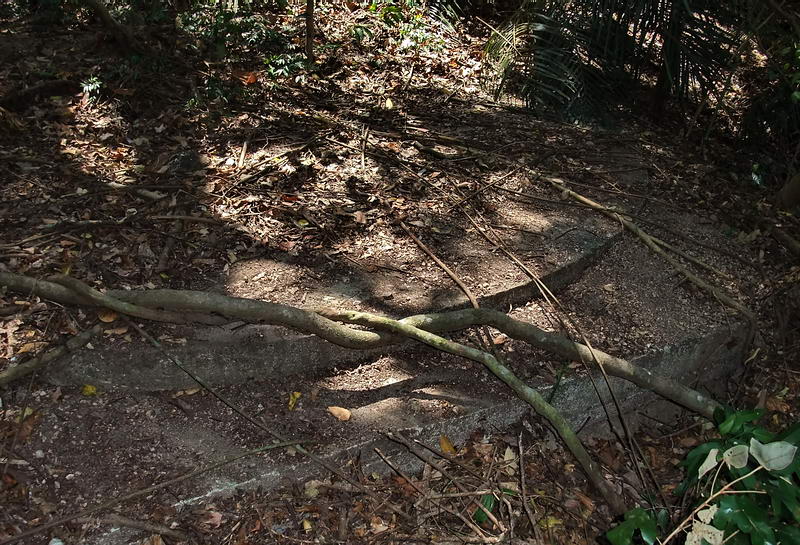
A view of the gun position showing the two concrete pads, the upper one
being rounded.
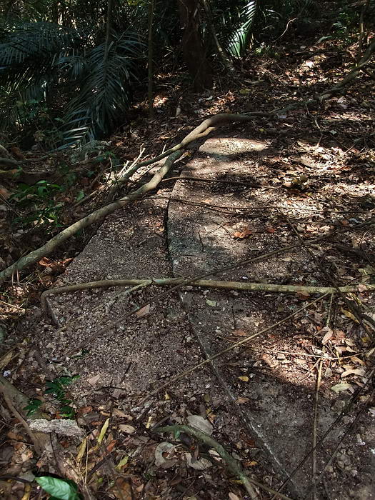
Another view of the position.
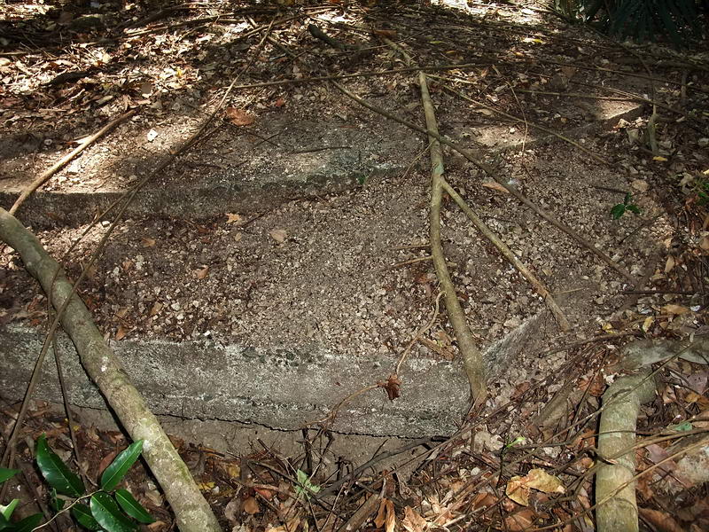
Another view of the position.
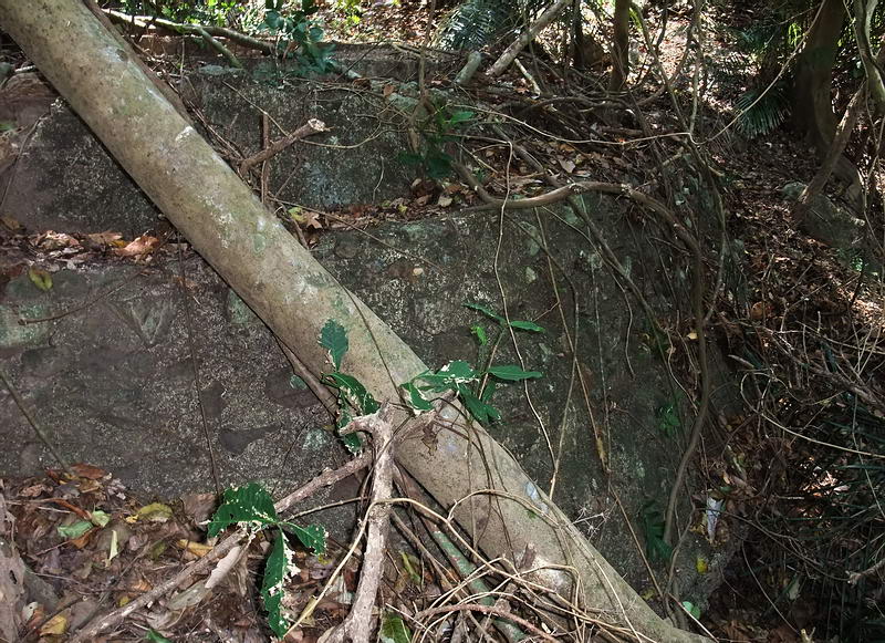
The concrete embankment below the position.
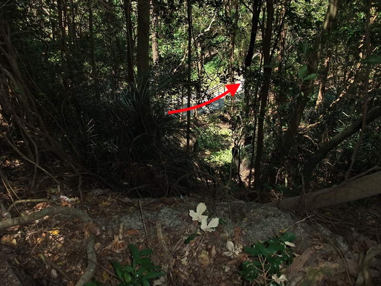
Standing at the edge of the concrete embankment looking down towards the
North Shore Road. The angle of the trees gives you an idea of how steep this
little ravine is. (The red arrow marks the road heading east).
|
|
 |
|
|
|