|
FIELD NOTE:
|
| PLACE: |
CORREGIDOR |
DATE: |
29 MARCH 2010 |
| LOCALE: |
TOPSIDE, OFFICER'S
ROW, CLUB |
| OBSERVATION: |
OFFICER COUNTRY |
| BY: |
JOHN MOFFITT |
| |
REF: FOTS2/100329 |
| |
|
First on my “to do” list this Corregidor trip was a visit to the Officer’s
Club for "ironman." Since the day I arrive is a partial hike day, I thought
wandering around that area would be a great way to spend the afternoon.
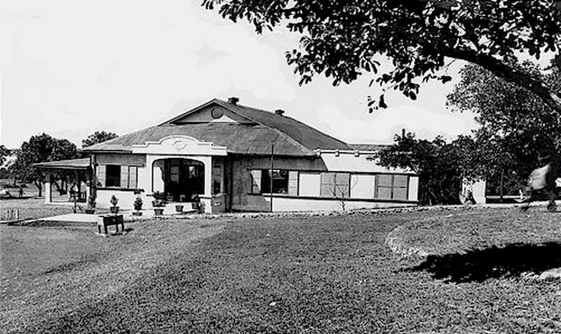
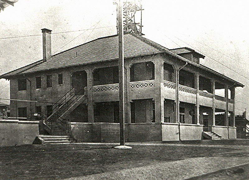
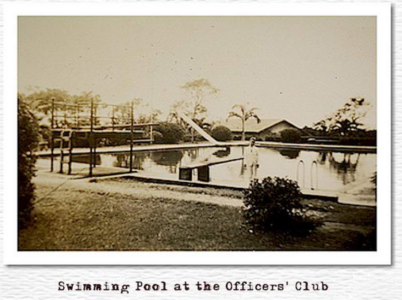
1924 photo labelled “Officer’s Club.”
The Officer’s Club was also known as the “Corregidor Club”.The club bordered
on the Corregidor golf course. Here are two pre war views of that 9-hole
course.
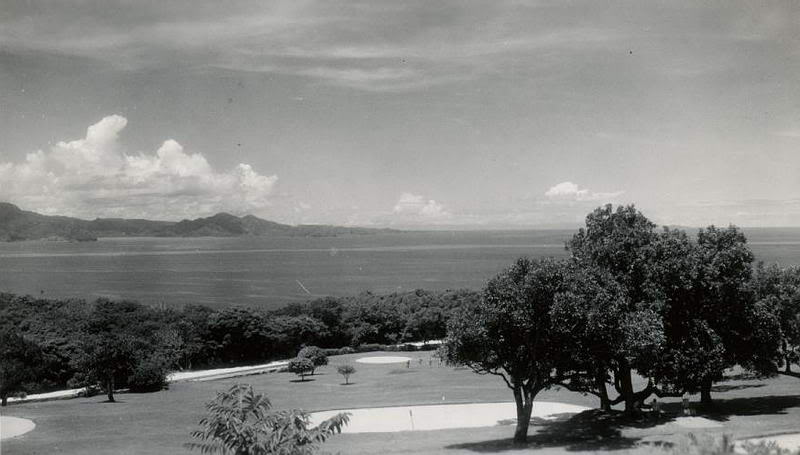
Corregidor Golf Course
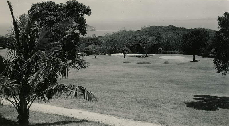
Corregidor Golf Course
The ferry docked at 9:30am and after walking up to the Inn, checking in,
gearing up and bumming a ride, I was at the Spanish Flagpole on Topside at
10:45am. First stop was up the hill to the Lighthouse for a cold drink. It
is really starting to get hot on the island now and I was anticipating a
thick and thorny trek in a few minutes.
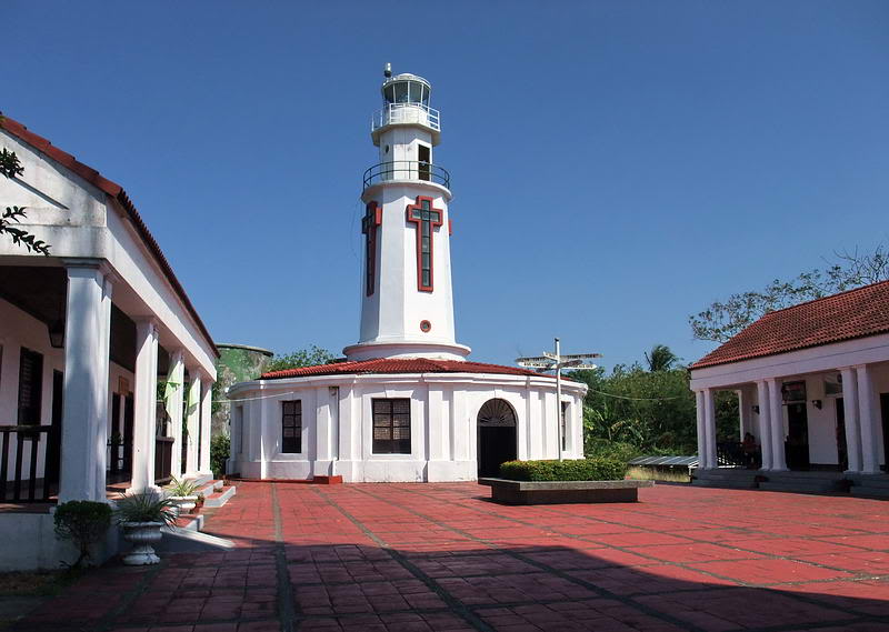
The rebuilt Spanish Lighthouse, photo taken in February, 2010.
The buildings surrounding the courtyard contain washrooms and six different
gift shops.
The weather this day would swing from dark and cloudy to bright sunlit
moments which are always a challenge to photograph in the jungle. It was hot
but due to a very dry El Nino season this year, the vegetation is quite dead
which makes for good visibility. Even many vines were dead so continuous
cutting was not necessary. I took advantage of this to check out the whole
area.
Starting at the Lighthouse, my plan was to walk down to the row of Senior
Officer’s Quarters. After exploring them a bit I would try to find an old
path down towards the Officer’s Club which is the most direct route. After
photographing whatever was left of the club I would pass by the tennis court
to the swimming pool and then out to the road. It seemed like an hour or two
at most would do it but I kept coming across things to check out. By the
time I got back to the Corregidor Inn, it was 5:40pm.
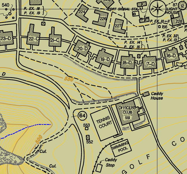
1936 Map covering today’s exploring area. (Map courtesy of Mapmaster)
It takes all of one minute to get from the Lighthouse down to the old road
behind the Senior Officer’s Quarters. These particular buildings are mostly
out of sight to the day tour crowd so the grounds have not been cleared of
grass this year.
Each two story building appears to have housed two individual families. The
bottom floor has no interior staircase up to the second floor. A large
exterior staircase goes up to the second floor and each floor has their own
fireplace although they utilize the same chimney.
View of a Senior Officer’s Quarters in better times. They are large two
story buildings with fireplaces, porches, exterior staircases and a
perimeter wall between the two houses.
I wandered around a few of the buildings but since they are very similar, I
will show you photos of in and around 17-D.
Standing on the concrete paved road behind the houses. 17-D is to the right
and 16-D is ahead of me. This is the back of the buildings adjacent to the
Lighthouse.
From the rear corner of 17-D, here is a side view of 18-D.
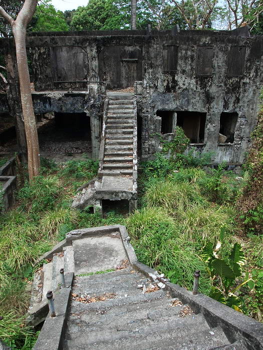
The exterior staircases of both 17-D and 18-D.
17-D lower porch looking towards 16-D.
Looking out a window towards 18-D.
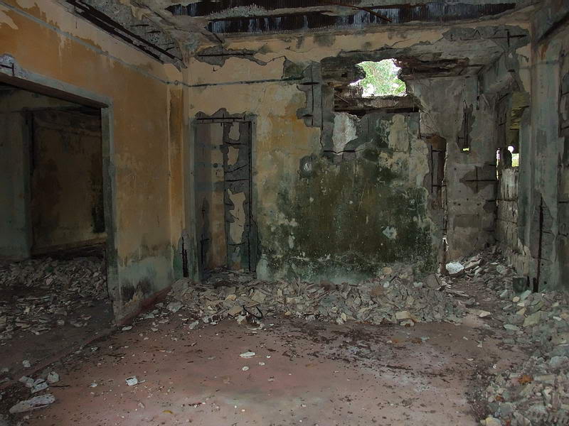
Part of the interior of 17-D.
The lower fireplace of 17-D.
Part of the interior of 17-D.
Upper rear corner of 17-D looking towards 16-D.
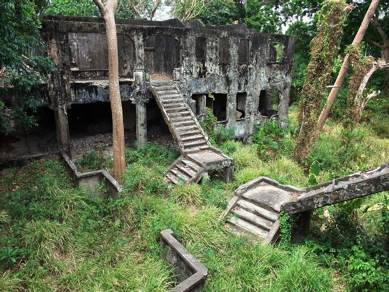
Looking down from the front corner of 17-D, you have a clear view of the
exterior staircases and the perimeter wall between here and 18-D. Under the
grass at the gap in the walls is a set of steps. From here I will go
straight ahead across the old road and head downhill.
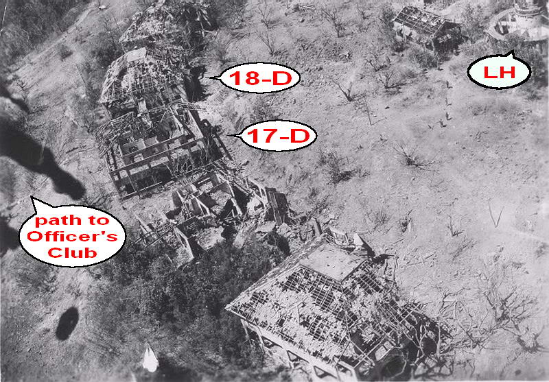
February 16, 1945 photo of the Zone B parachute jump in progress. You can
see the Senior Officer’s Quarters in question taken 65 years before my
photos. The concrete path down towards the Officer’s Club is clearly
visible.
OK, time to head down the hill towards the Officer’s Club. I walked to mid
way between 17-D and 18-D and headed into the bushes. Within seconds I could
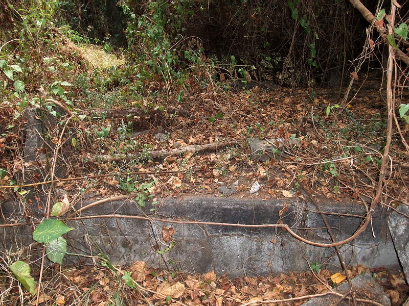
see a nice set of concrete steps going down. This might be easy after all.
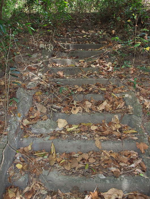
Looking up the concrete steps below the Senior Officer’s Quarters.
At the bottom of the steps was an open area with high grasses. The map
showed a Caddy House just ahead on my left but I believe that is gone now.
In its place is an abandoned radio site that we discussed in this thread:
http://corregidor.proboards.com/index.cg....read=587&page=3
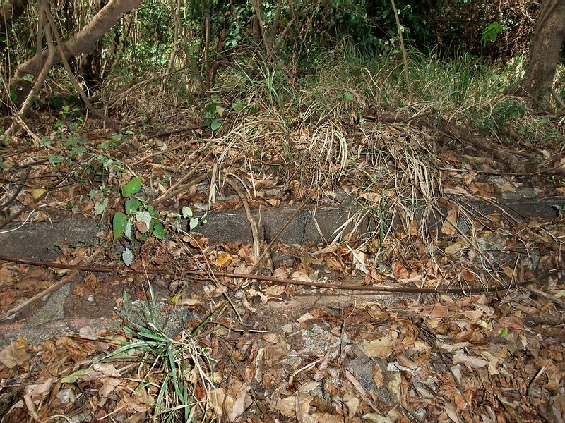
View of the radio site taken from near the bottom of the steps.
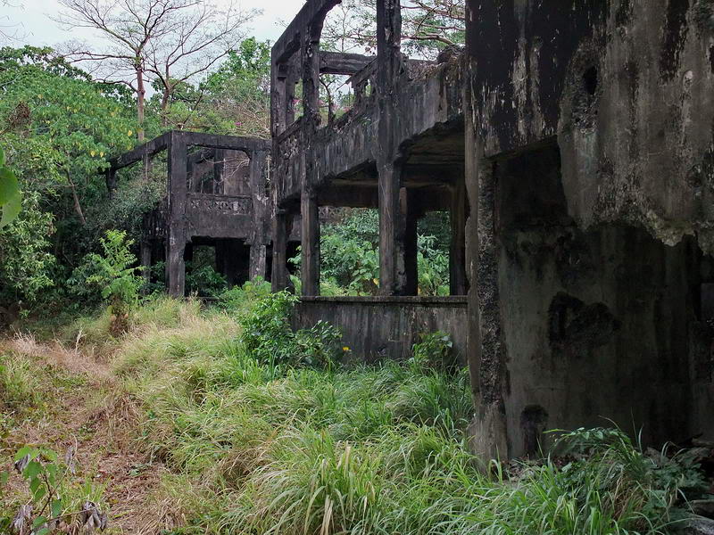
I spent some time here and then got back on track towards the Officer’s
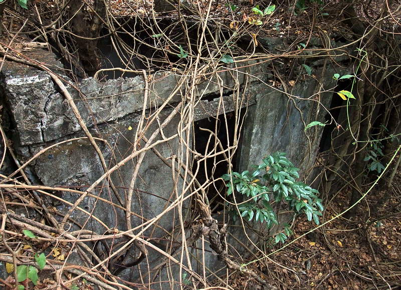
Club. Just past the road to the radio site, the first concrete walkway up to
the club was in view.
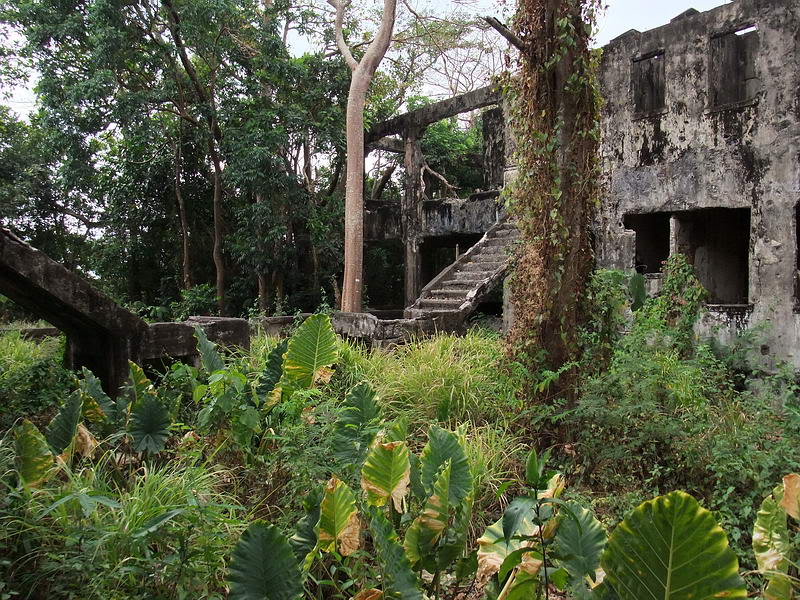
This was a wide raised walkway at the northern corner of the building.
A view of steps from one of the other walkways at the same end of the Club.
There appears to have been a concrete porch with a concrete railing along
the front of the Club. (This does not agree with the photo but I will get to
that later)
A better view of the concrete porch at the southern corner. The posts of the
railing are almost gone but you can see what it was.
Behind the porch, the main floor of the Club was raised off the ground. This
was a very common building practice, especially in the tropics.
Standing where the floor would have been looking towards the rear of the
porch. One of the concrete floor supports can be seen. There are many of
them in a grid pattern.
Most of the concrete floor supports look the same.
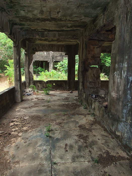
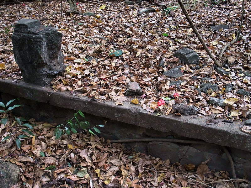
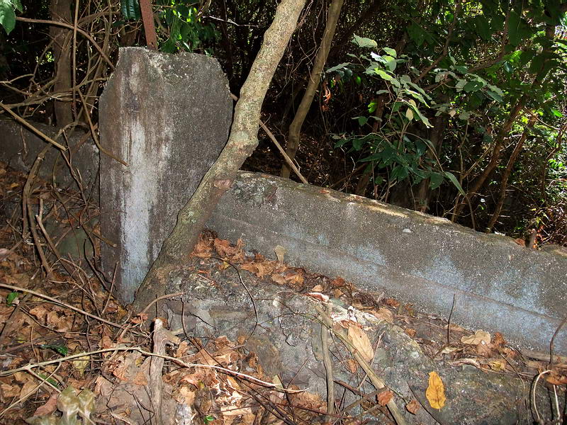
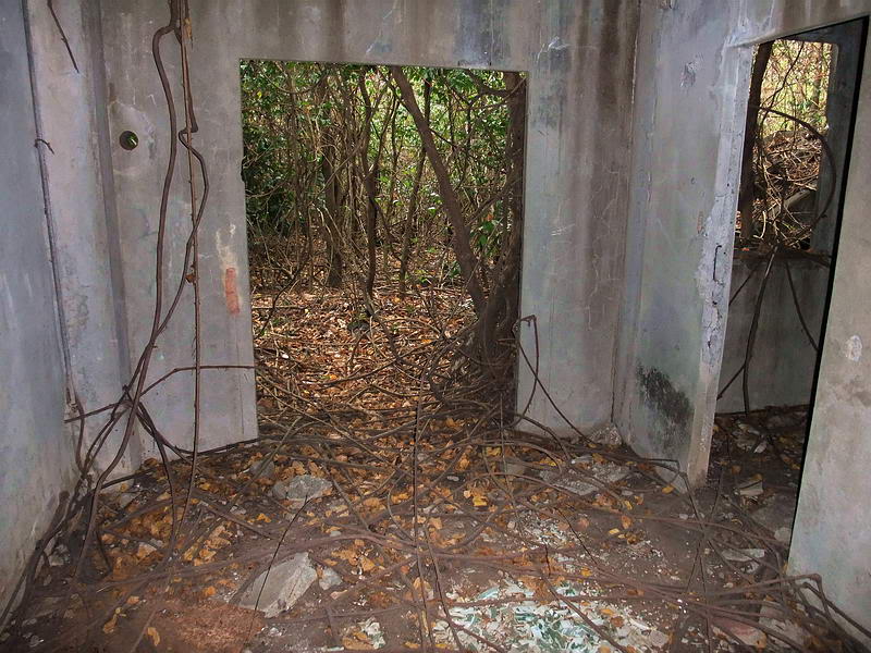
Near the back of the building is a narrow concrete wall.
Here are the steps up to the south side of the building.
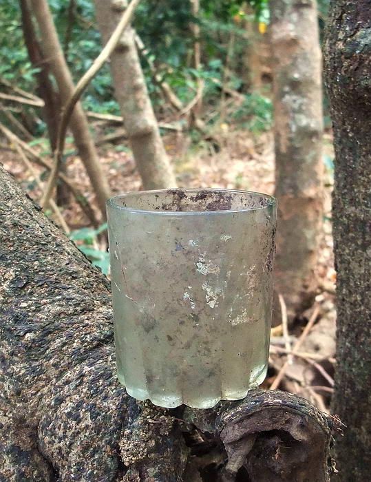
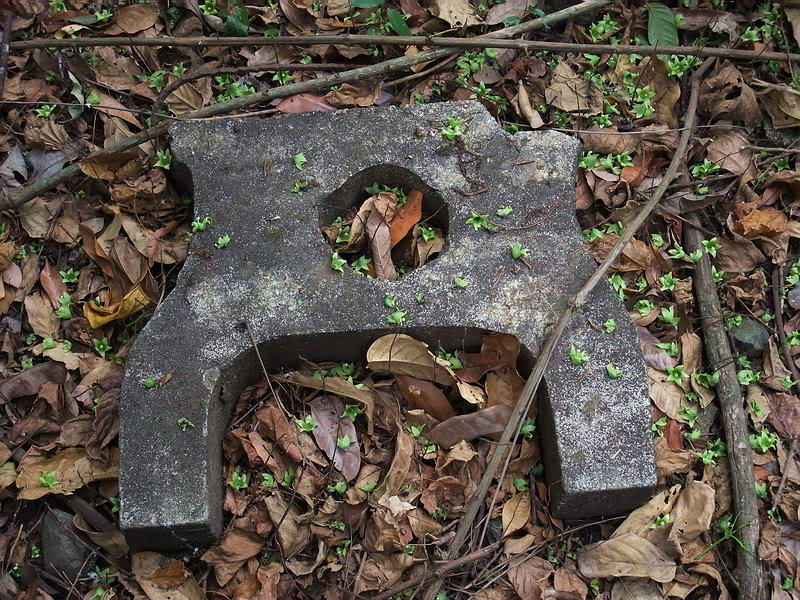
I kicked this glass which was lying among the leaves so I propped it up for
a photo.
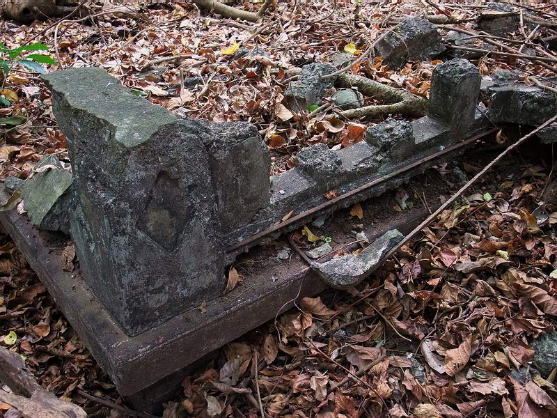
Ahead I could see a low concrete wall with rectangular floor supports so I
assumed that was the rear wall of this single story building. I was in for a
surprise.
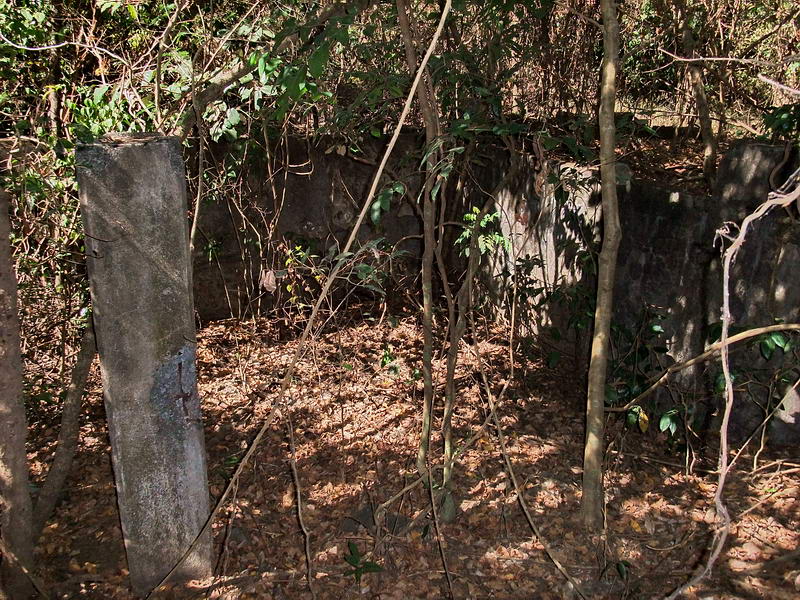
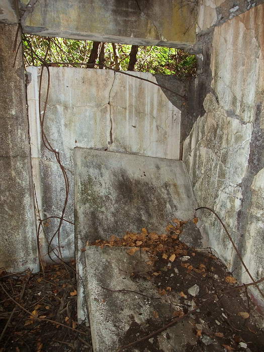
Low concrete wall with rectangular floor supports.
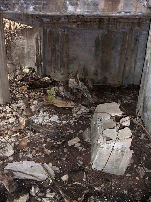
When I got there, not only was I now looking down at a lower level to this
structure but there were many concrete walled rooms towards the right.
The left side has high concrete pillars equal in height to the single
story’s pillars so it appears that the upper level extended out over this
lower level along the side facing the tennis court. The left side was open
under the upper level. The right side had numerous rooms under the upper
level. There are no steps between the two levels of the Officer’s Club. All
lower level doors except one side door open out towards the tennis courts.
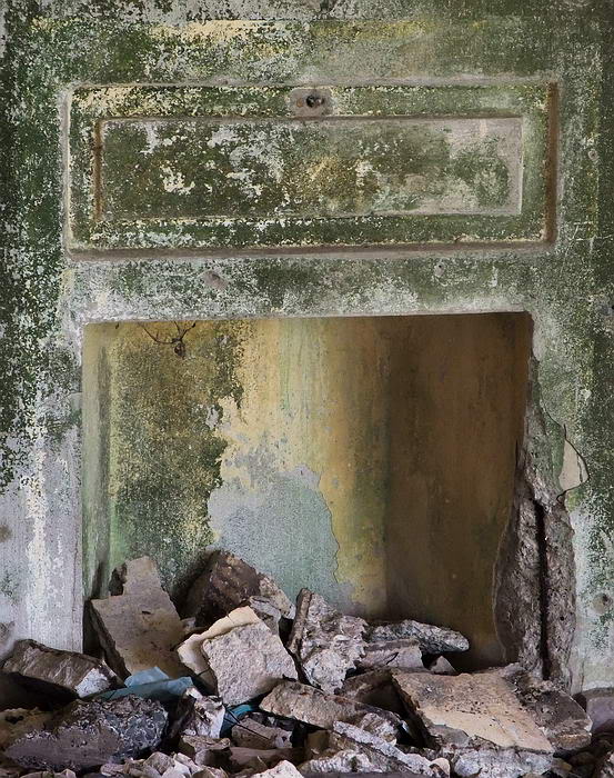
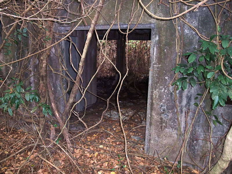
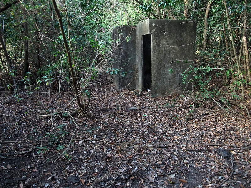
The single side doorway to the lower level rooms.
Another view looking down.
At least one purpose of these rooms was toilets and showers probably for the
tennis court and golf course. Broken chunks of porcelain litter a couple
areas.
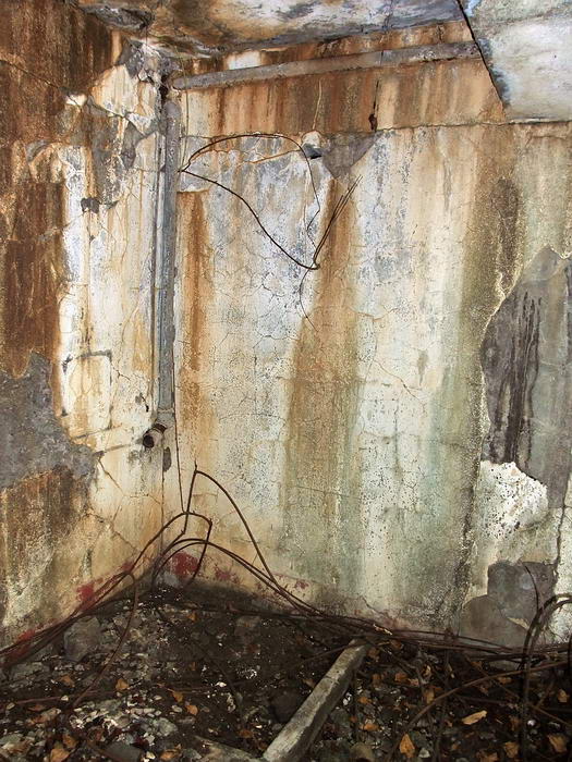
Water pipe running along a wall.
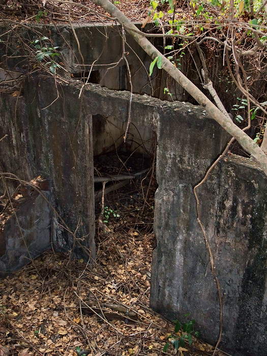
Collapsed interior concrete walls to toilet/shower area.
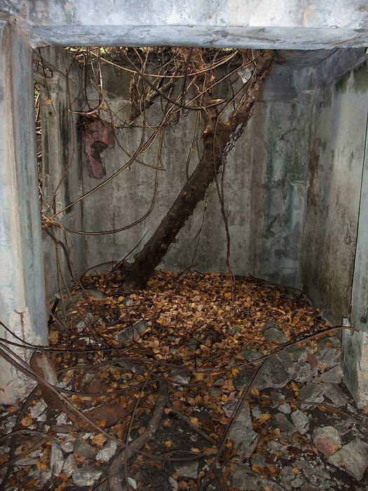
One of the rooms with the roof partially destroyed.
Another room. A sink is the large item on the floor.
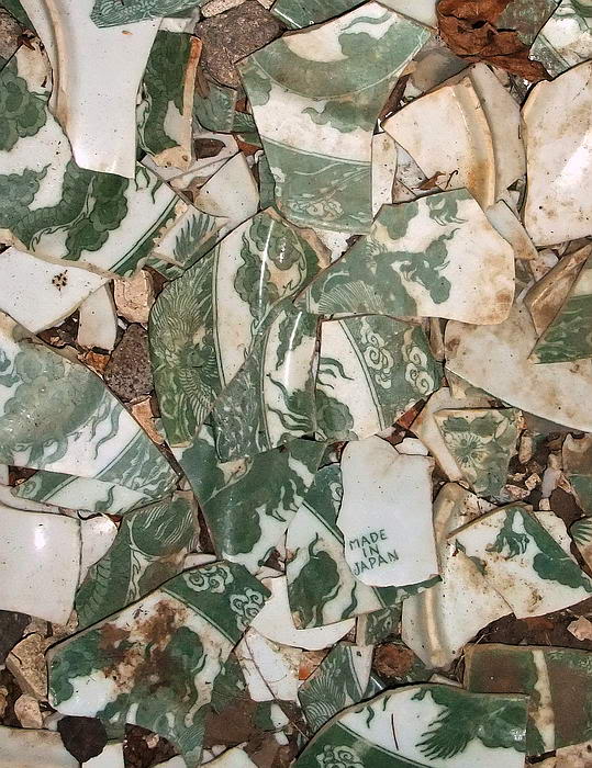
There were many broken plates on the floor of one room. I was expecting them
to be stamped “US Army Quartermaster Corps” but I finally found a small
piece to say where they were actually made.
Some broken plates can be seen on the floor in this photo.
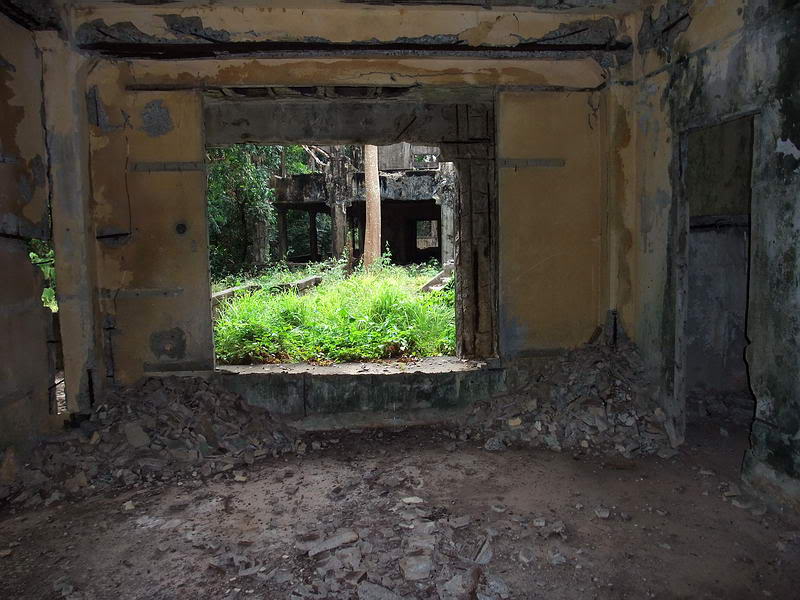
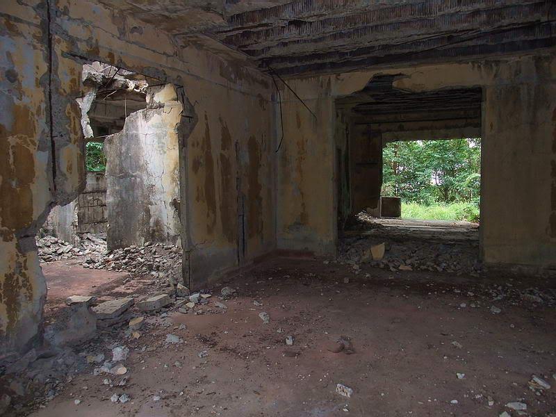
There was a big window here which looks out onto the tennis court.
The largest doorway facing the tennis court.
After viewing the map and photos, here is something for you to think about.
I am wondering if the 1924 photo which is labeled as the “Officer’s Club”,
is actually the small “Recreation Building” shown on the 1921 map. The old
photo shows a simple structure but what you see in my photos seems to be
much more substantial.
1921 map (Map courtesy of Mapmaster)
As a reference I added the location of the concrete walkway at the edge of
the Golf Course. Note that in 1921, the tennis courts are located where the
future large Officer’s Club will be located. The swimming pool, trolley
line, Caddy Stop and a few other smaller structures do not exist yet. A
small Recreation Building is to the left of the tennis courts.

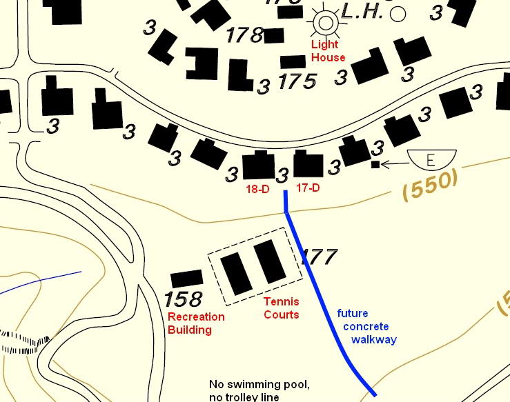
Here is the 1936 map again for comparison. (Map courtesy of Mapmaster) This
is the configuration of buildings that I saw recently.
In the above 1924 view, you see the single entrance walkway but there are
actually more walkways. Also, the land in this photo is quite flat at and
past this building. This is the same terrain that is shown on the 1921 map
where the Recreation Building is located. The large Officer’s Club shown
nearby on later maps is on a slope. From the upper side it appears to have
been a single story building but on the lower side, it definitely had two
levels. As you saw, the lower level has concrete walls and many different
sized rooms. Also, there is no concrete railing in that 1924 photo which
certainly still exists today.
I expect the numbers of officers (and their families) to use a club was
increasing over the years so perhaps the old Recreation building was found
to be inadequate. According to LOST CORREGIDOR by Selma Calmes M.D., “the
total population of Corregidor and adjacent forts was Officers 125, Warrant
Officers 6, Nurses 9, American enlisted 1800, Filipino enlisted 1300, and
civilian population of nearly 5000. Most of these people were on Corregidor
because it was the largest island and was the headquarters. The overall
population on Corregidor in 1935 was estimated to be about 9000”.
My humble guess is that sometime after 1924, the officer’s recreation area
was totally rebuilt. The original Recreation building was torn down, the
tennis court was relocated and rebuilt then a new large Officer’s Club house
was built over top of the original tennis courts.
What do you guys think?
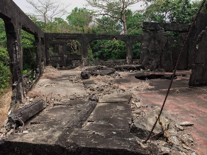
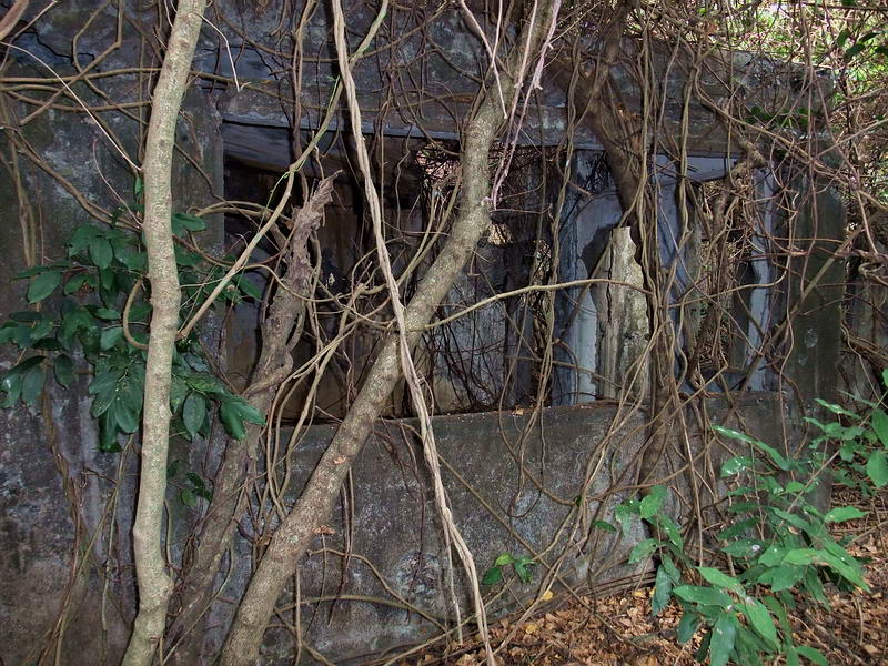
Continuing on, due to thorny vegetation I made a loop around the tennis
court area. Other than a long wall at the northern end I did not find any
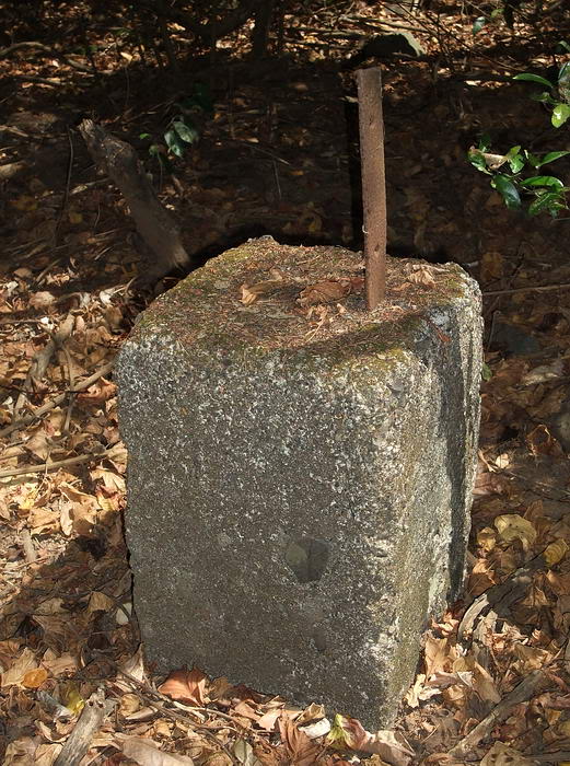
trace of it. One thing I did see was a broken metal communications pole.
This type of pole was usually used for power to the trolley lines but no
trolley was here.
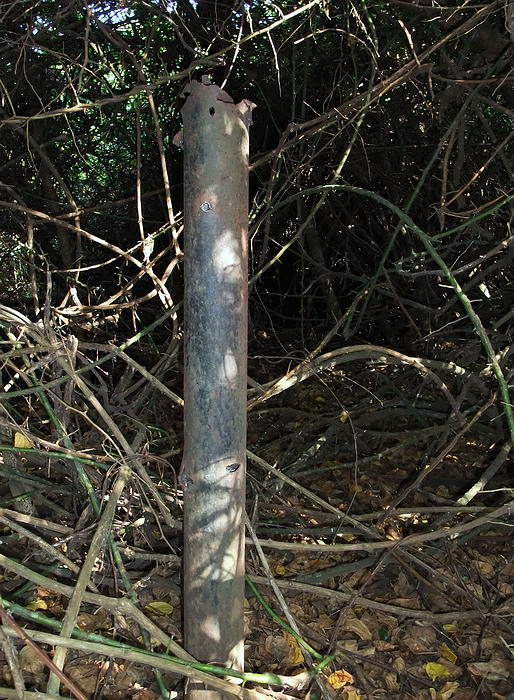
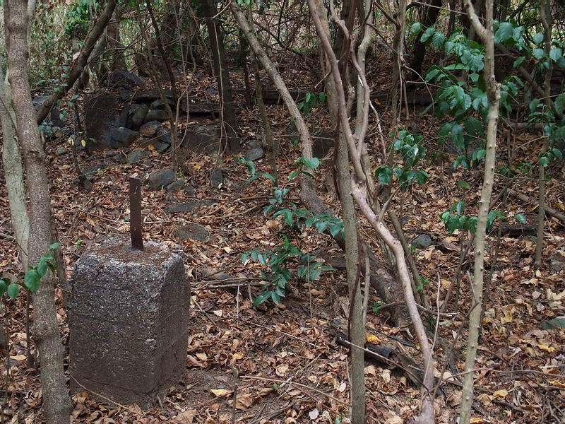
Battle damaged broken metal pole. The top part of the pole lies on the
ground where I am standing.
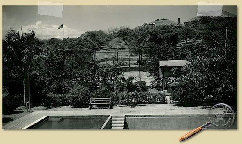
In 1931, General Kilbourne had a swimming pool built. This undated photo
looks across about 2/3 of the pool. Only the shallow section of the pool had
water in it that day.
The tennis court has been moved by now and the large Officer’s Club may be
just out of sight at the far right. The 1932 map does show the large
Officer’s Club building existing at that time.
The long wall at the far end of the tennis court is still there and a huge
bomb crater is in the middle of the court.
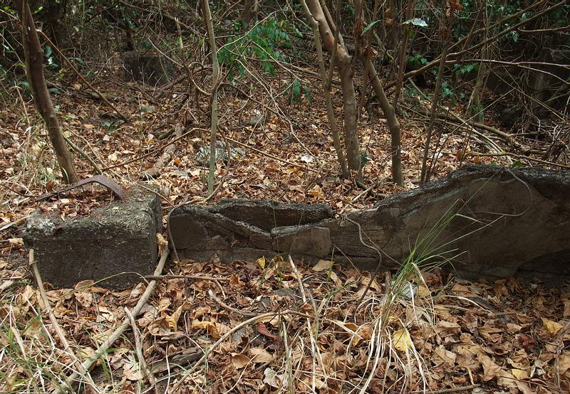
I do not know what the small building to the right of the tennis court is.
On a closer look it appears to be built on stilts as you can see tree
branches behind it. Below the building you can see what may be concrete
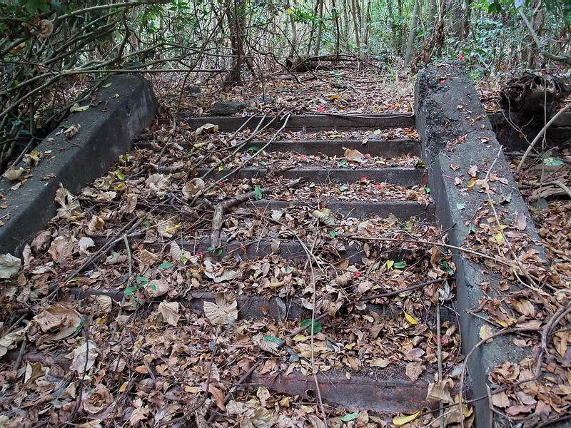
steps. This is the exact location of the end of the trolley line. Today you
can see the trolley bed (about 3ft lower than normal ground level) in
between two short concrete side walls with a concrete wall across the end of
the line.
In the same photo, two of the Senior Officer’s Quarters buildings (19-D and
20-D) can be seen at the top of the ridge along with the US flag flying on
the Topside Spanish Flag Pole. The Flag Pole (Staff) is #540 on the 1936
map.
One thing I just noticed in the photo is the bench on the far side of the
swimming pool. It is made of two shaped concrete ends with wood in between
them for the seat and back. One end of a similar type of bench remains
nearby today.
The 1936 map shows two very small structures to the left of the tennis
courts. They are #552, Servants Quarters and #553, Caddy House. Either they
are gone or I missed them while wandering around. Vegetation was the
thickest in this area plus I did not actually look for them.
The swimming pool, first cleaned out two years ago, still looks pretty good.
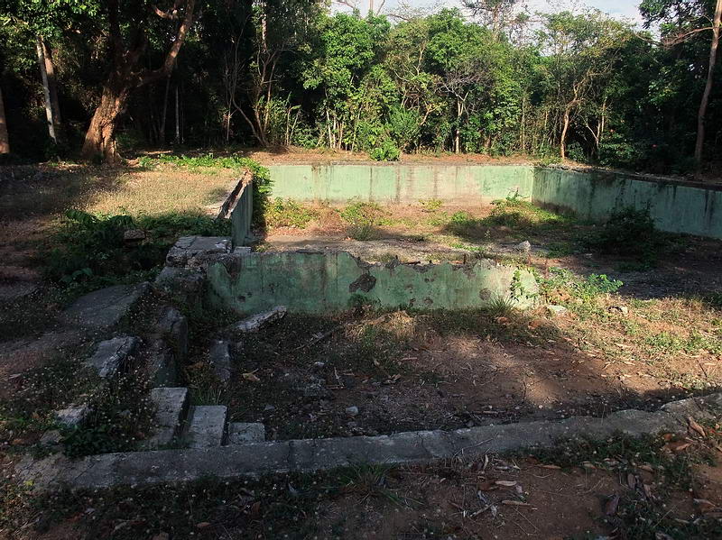
A late afternoon view of the swimming pool taken from the shallow end.
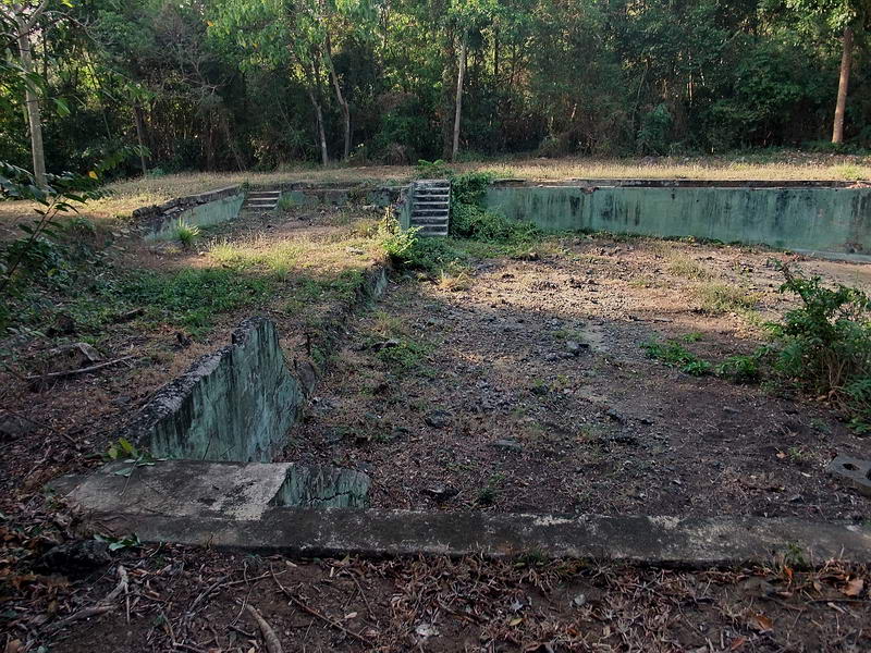
Looking across the shallow end of the pool. This view is similar to the old
undated photo three photos up.
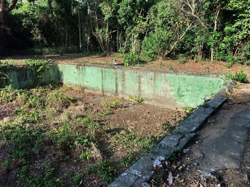
Looking across the deep end of the pool in the direction of the Officer’s
Club.
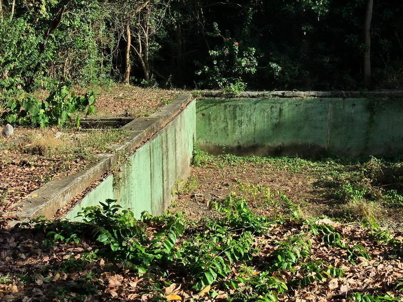
Looking across the deep end of the pool. The Officer’s Club is behind me.
Note the center rectangular hole.
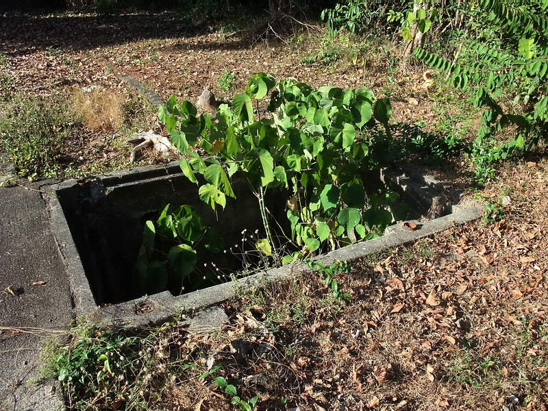
This rectangular hole had a metal cover at one time and is as deep as the
bottom of the pool. Note the cut off metal pipes that were the supports for
the diving board.
Looking across the Swimming Pool you can see the roof of the Caddy Stop
above the trees. All that remains of the Caddy Stop are steps up to a
rectangular concrete floor and the walls of two washrooms.
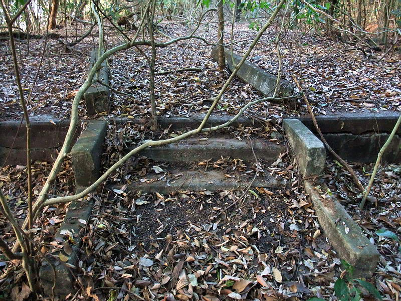
Steps up to the concrete floor of the Caddy Stop.
The walled area contains two washrooms with doors on opposite sides. Broken
porcelain still lies inside the walls.
In this area I saw no remnants of the trolley line but traces of it are
probably there under the dead leaves and branches. It was getting late so
time to head home anyway. From the Caddy Stop, the road down towards
Middleside can be easily seen so I called it a day.
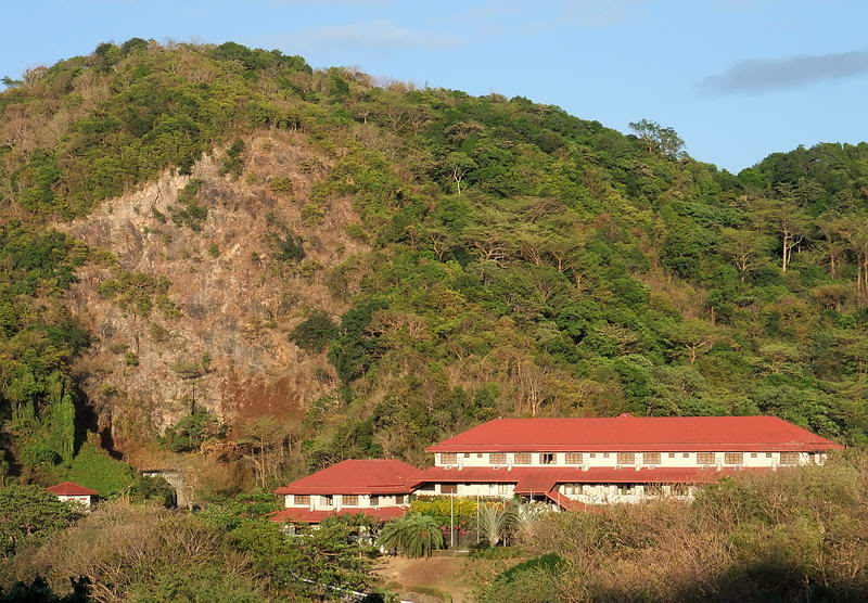
Late afternoon (5:30pm) view of the Corregidor Inn as I come around the
corner past the Stockade area. My home for a few days is in sight. Behind
the Inn is Malinta Hill. The Malinta Tunnel west entrance is visible to the
left of the Inn.
In summary, I have been to the swimming pool and part of the abandoned radio
site before but I have never explored much further. Thanks to ironman for
asking about the Officer’s Club or I never would have bothered going to this
area at all. Another pleasant surprise on Corregidor Island. |