|
FIELD NOTE:
|
| PLACE: |
CORREGIDOR |
DATE: |
20 AUGUST 2009 |
| LOCALE: |
CROCKETT RAVINE |
| OBSERVATION: |
RE-VISITING THE C-1
TUNNEL |
| BY: |
JOHN MOFFITT |
| |
REF: FOTS2/100427 |
| |
|
This trip report is
in response to doubts and questions I had regarding the Colonel Bunker book
excerpts that were posted by Phantom. Do we know for sure which tunnel was
his C1 Tunnel? How many tunnels did Bunker have?
Here is a link to the original thread:
http://corregidor.proboards.com/index.cgi?board=talk&action=display&thread=403
Because of our doubts, Phantom and I spent a couple days in the area earlier
this year and I followed up with another visit two weeks ago.
The area on Corregidor that we are exploring is at the southern end of a
ridge not far from Battery Wheeler.
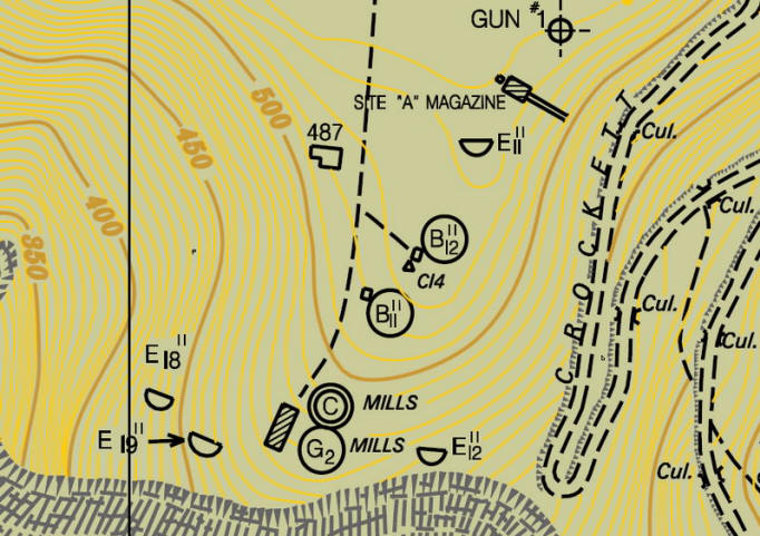
The double circle with a ‘C’ in it is the Fort Mills Commander’s Station or
Command Post. C1 refers to it being the primary command post. The circle
with G2 in it is a secondary Gun Group Command Post. These two structures
are physically attached but on two different levels. C1 is the upper level.
(Map courtesy of Mapmaster).
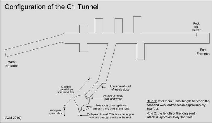
Overall tunnel sketch.
Here are some recent photos of the tunnel in question:
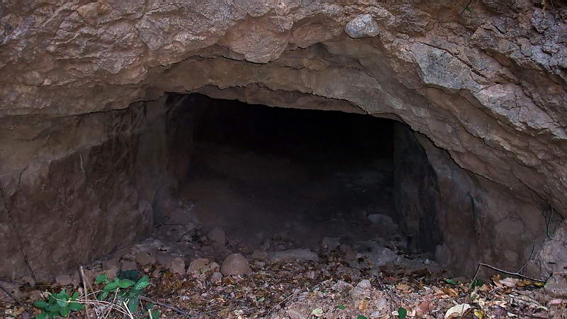
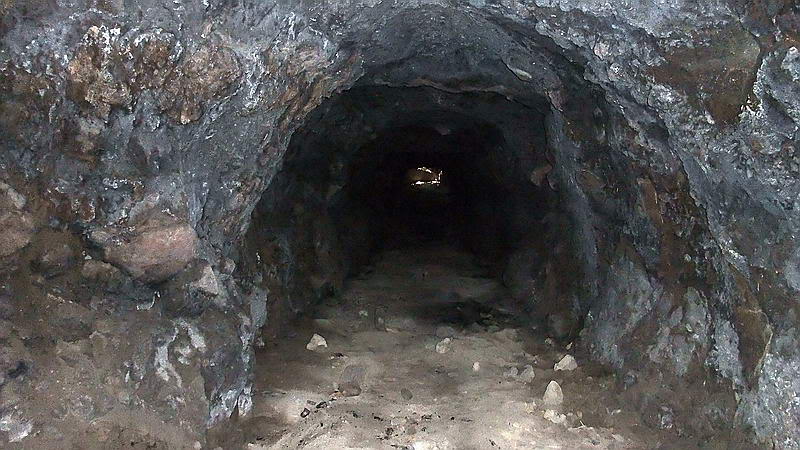
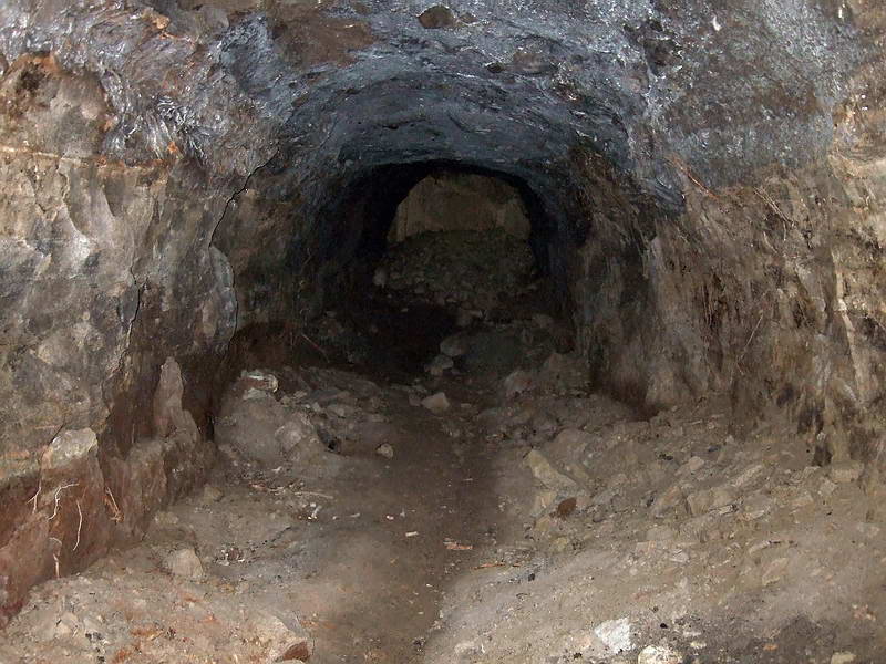
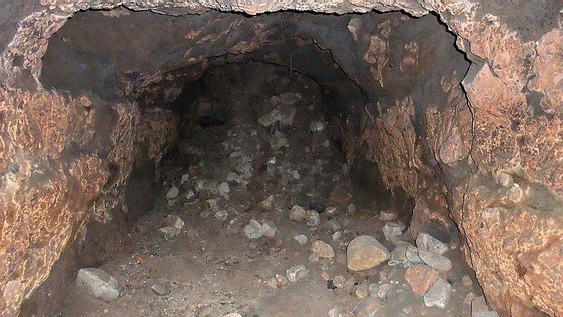
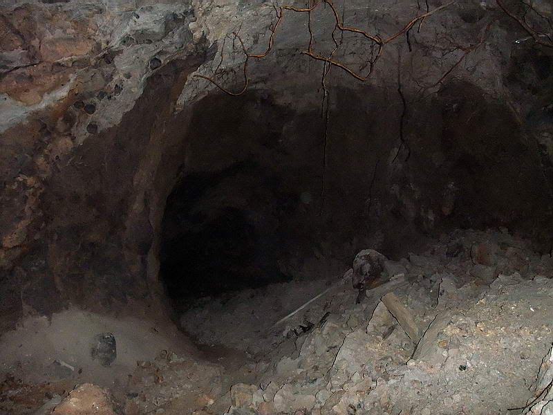
Looking into the East entrance.
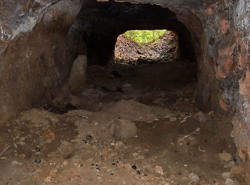
The view back out the East entrance.
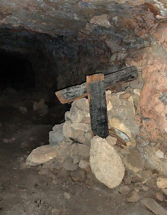
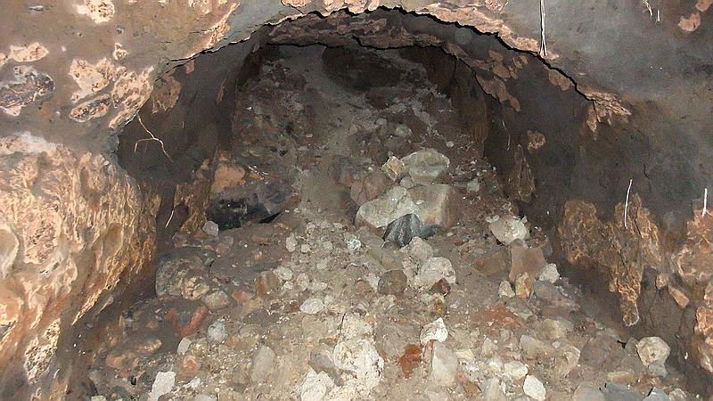
The rock pile barrier close to the entrance.
Looking back towards the east entrance from this point you can see the start
of a lateral on each side of the main tunnel.
All the laterals
look quite similar when viewed from the main tunnel so I will just show you
this one.
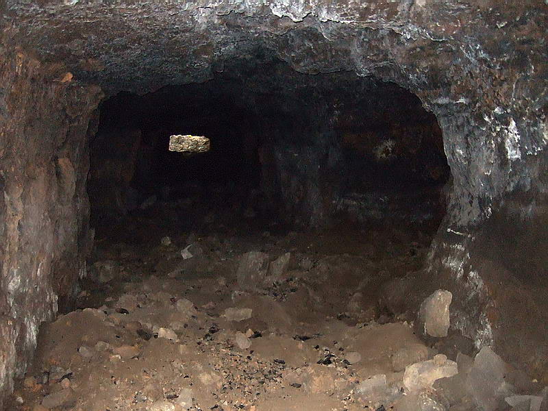
Looking directly into one of the short laterals.
Recent digging is
certainly going on in this tunnel. Candles have been placed around dig
holes. Small pieces of metal are neatly piled in a few places. Since the
metal is still there, it must not be of much value to them.
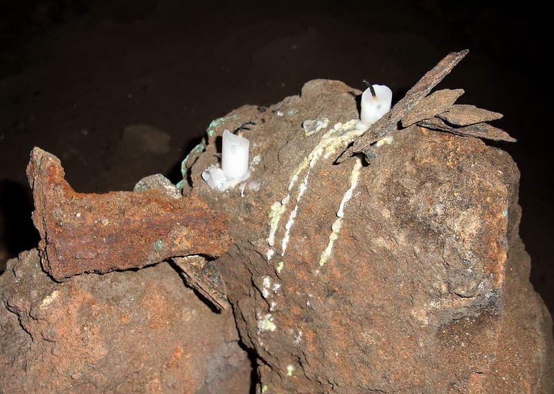
Candles and pieces of metal stacked up.
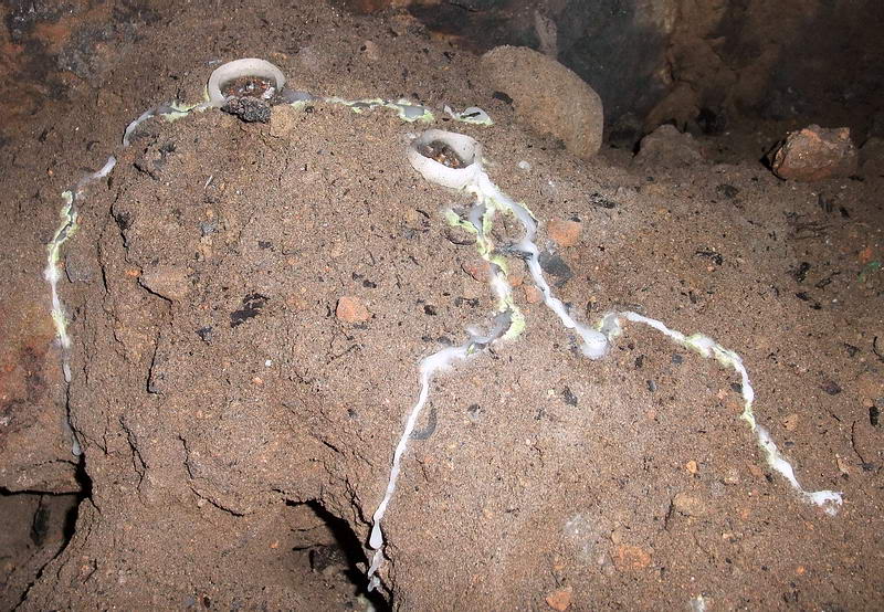
Candles burnt to the ground above some recently dug holes.
There is a very fine
layer of dust over all the tunnel floors, especially the laterals. My hiking
boots leave footprints that remind me of similar ones left by astronauts on
the moon. There is no moisture or wind to disturb them so they would last a
long time. Around the holes I don’t see any footprints at all until I look
closely. In places I see the outline of a sole but no tread.
Sandals/slippers are being worn by the diggers.
One to three feet of small rocks and fine dusty rubble sits on top of the
concrete floor today. I can see this floor in three places. One thing that
is very evident throughout the tunnel is charcoal and burnt pieces of wood.
Lots of it can be seen in the sides of the holes that have been dug. Perhaps
that is what remains of the tunnel wall lining that Bunker had installed, it
was burnt instead of being scrapped. I still see no holes or metal brackets
so the lining must have been just braced to the tunnel walls if at all.
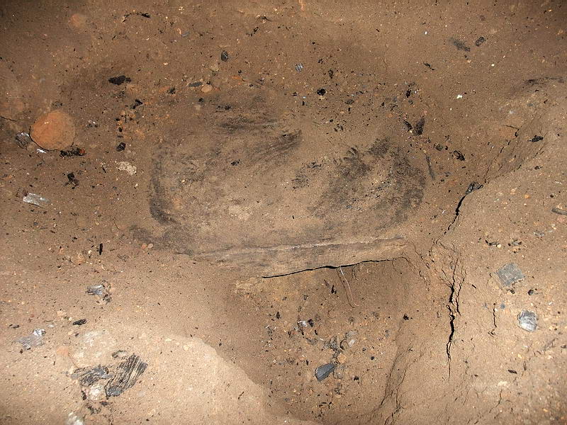
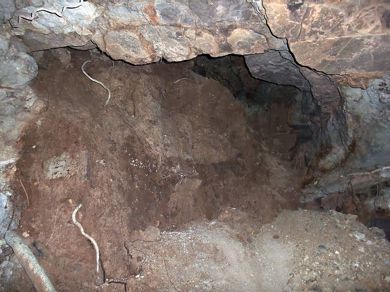
A hole that has been dug down to the concrete floor and continues under it.
Maybe the digger was following the piece of wire sticking out from under the
concrete. Note black chunks of burnt wood lying all around.
At the end of the
wide main tunnel, there is a slight turn and a transition into a narrower
tunnel. It continues out to the western entrance which can be seen in the
distance.
Approaching the
destroyed western entrance you can see a piece of fallen concrete ahead of
you.

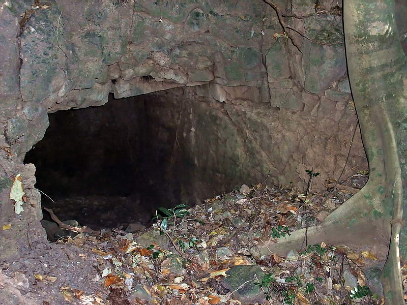
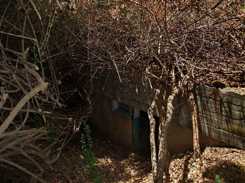
Inside view of the Western entrance.
To exit the tunnel,
climb up over the fallen concrete and rocks to come out on the western slope
of this hill.

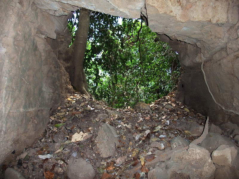
The view when looking back down into the western entrance of the tunnel.
Holding onto a few
trees as you climb up the hillside, keep slightly to the left. In one minute
you will be at Col. Bunker’s Dugout.
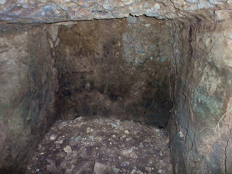
Looking towards the entrance to Col. Bunker’s Dugout. Some rocks and soil
have fallen down.
It is not very deep but carved from solid rock with precision. Perhaps the
construction crew had a Colonel looking over their shoulders.
Inside the dugout looking toward the entrance.
Now lets head back
inside the tunnel.
There is a side tunnel heading south at an angle away from the main tunnel.
At first it is fairly wide but tapers where there is a slight turn to the
right. At this turn, a steep slope of rubble is visible and you have to
crouch under the low ceiling when starting to climb the slope. I estimate
the upward angle to be approximately 40 degrees.
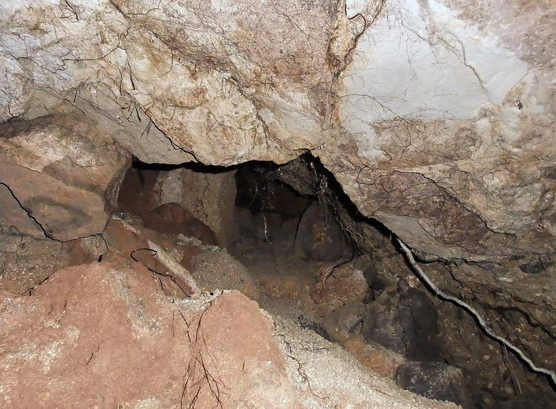
In the side tunnel approaching the rubble slope.
A closer view of the rubble slope.
I have mentioned in
earlier posts how hot it is in the Philippines now but within a few steps it
feels like I walked into a furnace. The air is dead and it is so humid that
my glasses and camera lens start to fog up.
Within feet of the start of the slope I can see a big chamber with a high
ceiling. Chambers similar to this that I have seen in the past were the
result of large explosions. Making my way up the right-hand side is not
difficult.
Looking up as I get close to the top part of the chamber. The right side
seems open.
At the highest part
of the chamber there is a large crack in the rock. If I moved a rock or two,
the crack is possibly large enough to slide through. I would love to know
what is past this point but self-preservation kicks in. From here I see an
open space between the rocks going about 20 feet further.
Looking towards the crack in the rocks. Note that there are tree roots here.
Although there is no breeze from the crack, the surface cannot be too far
away.
I turn around to leave and this is the view looking down the chamber towards
the entrance. The rubble slope at the bottom is the same one you saw in
earlier photos looking up. That is broken wood that you see towards the
right. See that white line about 2/3 of the way down the chamber? Note the
next photo.
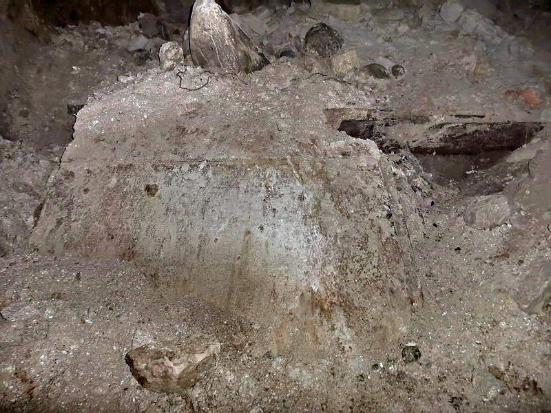
The photo above is
going to be a little difficult to describe. From a distance this looks like
a concrete slab with a dark horizontal piece of something to the left. On a
closer look, the dark object is a piece of wood similar in size to a railway
tie.
The dust covered concrete slab is quite large. I cannot determine exactly
how big it is as the bottom is buried in the rubble. Between the upper right
corner of the slab and the left end of the wood, is a small area where you
can look into.
You can see that the bottom of the slab is the finished side and there is a
bend where two pieces of concrete come together. It reminds me of the
ceiling above the top of a staircase where it is angled going up the stairs
but goes horizontal at the top of the stairs. What was this?
Now here is the fun part. Where is the C1 tunnel actually located with
respect to other structures and the hillside? Here is an overlay of the
tunnel sketch onto the same map as above. Look where the end of the southern
tunnel appears.
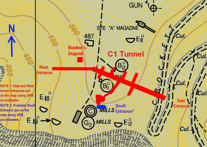
The tunnel is placed on the map using GPS co-ordinates to get accurate
positioning.
No wonder we cannot
find another tunnel along both sides of this hill/ridge. When Bunker talks
about his tunnel(s) in plural, he is actually talking about a side tunnel in
his ONE and ONLY C1 tunnel.
It is time to re-examine Bunker’s text with the assumption that he is
talking about a single C1 tunnel with three entrances. In the past I was
trying to understand how the tunnel that we see today matched up with
Bunker’s text. Lets look at it from the opposite direction. Take Bunker’s
text and make it fit the tunnel. With a few exceptions, it actually does
fit.
Chronology of C1 Tunnel construction events:
|
|
Construction of the main tunnel starting from the east entrance.
The sketch shows a large tunnel of equal width going 2/3 the way
through the hill. The start date of construction is not
mentioned.
|
Second:
SATURDAY 14 FEB. 1942 |
THIS
MORNING AT 6:50 THE ENGINEERS BLASTED THROUGH OUR TUNNEL
ADDITION TO THE OPEN AIR. WE WERE GREATLY PLEASED. TWO DULL
BOOMS AND THEN TWO SHARP CRACKS AS THE EXPLOSIONS CAME THROUGH,
JUST AT ENTRANCE TO OUR HOMEMADE TUNNEL NEAREST C1."
An
“additional tunnel” off of the existing main tunnel was
constructed and it is the tunnel entrance “nearest to the C1
Command Post.” (i.e a Southern Entrance)
|
Third:
THURSDAY, 26 FEB 1942 |
"BAWLED
OUT OUR CREW, WORKING ON THE SMALL TUNNEL FOR LOUD FILTHY
LANGUAGE. IT'S EXCESSIVE USE IS NAUSEATING-EVEN TO A
NON-PURITAN".
Small
tunnel towards the West Entrance?
|
|
FRIDAY,
27 FEB. |
"AFTER
BREAKFAST VISITED OUR C1 TUNNEL. THE CREW EXPECTS TO BREAK
THROUGH IN 4 MORE BLASTS. "
Small
tunnel towards the West Entrance?
|
|
SUNDAY 1
MAR 1942 |
"THIS
MORNING WITH AN EXTRA BLAST, THE "MINERS" FINALLY BROKE SURFACE
BELOW MY DUGOUT WITH THE OTHER END OF OUR MAIN TUNNEL. "
The
above three comments cover a four day period. “Below my dugout
with the other end of our main tunnel”. No question, it was the
West Entrance that was created today.
|
TUESDAY,
7 APRIL 1942
|
“ENGINEERS HAVE FINISHED POURING THE FLOOR OF OUR TUNNEL AND WE
SURE ARE GLAD TO GET RID OF THEM.”
Only
this year did I see evidence of a concrete floor. Phantom
noticed it in the main tunnel when he kicked away dirt at the
bottom of one of the digger’s holes. Last trip to the tunnel I
noticed two more locations where the concrete floor still
exists. Both of these locations are in laterals.
|
Phantom told me that
Col. Bunker mentions having the engineers construct a concrete barrier
(diversion dams) at the west entrance to stop water from a small stream from
getting into the tunnel when the rainy season comes. Well, there is a small
dry stream down the north side of that entrance. What appears to be a
concrete barrier does lie across the western entrance.
This may be the concrete barrier that even today lies across the mouth of
the western entrance.
Now that we know
that the southern tunnel goes very close to the C1 Command Post, where is
the entrance that was blasted open on 14 FEB, 1942? It should be in the area
between B11/11 and C1 itself. That particular area contains samples of every
thorny plant that God ever created so Phantom and I had skirted it earlier
this year. It was not where we were expecting to find other tunnels anyway.
If there is a single good reason for the El Nino dry climate this year, it
is that ground visibility is the best in years. In many places the thorny
plants are still there but their green leaves are gone so you can see
further.
The hiking trail to C1 keeps well to the west to avoid this vegetation so I
will start at B11/11 and head south. Within spitting distance of B11/11, the
hillside drops off quickly but I can see a level bottom and what appears to
be a rock-filled crater. Holding onto some branches and vines, I go down the
slope.
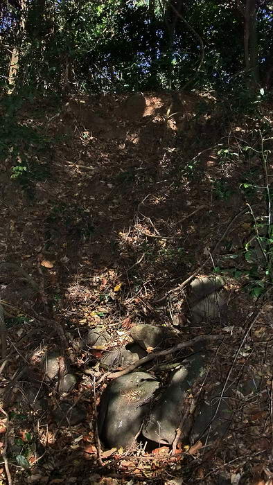
B11/11 Command Post.
When I look around I
see a concave depression in the hillside and a horizontal flat area below
it. Everywhere else along this ridge is sloping south. There appears to be a
rock filled bomb or shell crater to one side of the depression.
Normally I would not think any more about this area and move on. However,
knowing that the south tunnel is almost under me, I think that the chance I
am standing at or near the destroyed South Entrance is quite good.
View from the bottom of the rock filled crater looking back up to the top of
the depression. It is difficult to get a photo that looks anything like
actually being there. The level area is beside and behind me.
The depression in the hillside is only 40 feet or so from the rear door of
C1. Since this was the command post of the “Fort Commander” perhaps having
access to a nearby bomb-proof tunnel was the incentive for building such a
tunnel at this location. I wish someone knew for sure.
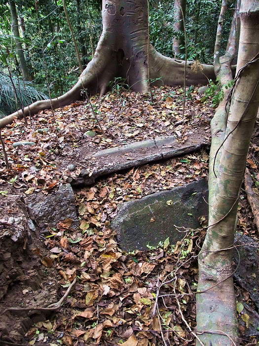
The rear door of the C1 Command Post. Note the dense vegetation.
C1 has been cleared
recently as part of a trail feature from here back towards Battery Wheeler.
Another thing to consider is: has this south tunnel entrance been covered up
after a wartime explosion destroyed it? Remember the post war photo of a
bulldozer leveling the Battery Boston area. Well, this is the same ridge,
just a few hundred feet further south. As usual, I expect we will never
know.
So what about the steep slope inside the semi-collapsed area of the southern
tunnel? Doesn’t make any sense. Well actually it does. Look at the map
again. This map has 5 foot contour intervals which makes it easy to
determine the elevation within 5 feet at any location.
The main east-west tunnel has a little downward slope towards the west. Note
the contour lines at the south and the two east/west entrances. The south
entrance is quite a bit higher so steps or a ramp inside this tunnel would
be necessary to get from this entrance down to the level of the main tunnel.
Unfortunately, few things in life can be determined with 100% accuracy. A
few comments by Col. Bunker do not agree with what we see today.
FRIDAY,
6 FEBRUARY 1942
|
“ARTY
ENGINEERS GANG OF GUGUS (FILIPINO SOLDIERS) ARE TRENCHING A 75pr
CABLE FROM MANHOLE 43 TO NORTH ADDITION OF TUNNEL”
Two
manholes are very close in the area of the tunnel. One is within
feet of the rear door of C1 and the other is at the top of the
ridge above the Dugout. Knowing the location of two manholes is
irrelevant though, there is no “north addition.”
|
|
TUESDAY,
17 MAR 1942 |
“PROGRESS ON OUR TUNNELS HAS SLOWED DOWN. THEY ARE NOW LAGGING
THE TOPS AND SIDES OF OUR 4 LATERALS.”
\This
tunnel has more than four laterals. If he means that they are
lagging only four of the laterals then he is not saying it
clearly.
|
|
TUESDAY,
17 MAR 1942 |
“THE
NOVELTY SIDING WHICH I HAD BATTERED DOWN OVER THE 2" CRACKS
BETWEEN THE SIDING PLANKS LOOKS WELL.”
I have
always questioned if this tunnel was ever lined since there is
no evidence of drill holes, or nuts and bolts etc. This siding
must not have been anchored to the tunnel walls or ceiling
anywhere at all. This was a rush job so perhaps that is not
unusual.
|
Even with the above
comments, I now think that what we call the C1 Tunnel actually ‘is’ the C1
Tunnel. Too much evidence to think otherwise.
Mr. Phantom, when you return next year, lets have a detailed look around
here again. Now we can concentrate is this small area and not try another
steep death march down and up any adjacent ravines. Perhaps there are still
remnants of his kitchen etc to be seen. Also, another tunnel nearby is
mentioned in Bunker’s text.
Thanks for creating one of the longest threads in the Corregidor.org forum’s
history. It has been an interesting trip.
A big thanks to Mapmaster because without his maps this trip report would be
only three sentences long. A visual representation of where you are in
relation to what is around you makes a world of difference.
If anyone has anything additional to add, please do so. In the end, accurate
history will be the winner.
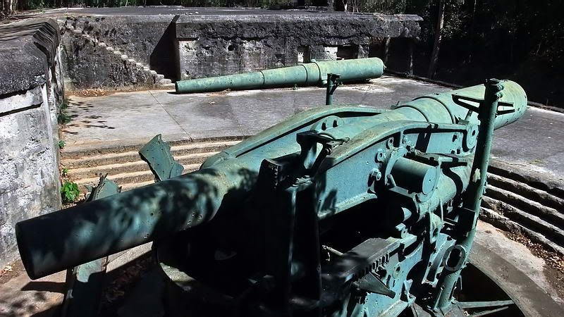
Finally, I’ll give you a couple shots of nearby Battery Wheeler. You pass
within sight of Battery Wheeler when you take the new walking path to C1.
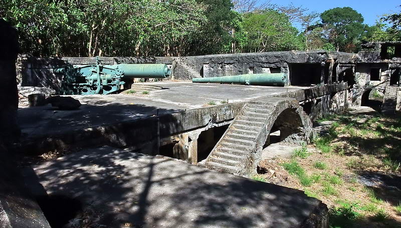
Battery Wheeler Gun #2 position. The barrel lying off to the side is from
the dismantled Gun #1.
Another view of the Gun #2 position.
|