|
FIELD NOTE:
|
| PLACE: |
CORREGIDOR |
DATE: |
5 FEBRUARY 2011 |
| LOCALE: |
TAILSIDE |
| OBSERVATION: |
LT. LAWRENCE'S GUN POSITION |
| BY: |
JOHN MOFFITT |
| |
REF: FOTS2/110205 |
| |
|
The tail of Corregidor is seldom visited today. Many people I speak to have
no idea of the war history in this area whether it be from the 1942 or the
1945 battles. Some do know the history but due to vegetation and reptiles,
Kindley Field is their eastern limits. A few of us who are mostly members of
this web site and some CDSG buddies do wander to the remoter areas. There
are hazards but it is often rewarding.
In early December 2010, starting around 8am I walked from Kindley Field to
East Point. This is as far east as one can walk without getting your feet
wet. I planned to arrive at low tide, cross over to Razor Island and finally
get some photos of Hooker Point. That went well. I got back to Kindley Field
at 3:45pm. It all sounds good but covering that amount of territory does not
take that long. I actually had two goals that day.
Thanks to chadhill and okla, I got interested in the 1942 Tailside battles
again. As I headed east towards the tail, Goal #2 was to keep to the north
side as much as possible looking for any signs of Lt. Lawrence’s gun
positions. Vegetation was terrible as that time was at the end of the rainy
season. I had read somewhere about quickly constructed wood and rock
reinforced positions so probably little remains today. No one I spoke to had
ever found anything, few ever looked.
The terrain here alternates between moderately difficult scrubby treed areas
and walls of thick high grasses and vines. Going was slow mostly due to high
grasses. If I had waited a couple months then the grasses would have died
down a bit. I felt like I had just walked a mile in 3 feet deep snow….ok,
bad analogy for this part of the world. Lets just say that the grass and
vines were terrible to get through. At this rate I was going to miss low
tide at East Point. I gave myself another five minutes before I headed over
to the south side where the walking was easier and faster.
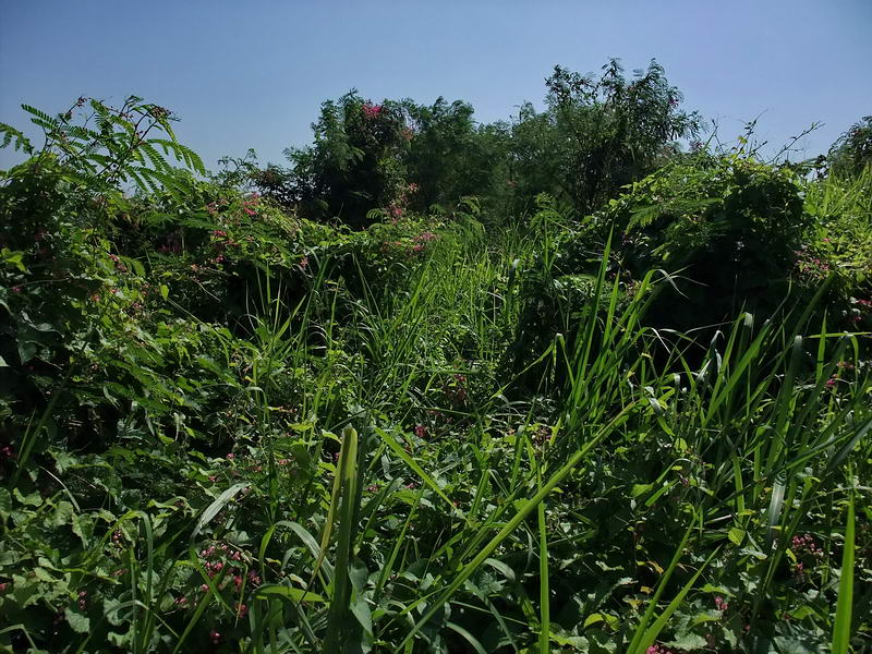
Photo of the December 2nd grasses and vines one and a half times taller than
me. I am headed for the trees dead ahead.
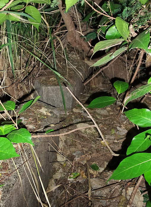
It was time for some luck. A dark spot ten feet in front of me turned into a
deep pit. The deep pit turned into the walkway in front of a concrete
magazine. Here was one of Lt. Lawrence’s gun positions. I took a quick look
around before heading for the tail. (My photos below are a combination of
those taken in December and January).
Few people on this web site are unaware of the exploits of Lt. Lawrence and
his men during the 1942 Japanese invasion. Numerous web sites and books
detail those events so I won’t repeat much of it here.
On the eastern tip of Corregidor, Lt. Lawrence’s heavier guns consisted of 2
- 75mm model 1917 British made guns, 2 - 37mm ex-caliber guns mounted in 50
cal. AA mounts, 2 - 50 cal. machine guns and 2 - 30 cal machine guns. (In a
letter to Belote, Lawrence also quotes these same figures). Maps are a bit
vague as to exact gun positioning but do show this quantity of guns emplaced
along the tail.
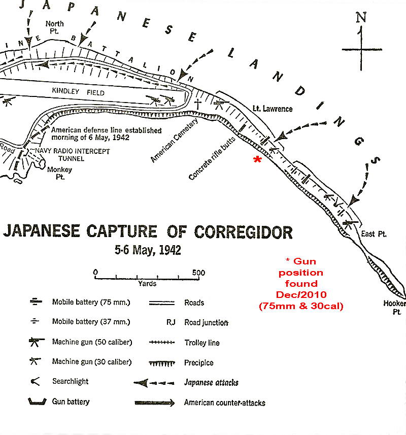
Map of Lt. Lawrence’s defense positions. (if someone remembers what book
this map came from I will add the info here)

75mm M1917 gun
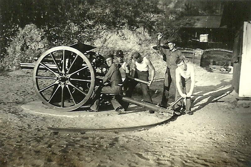
75mm gun ‘somewhere’ on Corregidor
Prime hiking season was coming next month and others from this forum would
be visiting soon. I decided to do minimal clearing for a few photos and save
this site relatively undisturbed for them to see. My first trip to
Corregidor in January was related to the return of Richard Adams, a 503rd
paratrooper, so I just kept the find a secret. February is when most of the
yearly visit guys come to Corregidor plus Karl and EXO. We would all go
then. However, later in January, The Phantom showed up so he became the
lucky guy. Also, last year I met a guy from Alaska named Jim Moffett. He is
a fellow tunnel rat and made a return visit.
The three of us headed east early on January 23rd. Waiting almost two months
since my last trek to the tail was a good idea. I won’t say it was easy
walking but certainly much better than in early December. On the way I
showed the guys some tombstones and later we passed by the concrete
wall/rifle butt. The grasses now were only neck high and traces of my
earlier path was still visible.
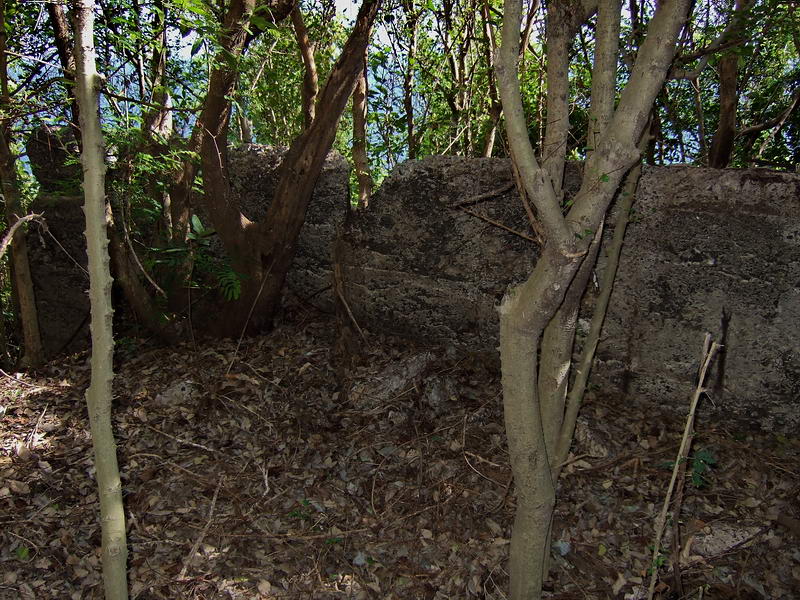
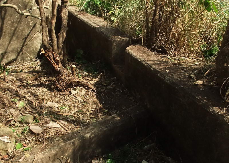
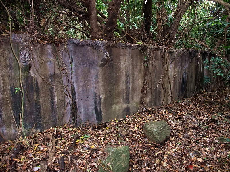
Looking east towards the concrete wall/rifle butt.
Looking west towards the concrete wall/rifle butt.
On arrival at the gun position, one thing is immediately obvious. This site
is much more substantial than I expected. There is one 75mm gun position, a
concrete underground magazine and a concrete dual machine gun position. If
anyone has visited this site it has not been in recent times. Trees and
vines are everywhere, there are no paths, no signs of bush cutting and no
metal scrapping. Something quite unusual is that there is no graffiti at
all.
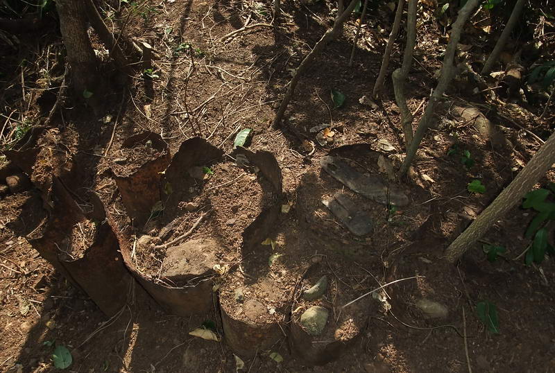
The 75mm gun position is certainly large enough for this sized gun. A long
berm in front of the position is made up of vertically placed steel pipes or
barrels surrounded by rocks and soil. The largest barrel is about 14”
diameter and filled with rocks. This position is below but not far from the
top of the narrow ridge. A dip in the upper side suggests a walkway or wide
path where the gun may have brought down from. The rear of the position has
had a bit of a landslide but it is still level ground where the gun was. I
was hoping to find a curved positioning rail behind where the gun was but if
it is still is there then it is buried.
Looking east, this is a view of the western end of the berm running along
the ridge.
The 75mm gun was to the right, down the slope is to the left. The gun
position itself has small trees in it now but it is flat except for soil
that has slid down into the rear of it. (Phantom cleared away small trees,
branches and leaves for this photo).
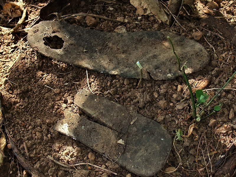
Phantom found some booth soles while scraping away the leaves. The larger
one is probably American but the smaller one with the “V” looks like a
Japanese Tabi split sole boot.
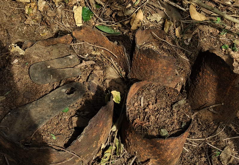
A closer look at some of the pipes and barrels used in construction of the
berm in front of the 75mm gun.
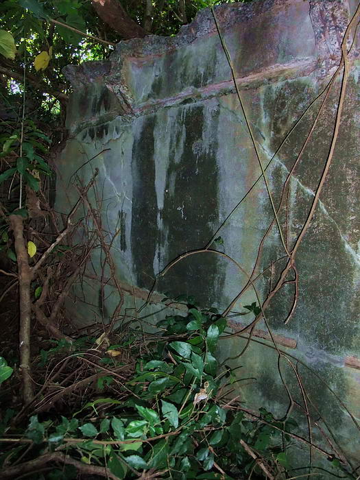
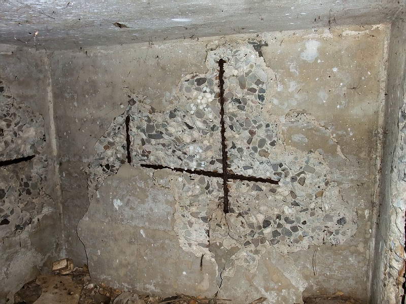
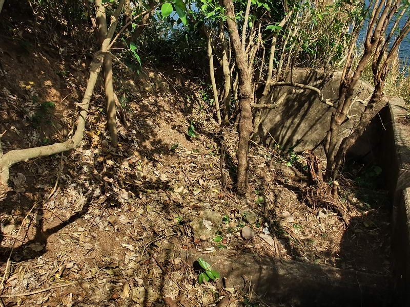
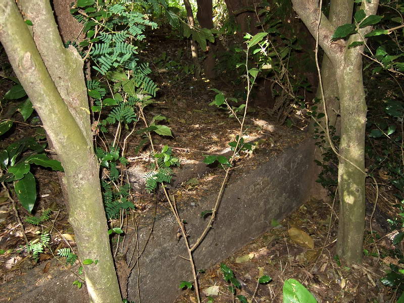
Down the slope slightly west of the 75mm gun is the magazine. It is
constructed of steel reinforced concrete and has a 6’ x 6’ interior size. A
few pieces of concrete have separated from the north wall, east wall and
ceiling showing the rebar. No scrapping or graffiti here. Smooth beach rocks
were used in the concrete so it may not have been as strong as it could have
been. I guess they used what they had available. There is no battle damage
here. On top of the magazine are layers of rocks with a foot or two of soil
on top. An air vent sticks straight up from the rear ceiling.
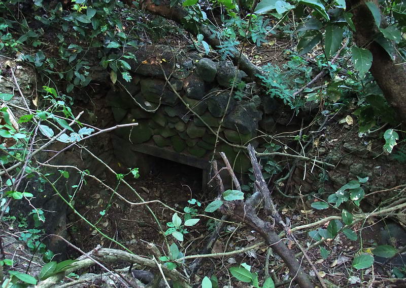
Looking down at the entrance to the magazine. Some clearing of branches etc
was done for this photo. I am standing close to the 75mm gun berm facing the
beach. You can barely see the path (to the right) from the magazine heading
further down the hill to the machine gun positions.
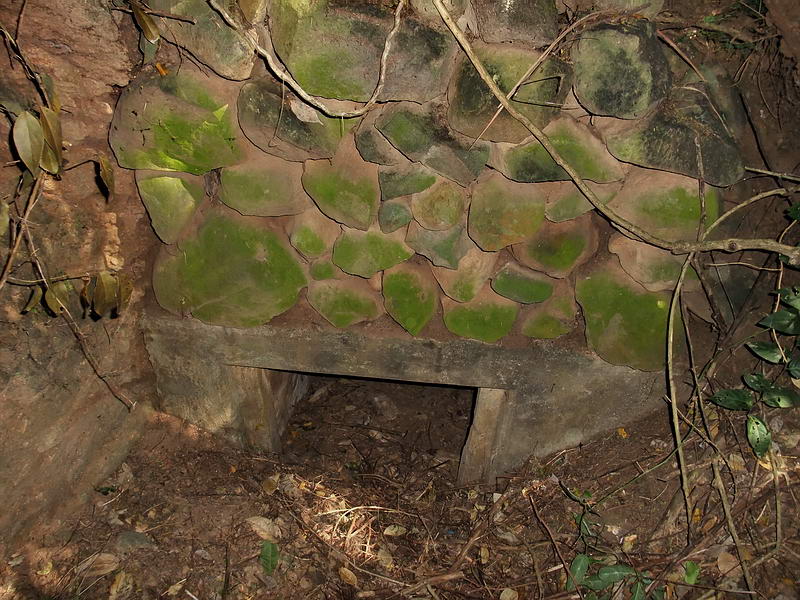
Close-up view of the magazine’s entrance.
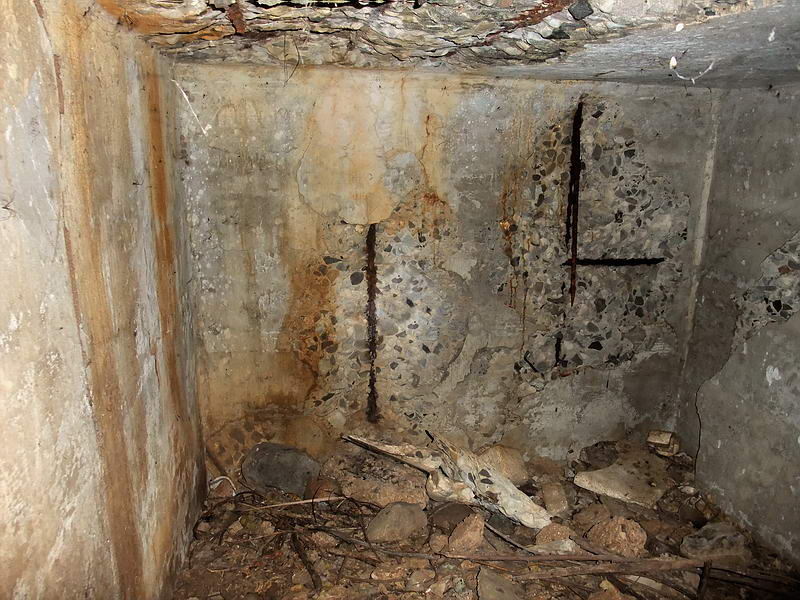
In the magazine looking towards the rear wall.
The eastern wall.
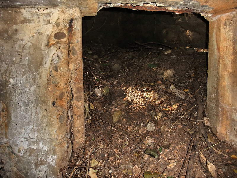
Looking out the entrance.
From the magazine, a short path leads east down
to the concrete machine gun positions located above the beach cliff. It
consists of one concrete structure with two gun positions. It is not
oriented straight out toward the beach but to the east. i.e facing down the
beach towards the tail of the island. The hillside behind the MG position
hides it quite well from Bataan. A bit of camouflage would make it
invisible. Lt. Lawrence was ordered to not disclose his positions by firing
and as he says, they were undamaged. Even 1945 bombardment and battles have
not damaged this position, it is intact. A bit of the hillside has slid into
the rear and inland sides of the machine gun positions though. One thing I
find unique here is the two angled gun barrel slots in the front wall. They
remind me of similar slots in hundreds of years old forts and castles. I
have not seen that anywhere else on Corregidor. Behind both gun slots are
angled concrete raised pads for tripods I assume.
Gun position #2 showing the slot in the front wall and one side of the
base/tripod mount behind the wall.
Close-up of the angled gun barrel slot. Like the rest of the position, it is
totally undamaged as Lt. Lawrence said.
Gun #1 position. The hillside to the right of this gun has slid down into
the position.
After clearing the trees and vegetation in January, you can easily see that
the angled concrete pad that is behind both gun positions. This is gun
position #2.
A wider view of Gun position #2.
Gun position #2.
Some of the hill has slid down close to the front wall.
The direction towards Bataan is roughly in about
the 10 o’clock position of this photo.
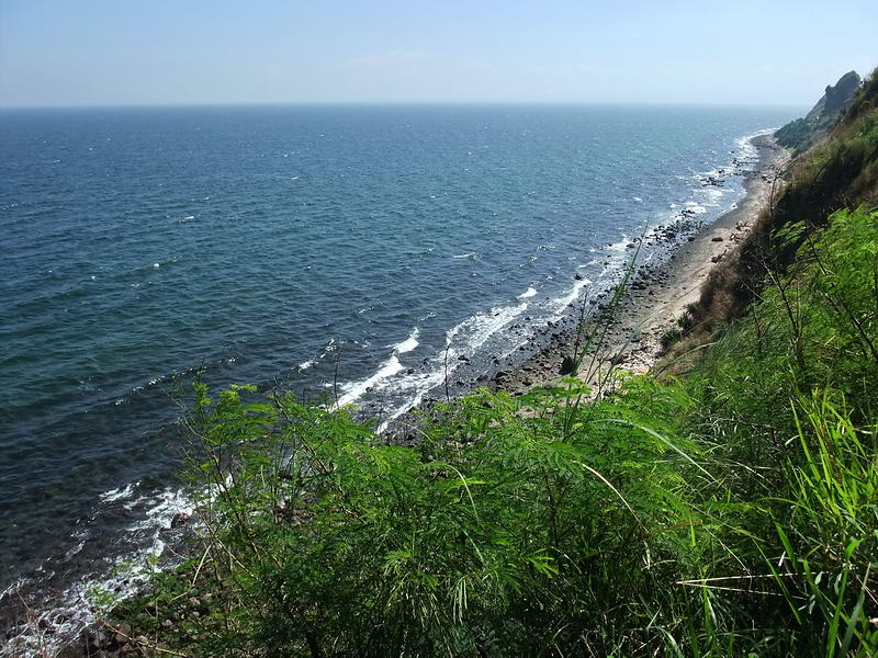
Looking straight forward of the Gun #2 position, this is the eastward view
along the beach.
No wonder the Japanese invasion forces were
virtually annihilated. More guns were also emplaced further down this beach.
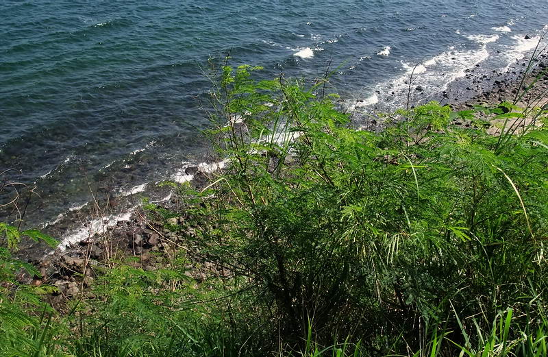
The view when standing outside the concrete wall looking over the cliff
directly below the guns.
Not far from the 75mm gun position was a
building at the top of the ridge above the south side cliffs. It had a
concrete floor but the rest was wood. This building is not on any maps. Here
is a look at one corner of the floor.
Finding any more of Lawrence’s positions would be difficult but interesting
to pursue. We finished up here and headed back towards the airfield. This
time I kept more to the left (south) than usual. A few more surprises were
in store for us.
The first one I could do without. While blazing a path through the tall
grass I noticed another dark spot in front of me. Here turned out to be a
rather unusual rectangular hole. This could ruin your day if not paying
attention to where you were walking. The hole is unusual because it started
out as a shallow concrete box in the ground. Someone knocked out the
concrete floor and one wall. They then dug a rectangular shaft at least 12
feet deep. The shaft is too small to use a pick and shovel. A metal bar and
probably a bucket to remove the dirt was used. There is a grass covered pile
of soil near the pit. Someone went to a lot of effort for no apparent
reason. Damn, we missed the gold again!!! 
Here is a look at the hole ‘after’ we cleared away the grass.
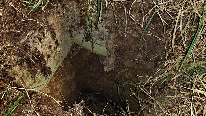
Looking down the 12 feet deep hole.
Note the concrete box that had its right side
and bottom removed. In the top two corners of the box, you can still see
small sections of the concrete floor that they chipped away.
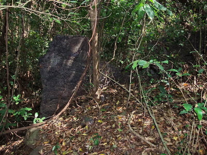
The next surprise was more interesting. Minutes after leaving the hole we
entered a wooded area and I noticed a chunk of concrete near a fallen tree.
This turned out to be the tombstone of the Spanish lady. More concrete
tombstones with crosses were found nearby. (Photos posted in the Tailside
Cemeteries thread).
Keeping south again and nose to the ground looking for local inhabitants, I
was surprised to see concrete through the trees in front of me. Ahead I
could see a wall. For a couple seconds I wondered if while we were looking
for more tombstones I got turned around and we were back at the rifle butt.
No, this one looked different. A quick sanity check with the GPS confirmed
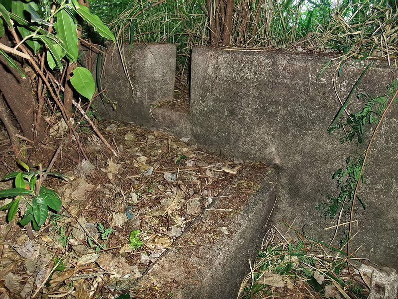
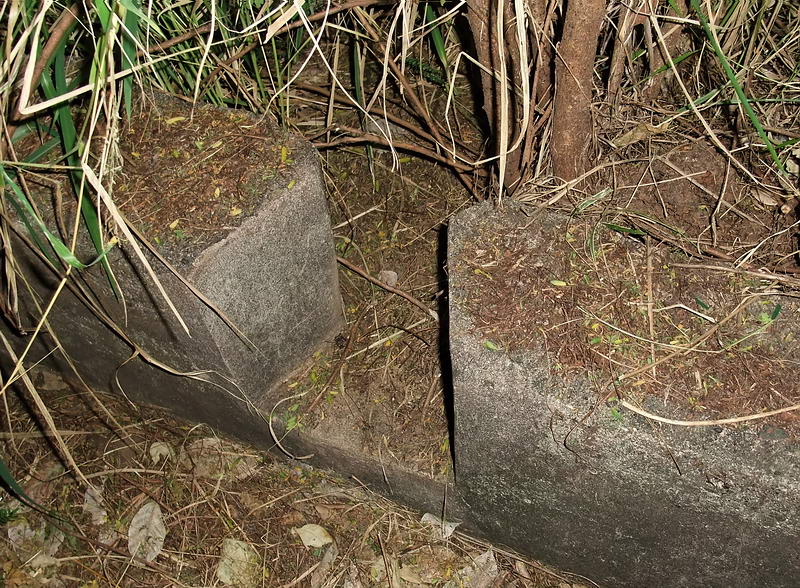
our position. Guess what folks, there are TWO of these walls/rifle butts. At
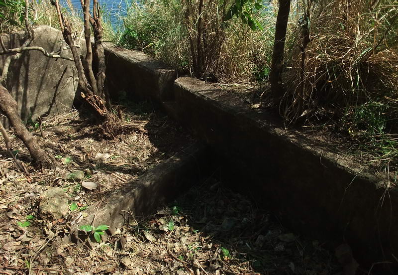
approximately 72 feet, this one is longer than the other one further east.
Both walls are similar in that their western side is built up to within 3
feet (or level to) the top. The height of the eastern side of both walls is
well over my head. Seems ideal for defending against an enemy coming towards
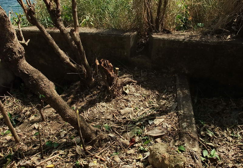
you from the tail.
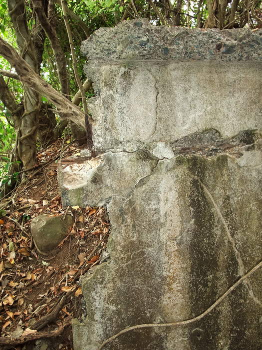
The northern end of the wall looking east. A chunk of the wall is missing to
the right of the center tree.
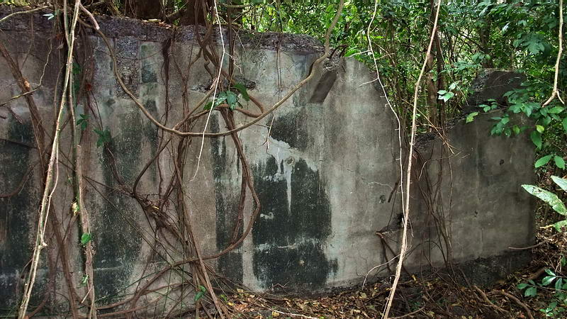
The northern end of the wall looking west. The chunk out of the wall is
easier to see from this side.
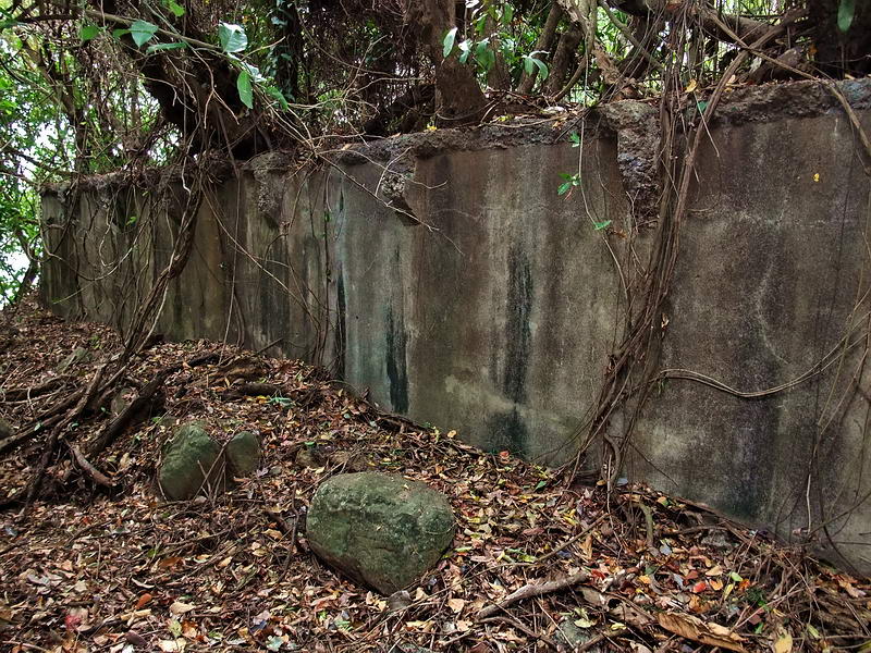
From roughly 1/3 of the way along the wall’s east side, here is the view
looking south.
Looking north along the east side.
This is the southern end of the wall. It is only four feet from the vertical
cliff down to the beach.
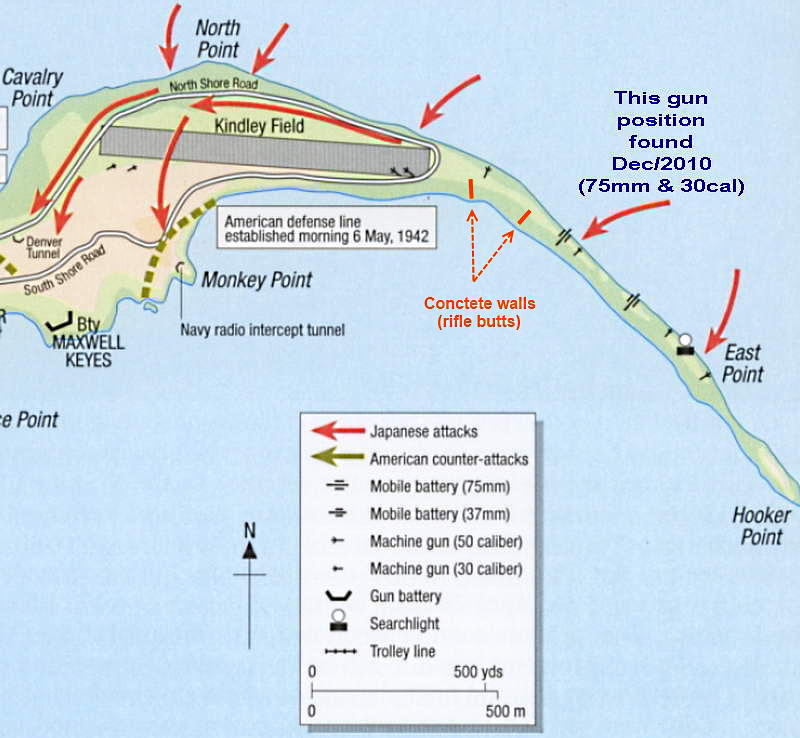
Map of the tail showing the location of both rifle butts. (American Defenses
of Corregidor and Manila Bay Terrance McGovern & Mark Bernhow)
When were the walls and Lt. Lawrence’s positions
built? The only reference I have found mentioning defensive structures being
constructed on the tail is in the following text.
“As soon as the marines reached their assigned positions at the end of
December (1941) they began to improve existing defenses and to prepare new
ones. Some work had already been done in the West and Middle Sectors, but,
except for a final defense line on the east side of Malinta Hill, there were
NO defenses east of Malinta Tunnel. The marines turned to with vigor and in
the next three months laid miles of barbed wire – twenty-one miles of wire
were laid in the East Sector alone – planted land mines, dug tank traps,
trenches, and tunnels, cleared fields of fire, built
gun emplacements, set up interior and switch positions, and established
final defense lines in each
sector”. (The Fall of the Philippines by Louis Morton, Page 529)
Enough fun, ten minutes or so later we were back at Kindley Field and
waiting for a ride back to the Corregidor Inn. This was one of those days
that makes a trip to Corregidor very worthwhile and rewarding. What else
lies hidden?  |