|
FIELD NOTE:
|
| PLACE: |
CORREGIDOR |
DATE: |
20 AUGUST 2009 |
| LOCALE: |
MALINTA HILL |
| OBSERVATION: |
COMPARISON 1977
SLIDES |
| BY: |
JOHN MOFFITT |
| |
REF: FOTS2/090820 |
| |
|
This trip report is
in response to a bulletin board post by "aloud" who was requesting current information regarding his
1977 trip to Corregidor Island. At that time their group, which included his
father, had located various structures including his father’s wartime
station up on Malinta Hill. See post
(The original post is located at:
http://corregidor.proboards.com/index.cgi?board=talk&action=display&thread=527)
At the time I was on Corregidor (August 13th to 16th, 2009), I had not
received copies of the 1977 scanned slides. Going on your descriptions, I
attempted to find the bunker and other structures you had mentioned. I know
of many structures on the top of the hill but perhaps there were others
hidden by the vegetation. There was only one way to find out.
I did not know exactly where to search but from previous treks on Malinta
Hill, I knew where not to look. New to me was much of the eastern slope so
that was my goal. I started at the south east corner of the hill and headed
north horizontally along the hillside at about 100 ft. elevation from the
start level. Vegetation was a little thick in a couple places but generally
it was not difficult to keep walking. When I reached the hillside above the
east entrance, I headed up again with the intention of turning south and zig
zag all the way to the top if necessary.
When I was ready to turn south for the next leg, I could see a ridge and
some concrete through the trees above me. While hoping to find pay dirt, I
came to nothing but dirt. This was the old road along the east side of
Malinta which is now used by the Corregidor Inn’s guides as a hiking trail
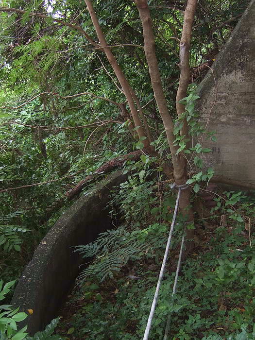
to the top. The concrete I saw supports the down hill side of the old road.
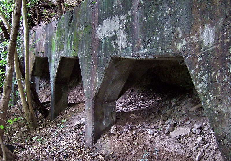
The road along the east side of Malinta Hill passes along this concrete
support structure.
I was now quite a ways up the hill so I had a choice. I could continue my
zig zag trek which might not even be in the correct area or continue
straight up the hill to the top and spend the rest of the afternoon
exploring up there. Since I was waiting for photos from aloud, I decided to
continue going up. I might recognize something and save a lot of future
effort.
From here to the top was steeper and more rocky but there were still trees,
roots and vines to hold onto. Climbing was not dangerous but it was slow.
From the bottom to the top of the hill, I saw nothing more than crumpled
corrugated sheet metal, glass, a few railway ties and other miscellaneous
scrap. The only thing of minor interest so far was a half destroyed car or
truck battery. I cleaned off the label and saw “Chevrolet…Made in Japan”.
The rest of the afternoon was easy walking while taking photos along the
north-south ridge at the top of Malinta Hill. I have been here many times
before and was just adding some rainy season photos to my collection.
In the rainy season a thin layer of moss in many areas gives concrete a
greenish tint that does not occur in drier months. Note that some of my
photos of any one location look different due to them being taken on
different years, different seasons and even different times of the day. Last
Thursday when I was there it was cloudy so a great day for photos with no
white burnt-out sunny areas or black shady areas.
I will post your 1977 photos (scanned slides) one at a time and then add
some new photos to show what that particular area looks like today. All of
your photos were taken at the top of the hill with only a few exceptions.
Also, more structures exist along that ridge but I will only cover the ones
in your photos.

Starting from the north end of Malinta Hill, your first photo was at
Searchlight #8. It consisted of a straight concrete lined tunnel cut into
the hillside. Outside the entrance was an area for the 36” searchlight when
it was in use. This was protected by a low rounded concrete wall. At the
rear of the tunnel was a vertical shaft for ventilation, diesel exhaust and
perhaps even an emergency exit. From the text you posted, it sounds like
Battery M’s pompom gun was installed here perhaps after the searchlight got
destroyed. I have no information on that.
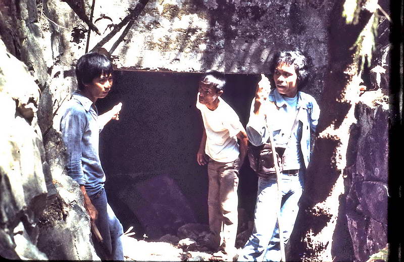
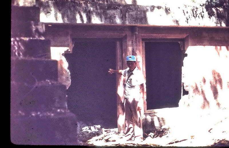
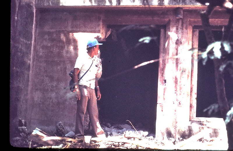
Your father (I’ll make that assumption) leaning on the north wall of
Searchlight #8 tunnel.
The rock wall at the end of the tunnel is the bottom of the vertical
shaft. Light can be seen shining down the shaft.
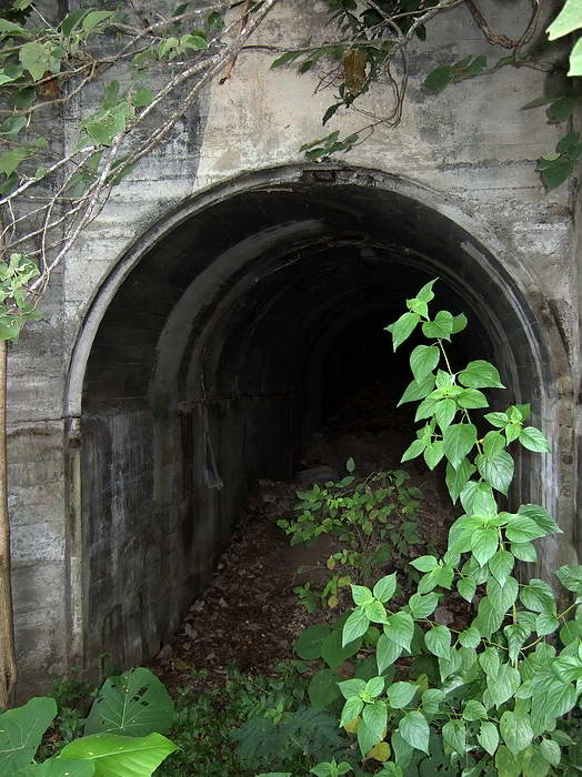
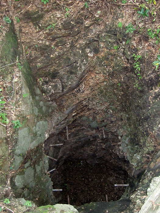
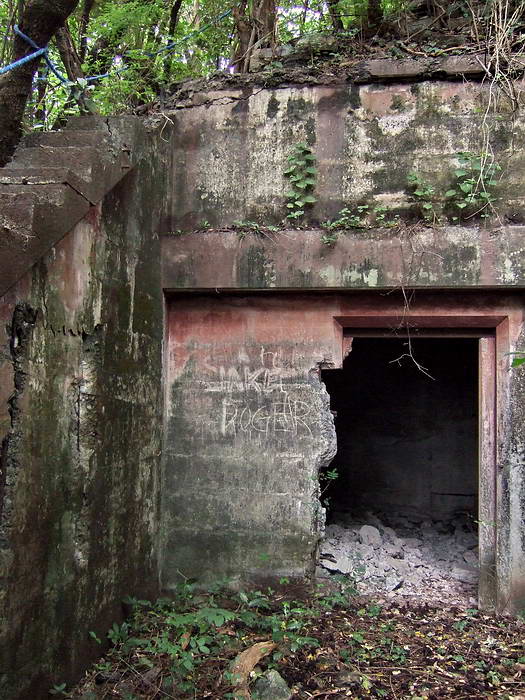
The entrance to Searchlight #8 tunnel
The low rounded concrete wall. To the left (facing east) is a very steep
slope down Malinta Hill.
In this photo you are looking east. The small grey open area near the
centre is Kindley Field. Towards the right you can see the curved tail of
Corregidor Island with Hooker Point just behind the trees.
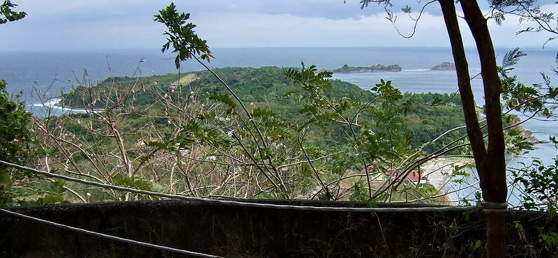
Here you can easily see Kindley Field and Hooker Point. The beach near
bottom right is the 92nd Garage area. The photo was taken at the entrance of
Searchlight #8.
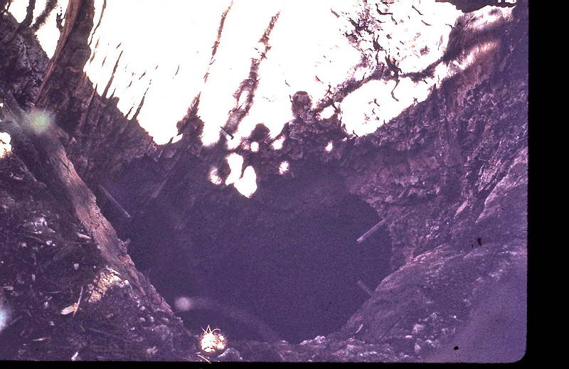
This photo was taken looking down the vertical shaft. The sun was behind
you and there are shadows of at least three people. Rebar can be seen in the
shaft walls.
The same shaft with rebar taken from a different angle.
The bottom can be
seen.
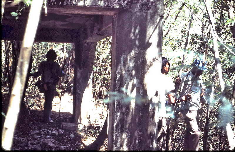
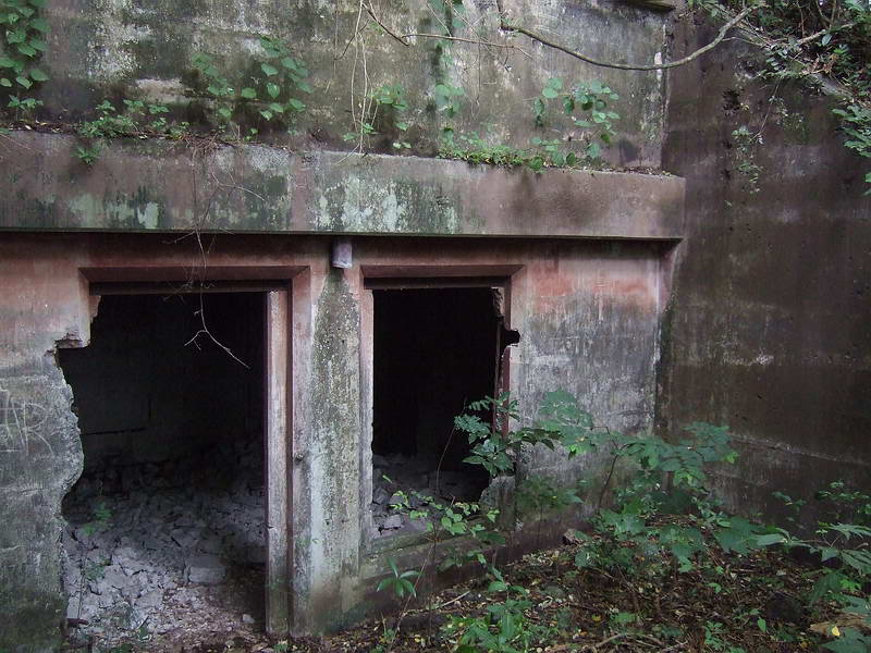
As you walk along the ridge heading south, you next come to is a small
bunker that is very close to a gun shelter. Both structures are in your
photos.
This small bunker is not shown on any map but due to it being only being
approximately 30 feet away from the gun shelter, it may have been a small
magazine for the gun and/or shelter for the troops. The rear entrance is now
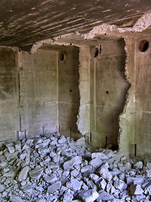
collapsed. Inside is a big chunk of unidentified metal.
Standing in front of the small bunker
Entrance to the small bunker
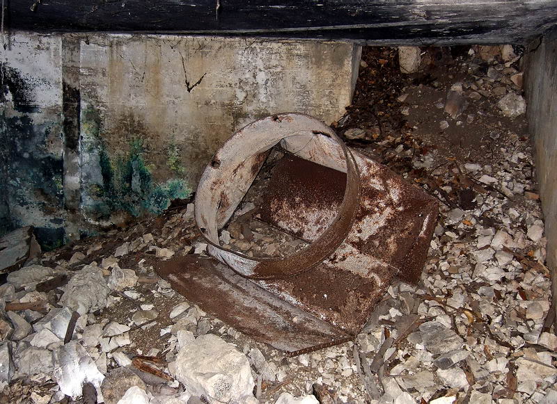
Inside view of the small bunker showing the collapsed rear entrance to
the right.
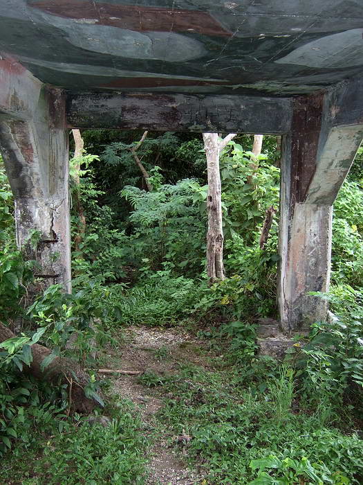
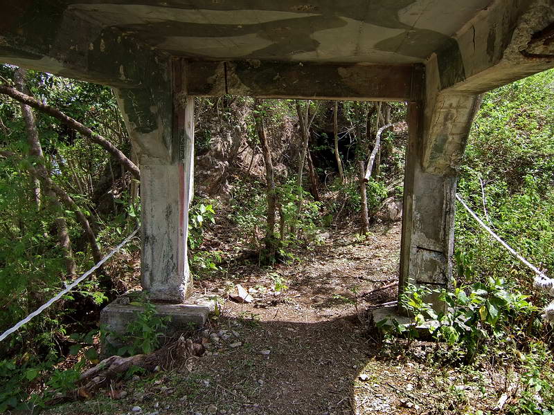
A few steps south is a 75mm gun shelter. It is made of reinforced concrete,
rectangular in shape with a floor, circular gun platform on the western
side, four posts and a flat roof. There are quite a few of these on
Corregidor and they are some of the oldest defenses on the island. This
particular one is at the narrowest part of the ridge allowing for very good
east and west views of the island.
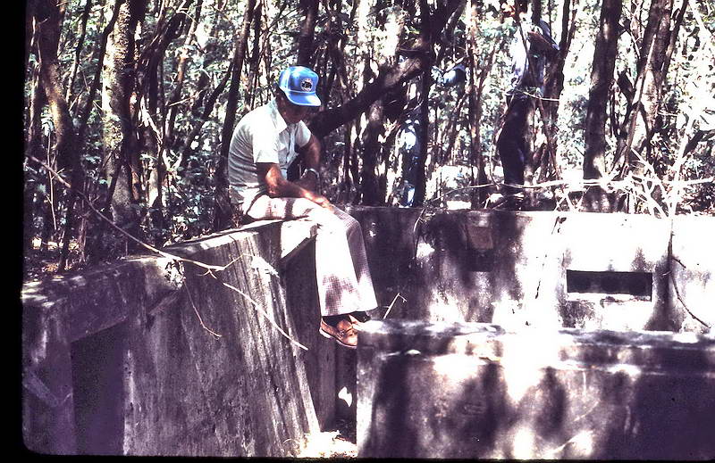
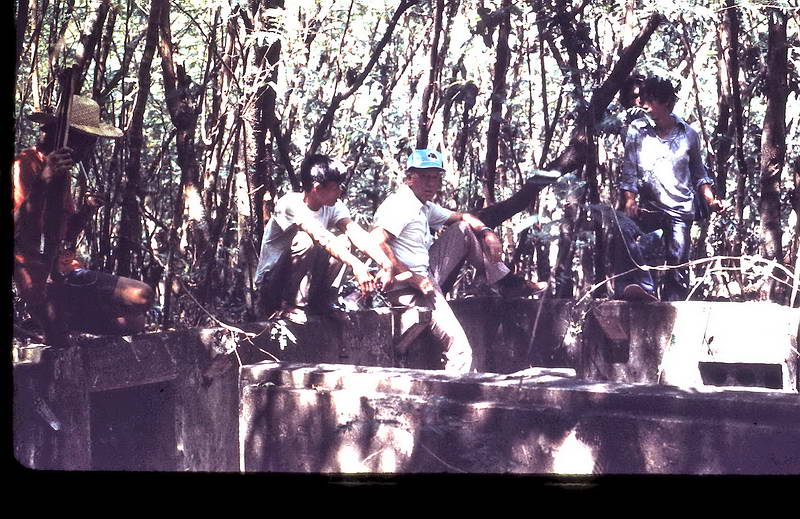
View of a 75mm gun shelter looking south. The ceiling still has a
camouflage paint scheme. Note that your father is holding onto a tree and
looking downward. A few feet in front of him is the cliff on the western
side of Malinta Hill.
Here is the view your father was looking at. This is the north section of
Bottomside. You can see Lorcha Dock at the bottom, North Dock in the middle
(with the Sun Cruises ferry docked) and Engineer’s Dock. In the distance is
the province of Bataan.

Here is the same 75mm gun shelter a few days ago. It is the rainy season
now and any relatively open area gets covered in vegetation. From this angle
you cannot see how steep the left and right hillside is. Those ropes are
there for a good reason. This view is also looking south.
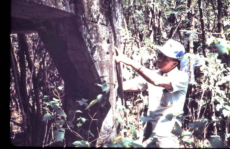
Your father appears to be pointing out battle damage such as bullet holes
on one of the gun shelter’s legs.
View from standing inside the gun shelter facing south.
Dry season view taken from standing inside the gun shelter facing north.
Note the wooden hand rail on the right as today’s hiking trail continues up
a slight hill on the way to Searchlight #8. Also note the dark area straight
ahead. This is the entrance to the small bunker mentioned above.
Continuing south there are a few more heavily damages structures that I’ll
ignore since you did not have photos of them.
Within a couple minutes walk you will come to what you called the “bunker
with upper and lower levels”. Actually these are two separate structures
each having its own specific function and not physically connected. A
combined Fire Command Station was on top and an Officer’s Station was down
below. An external stairway (part of the Officer Station’s west concrete
wall) allows you to go up or down between these structures.
The official map designation and purpose of the structure on top was ‘Gun
Group Fire Command Station’ for the two 12 inch mortar batteries on Topside
(Battery Geary and Battery Way).
The map designation also shows that this structure was not the primary or
secondary command station but was one of a few supplementary stations. It
may never have been equipped or used as such. At some point during the
defense of Corregidor, it seems this location was determined to be more
useful as a gun location than for its original purpose. I know nothing about
Battery M other that what is found on Corregidor.org.
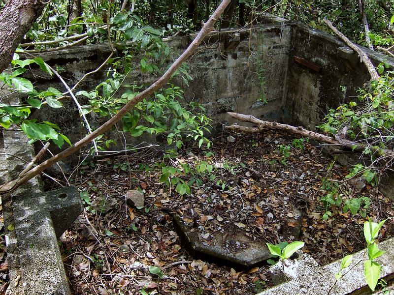
This structure had low concrete walls and two rooms. A concrete pedestal
with three mounting holes on the floor would have been the mount for the
range and direction finding equipment.
At the top of the walls there are right angled supports with holes in them
where I expect wooden upper walls and a roof may have stood. The map
designation does not specify ‘roofless’ so it was originally covered
somehow. These angled supports can easily be seen in all the photos.
There are conduit holes for communication cables and rectangular protected
areas in some of the walls for telephones. The rectangular protected area
can be seen in your photo.
In this photo of your father sitting at the corner of the building, you
can see three conduit holes and rectangular protected area
Same corner as the photo above.
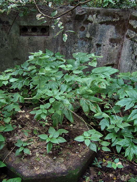
This is the same room that your father was looking into. The same three
conduit holes are in the wall. On the floor is a hexagon shaped pedestal
with three mounting bolts for mounting range and direction finding
equipment.
Here is the same room again from another angle.
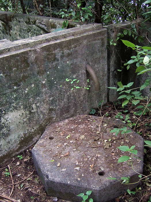
This is the second room equipped with a hexagon shaped pedestal with
three mounting holes. Some pedestals have bolts and some have holes.
A short ways south of the Fire Command Station is a set of concrete steps.
You would have noticed that the steps are actually built into the top of the
west wall of an underground bunker. The official designation of this bunker
is ‘East Defense Officers Station’. Remembering that your father was there
for the final defense just before Corregidor surrendered, this bunker may
also have been used for something else or even called something else.
At the front it has one door and one window. The rear has an air vent going
to the surface beside the Fire Command Station. It is one big room inside
with a few short partitioned walls on each side. We call these narrow
positions “telephone booths” as there are photos of soldiers sitting in
similar ones wearing headsets. They could very well have been radio
operators like your father.
Door to the East Defense Officers Station. Note the steps coming down the
wall at the left.
Same doorway as the previous photo. I wonder what memories would be going
through your father's mind at that time?
Steps down the west wall of the East Defense Officers Station.
Front view of the East Defense Officers Station.
Destroyed “telephone booths”. Your father may have manned one of those
shown in the photo.
View looking back out the East Defense Officers Station.
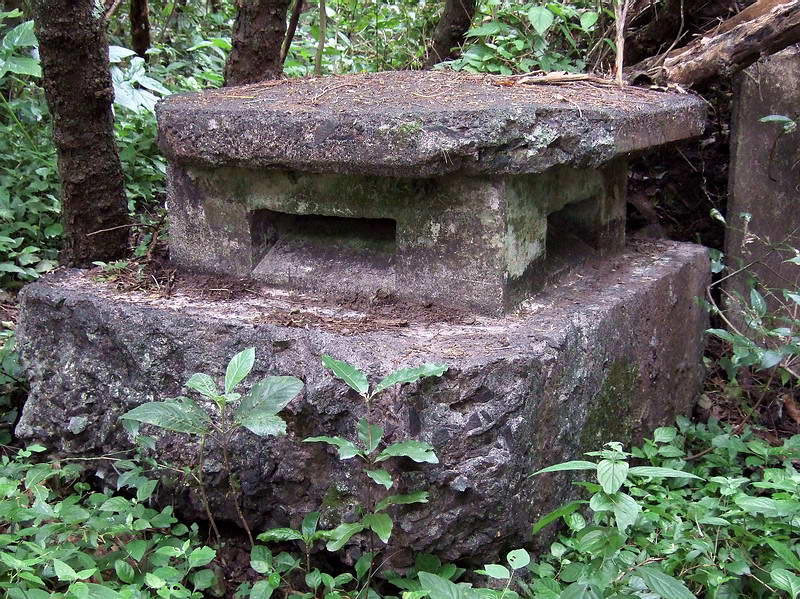
A reinforced concrete air vent is located on the hilltop beside the Fire
Command Station.
In this photo you are not very high up the east side of Malinta Hill and
the water is on your right so you are looking at the 92nd Garage area. You
were farther down the hill than I was when I took my photo. Due to
vegetation, especially at this time of the year, I could not get a photo
there.
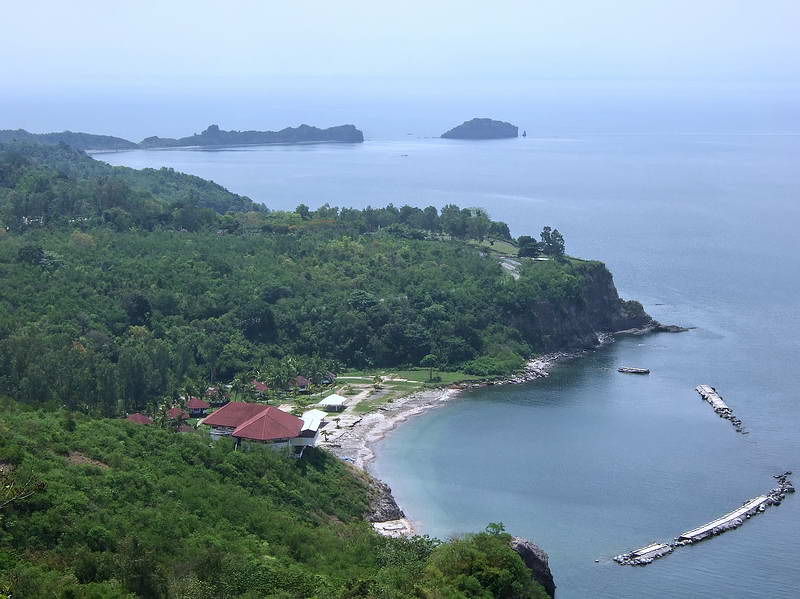
I don’t know exactly when, but a resort was built at the 92nd Garage
area. It has been closed and in disrepair for years. Those are the buildings
you see in my photo. On the point above 92nd Garage (Camp Point) is the
Japanese Peace Garden and Shrine. Above that you can see the east tip of
Corregidor Island.
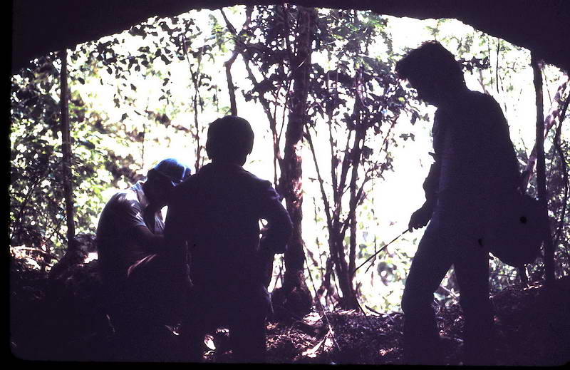
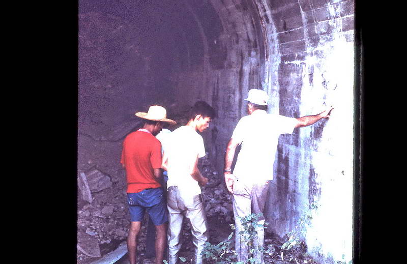
While heading back down the hill, you came to the cave with the 3 ft.
high entrance facing Monkey Point. The entrance may be low but you could
easily stand up inside.
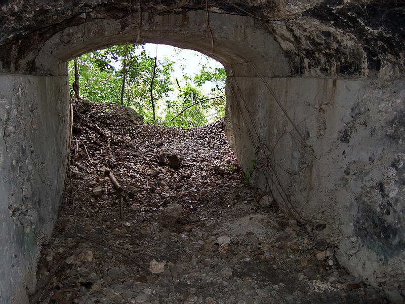
It is a manmade tunnel partially lined with concrete at the front and
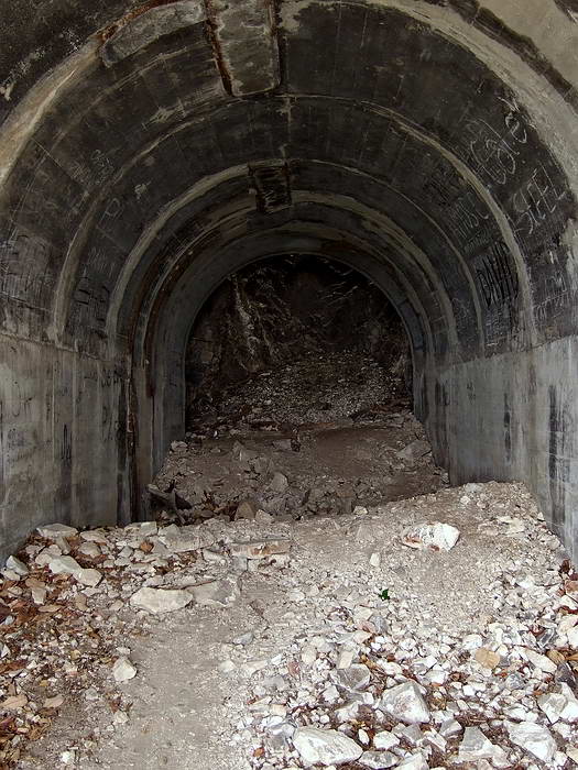
bare rock near the end.
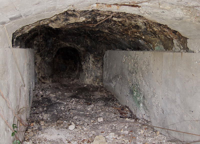
As you walk to the rear it tapers into a small diameter tunnel and ends
after a slight turn to the left.
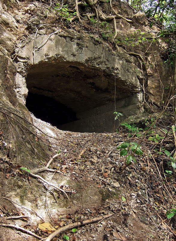
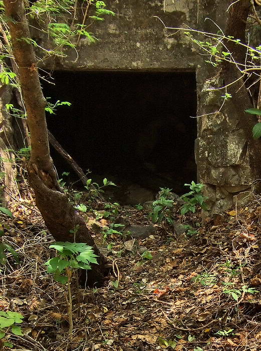
Tunnel entrance
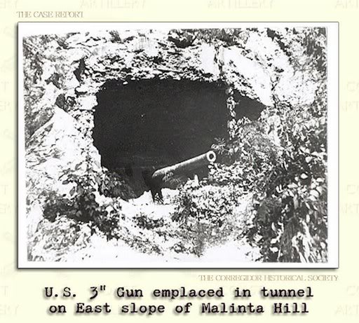
An undated photo shows a US 3” gun emplaced here.
By this time, you have walked most of the way down the hill and are located
close to the north eastern area of Malinta Hill. The walking from here was
mostly flat ground for a few minutes until you reached the North Shore Road.
Walking further downhill along the road, heading north-west now, you passed
lots of little tunnels/caves along the side of the road. You may have
forgotten it but you also passed the Malinta Tunnel North entrance.
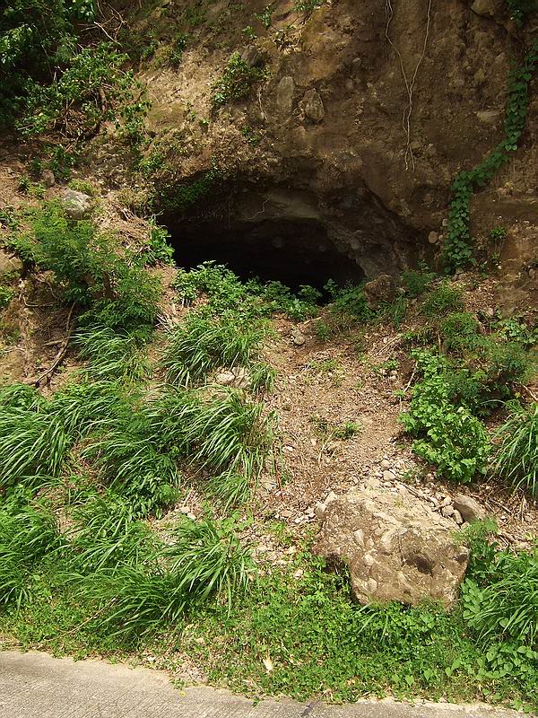
One of many man-made tunnels in the area
In a few minutes your group was within view of the beach between Malinta
Point and Engineer Point. This was the swimming beach for the enlisted men.
Your last photo is one of the buildings just across the road from the beach.
You now were at the bottom of the Malinta Hill.
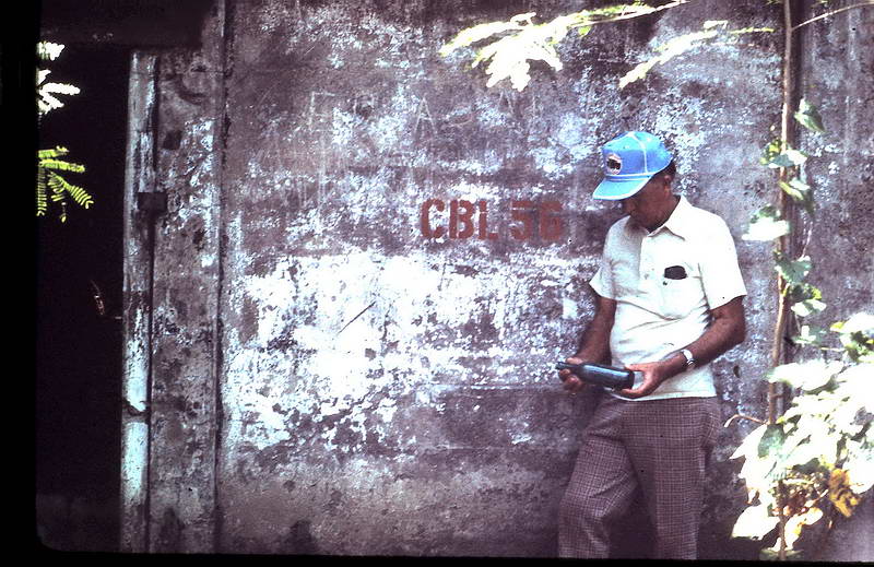
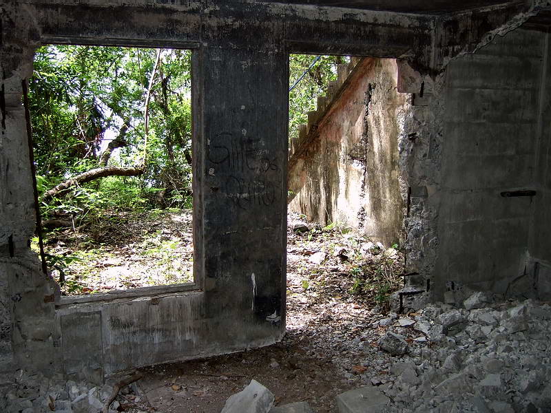
I do not have a photo showing ‘CBL56’ on the wall but notice the
similarities (door frame, hinges etc) to my photo. A window is on the left
side and a doorway on the right. The damage to the bottom right side of the
doorway is very similar. In your photo you can see a horizontal crack higher
up the door way. In my photo, this area has broken away. These buildings are
crumbling a bit every year. The angle that the two photos was taken is a
little different but maybe this is the same doorway, maybe not.
Continuing west and then south around Malinta Point would put the Corregidor
Inn in view with your lunch waiting.
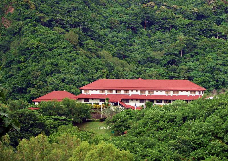
A rainy season view of the Corregidor Inn with Malinta Hill in the
background.
In October, 1977, it is quite possible that you walked through Malinta
Tunnel as you say and exited the east entrance to head uphill towards the
bunker. Since I walked from the east entrance to the top of Malinta a few
days ago, I can surely appreciate the effort you guys put into it. It can be
more or less difficult depending on the exact route but “easy’ is not a word
that comes to mind.
Not remembering exact details of an unfamiliar place 32 years later is
certainly understandable. I hope this brings back some memories for you.
Time for your second trip to Corregidor now.
|