|
Most guys who
are intrigued by Corregidor history have always been .
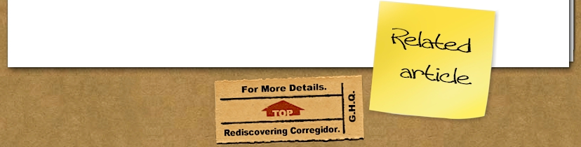
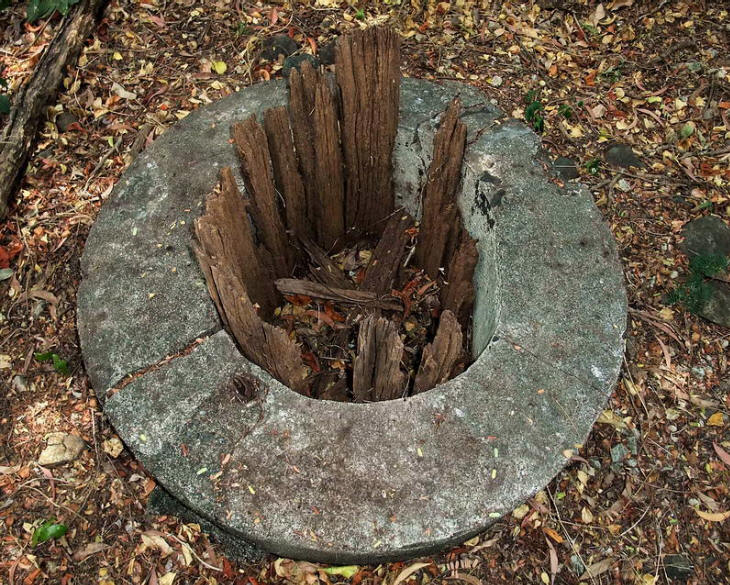
View of the airshaft at the surface. There is a metal rung ladder
down the inside of the shaft but it does not look very solid these
days.
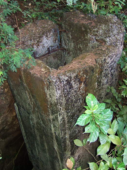
This view of the airshaft shows how close it is the South Shore
Road. The main tunnel entrance was on the other side of the road
where today, a large crater exists.
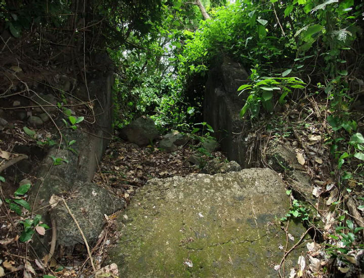
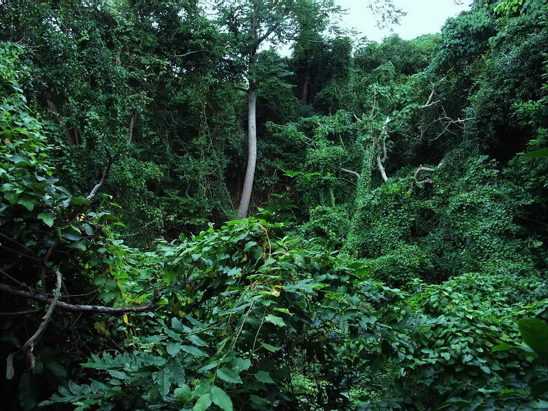
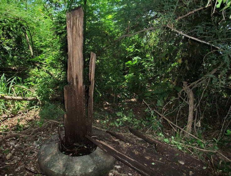
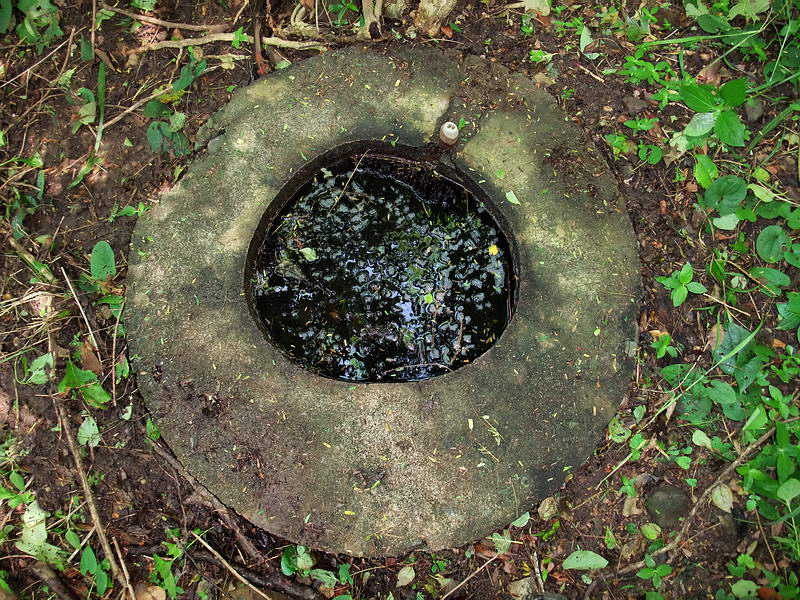
Continuing on from the airshaft, you cannot go much further south.
At that spot I am probably at the northern edge of the South Shore
Road.
As far you can go towards the Main Entrance.
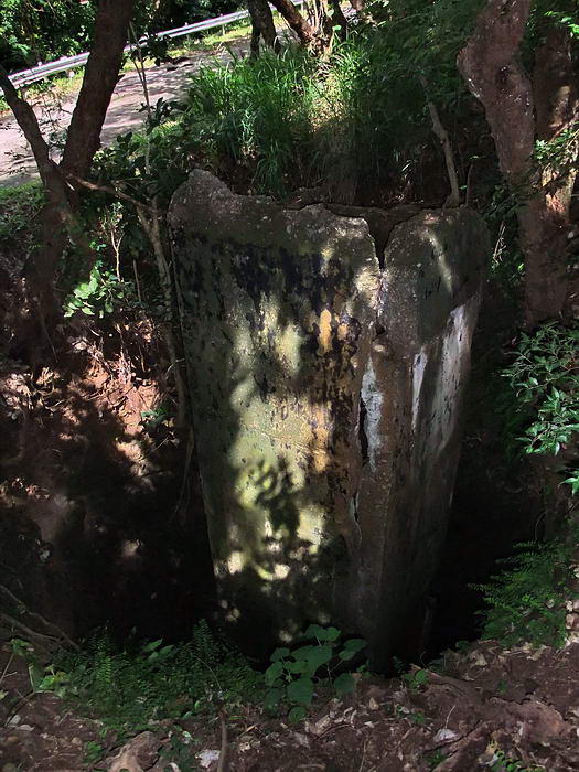
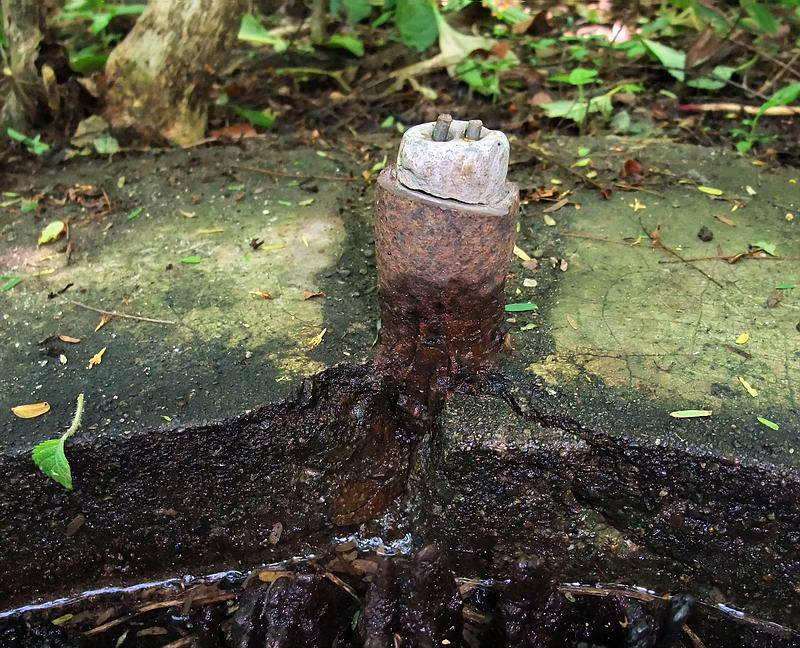
Unfortunately I did not notice if the pipe we see here is just a
section sticking up or it continues up through the ceiling. This is
definitely not the same pipe that we earlier saw on the surface. It
is located on the opposite side of the airshaft. Books mention two
pipes in this tunnel, one for diesel exhaust and one for
air-conditioning exhaust. I can’t say which one this is.
Having seen all that we can for now we head back to the surface.
Going up the 45 degree slope is not bad but the last vertical bit
makes you work for a moment. It is a bit awkward with not much to
hold onto. Little elbow room means the rope doesn’t help much.
After exiting the tunnel you go up the walled walkway and turn left.
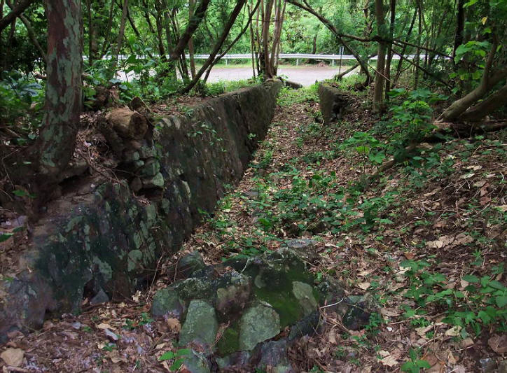
The steps down to the South Shore Road.
The big crater starts at the road embankment so to get down to the
location of the Main Entrance, it is easiest to loop around towards
the east. Less thorny and not so steep this way. After the 1945
explosion I don’t think a single blade of grass remained.
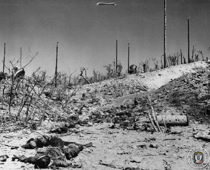
1945 photo at the Main Entrance of the Navy Radio Intercept Tunnel.
You can see the two concrete walls leading to the entrance. The
crater is just out of sight at the right. Dead Japanese soldiers are
in the foreground. (Photo courtesy Corregidor.org)
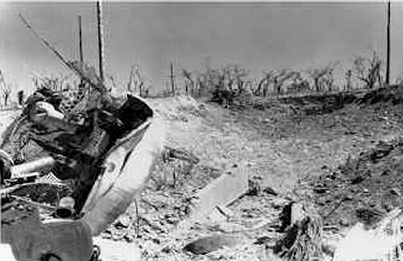
1945 view looking towards the crater. Note the two concrete walls
that led directly to the entrance. In this photo and the previous
one, what is that big chunk of metal seen at the left? (Photo
courtesy Corregidor.org)
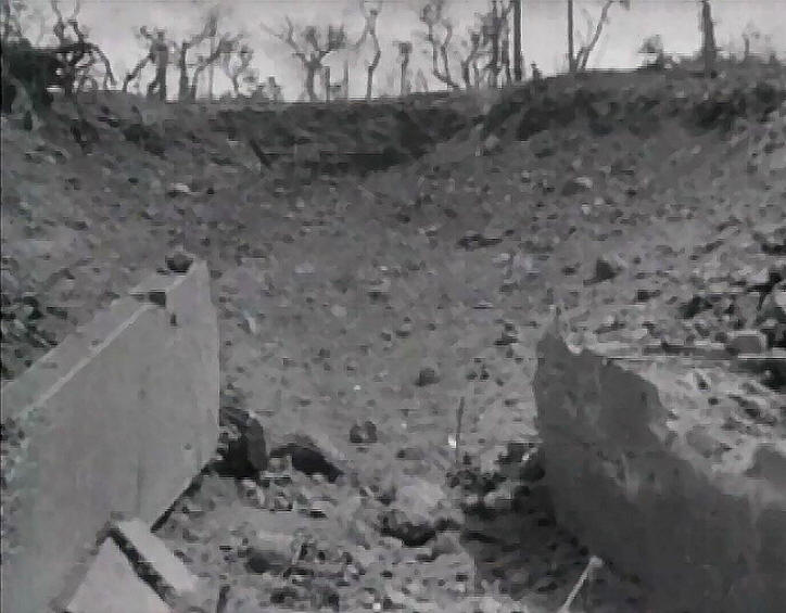
Video capture from a Japanese newsreel. The crater seems deeper now,
I wonder if the loose soil settled over the years.
The crater in January 2011. See what 70 years does!
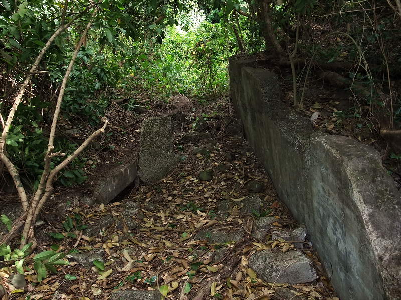
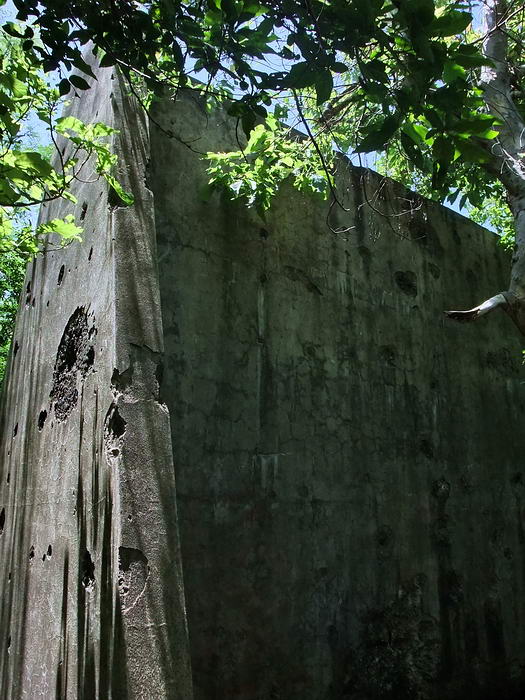
Here are the two concrete walls of the walkway into the Main
Entrance. The left-side wall has fallen inwards. The crater is
straight ahead.
Less than two minutes’ walk from the concrete walls is the Handball
Court. It consists of a high center wall with a court on each side.
Both courts have a concrete floor.
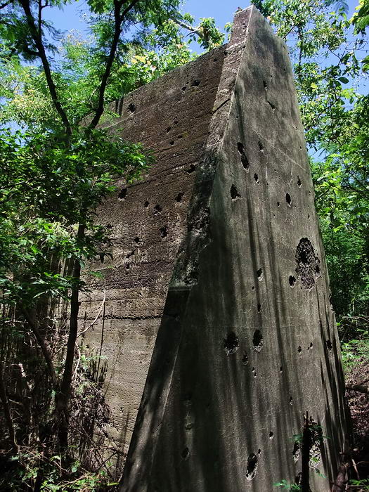
The battle damaged Handball Court wall.
The other side of the wall.
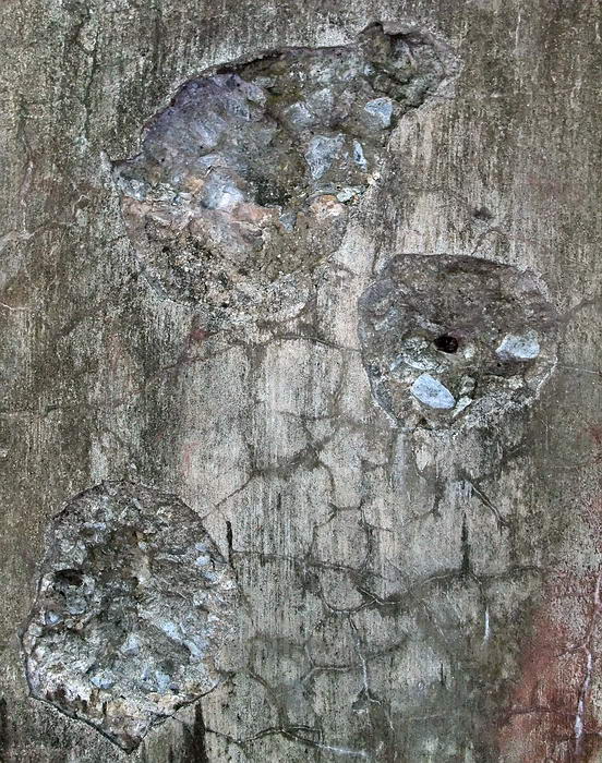
Close-up of some of the damage.
Notice the dark spot middle right. I
scraped it lightly with my pocket knife and it is metal. It is large
for 30 cal so perhaps it is a 50 cal bullet.
Broken concrete floor of the Handball Court.
Station CAST seems to have had an extensive antenna farm. I have no
idea how many tall wooden poles there were but I have recorded the
location of 17 so far. All of them were set in the ground and then
ringed with concrete. Two poles have coax cables sticking up from
the rings so here was the physical connection between these specific
antennas and a transmitter/receiver back in the tunnel. (One
document I read said that Station CAST also had transmitters).
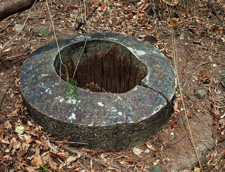
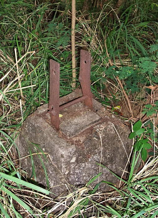
One of the antenna poles with the concrete ring.
Another sample of these poles.
Some have quite a bit of wood sticking out of them
but none have the
whole pole remaining.
Note the white dot at the 1:00 position.
A closer view shows a coax cable with two copper wires protruding
from the concrete.
Many places on Corregidor had field kitchens to feed troops who were
at their war time stations. The old photo below appears to show an
elaborate one. Near the south cliff is a small damaged structure
made of solid bricks and concrete. It is not as elaborate as the
field kitchen in the old photo but I am guessing that is what it
was.
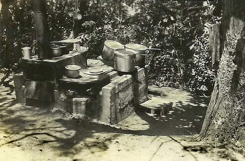
Field kitchen
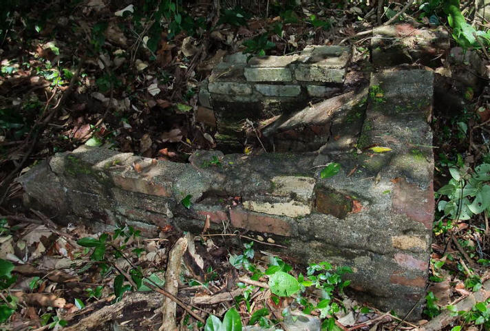
Possible field kitchen south of the tunnel near the cliff.
To the west of the tunnel were the Officer’s and Junior Rank’s
Quarters for the Station CAST personnel. One of the drawings shows
the quarter’s locations. Maybe some evidence was blown away but I
did not find that many buildings. The thorns and other vegetation
was quite thick above the south cliff so I’ll admit to not looking
very extensively in that area. I don’t know why the drawing shows so
many buildings for just seventy+ people. All structures I found
would have been constructed of wood. Concrete steps, support
pedestals and occasionally a floor are all that remains.
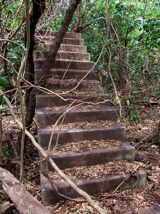
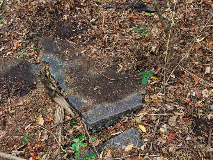
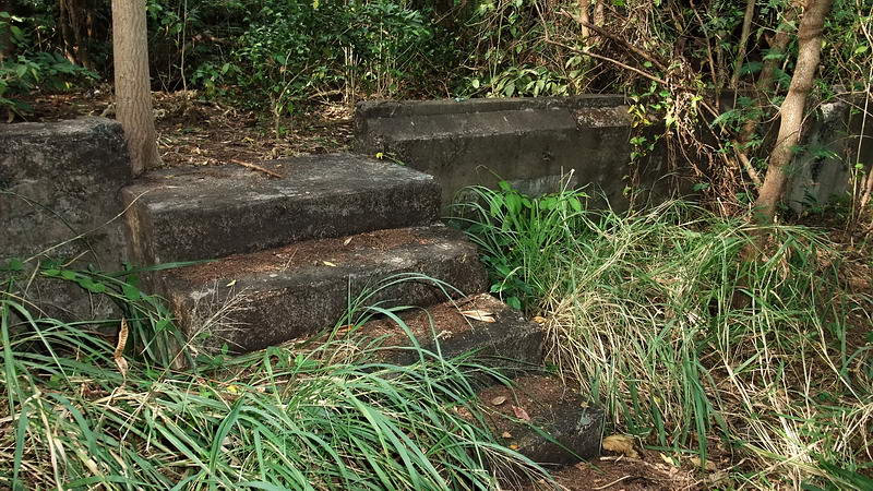
Concrete steps to nowhere.
This wooden quarters building is long
gone.
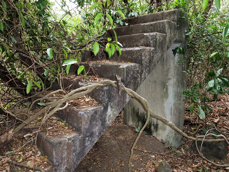
A second set of steps is nearby.
One of numerous concrete support pedestals for the wooden buildings.
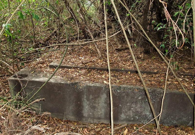
Corner of the most westerly quarters. This structure was
approximately
100 feet long by 60 feet wide and had a concrete
floor.
For some reason one of the large antenna poles w/ring is located
inside the concrete floor.
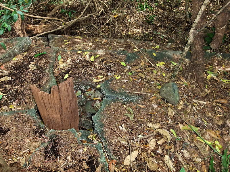
North of the South Shore Road were the two wooden officer’s
quarters. They had concrete steps, floor and low walls. Both
structures even had a carport/garage on their eastern ends. Behind
each structure was a small wooden structure on pedestals.
Front steps of one of the Officer’s Quarters.
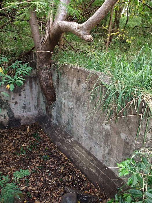
Both structures have low concrete walls.
The wood above the walls is
all gone.
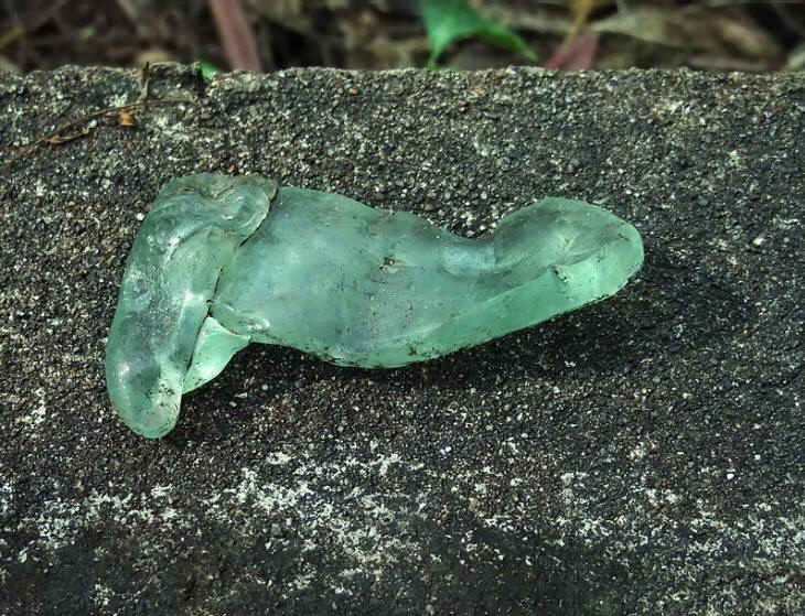
I kicked away some soil beside a wall and found a piece of melted
glass. On April 29th 1942, Japanese shells from Bataan burned both
structures to the ground. (Info from Battery "M" Historical Report)
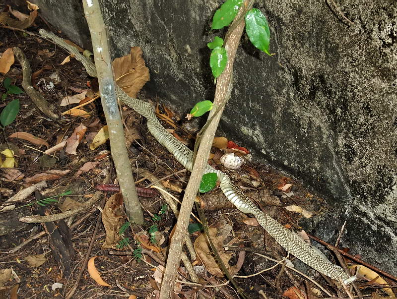
Beside one of the walls was a subtle reminder that I am trespassing
in snake territory. I suppose that this shredded skin means that it
is bigger than that now!!! 
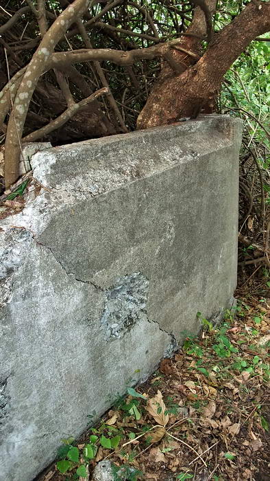
Front corner of one of the Officer’s Quarters.
For some reason the bit of trim at the top of the concrete wall
caught my attention. It seemed familiar. Other than these two
structures which both have it, I have not seen this anywhere else
around here. When I got back to my computer I found a 1945 photo of
the Monkey Point area with the same type of trim on a concrete wall.
I think I got lucky. If you look at the maps, place yourself at the
Officer’s Quarters and look east. Toward the left you would see the
South Shore Road heading away from you. As the road passes by the
tunnel you would see the crater on the right. A topo map I have also
puts the eastern end of Caballo Island in view to the far right.
Straight ahead, antenna poles are in a line from the Quarters going
past the big crater on the left.
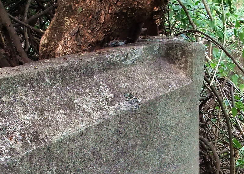
Closer view of the trim on these concrete walls.
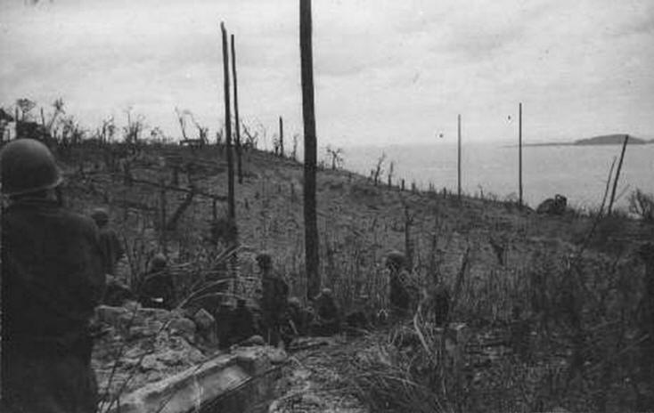
1945 photo looking east with the concrete wall at the bottom.
(Photo
courtesy Corregidor.org)
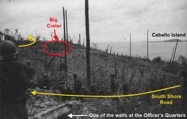
Here is the above photo labeled. This photo was taken from one of
the walls of the Officer’s Quarters. The soldiers in the foreground
are standing on and sitting beside the South Shore Road. (Photo
courtesy Corregidor.org)
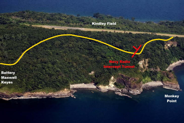
Some accounts of the explosion say that all the soil was blown away.
Perhaps much of it was but today the whole area is tree covered
again. I’ll leave you with an aerial photo showing you the section
of Corregidor Island we have explored in this report.
If anyone has further information regarding Station CAST, please add
it to this report so it can be as complete as possible.
Often on the ferry back to Manila I hear the day tour crowd saying
they had a great trip and saw everything there is to see on the
island. Little do they know what lies hidden out of sight away from
the roads. Corregidor is an amazing island. I hope that never
changes.
|