|
RETURN TO PAGE
1
I was a bit disappointed in that absolutely nothing remains to give a
visitor any indication of these tunnels being military in origin. On the
other hand, they are part of Bataan's WWII history. To explore inside them
was interesting and well worth the effort. Some books mention many more
tunnels than we know of today plus there were even two more at the Mariveles
airfield. Just walking the area was great for getting a realistic feeling of
locations I had only been reading about.

Google Earth satellite view of the Mariveles Navy Tunnels. (My GPS software
program has a feature where waypoints can be placed in their exact positions
on a Google Earth photo).
Tunnel #1B (collapsed) is most likely a second entrance to Tunnel #1A.
Tunnel #2 has not been located.
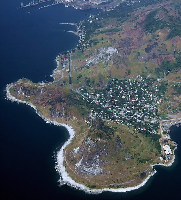
Similar view, different orientation. The tunnels are in the hillside at the
top of this aerial photo taken in December 2007.
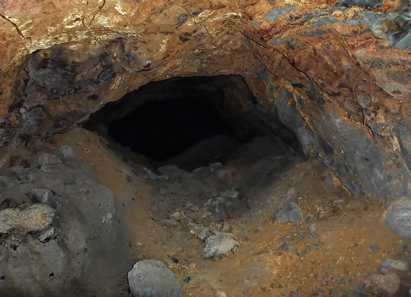
In December 2010, Karl arranged for the entrance of Tunnel #1 to be dug out.
It had been open years ago but later landslides had completely sealed it.
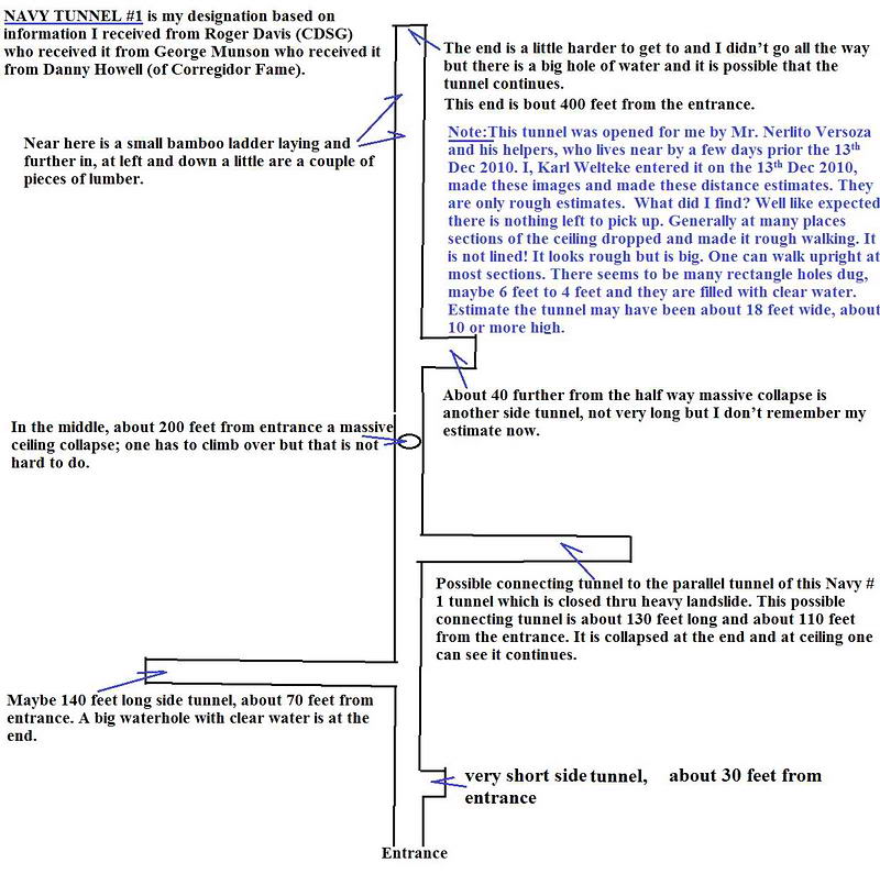
Sketch of Tunnel #1A. I'll call this entrance 1A as a nearby sealed entrance
only 68 meters away may be a second entrance to this tunnel. At the moment,
this cannot be confirmed 100%. (Sketch courtesy of Karl Welteke)
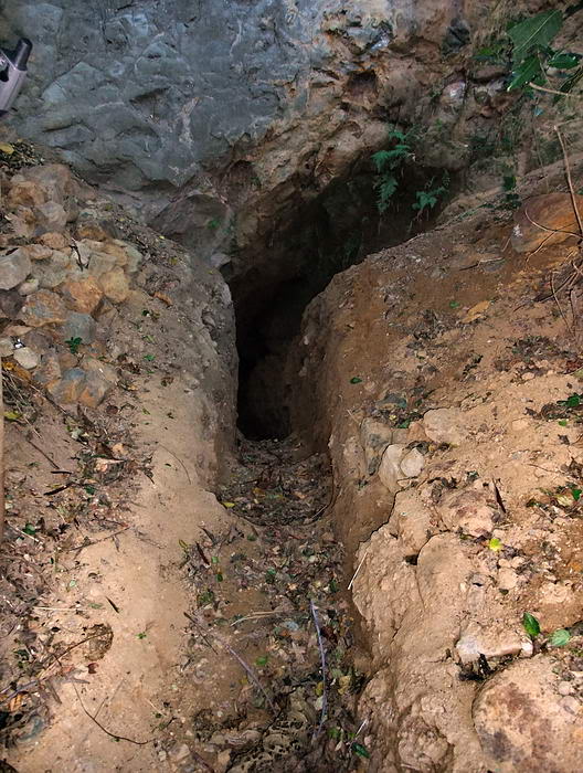
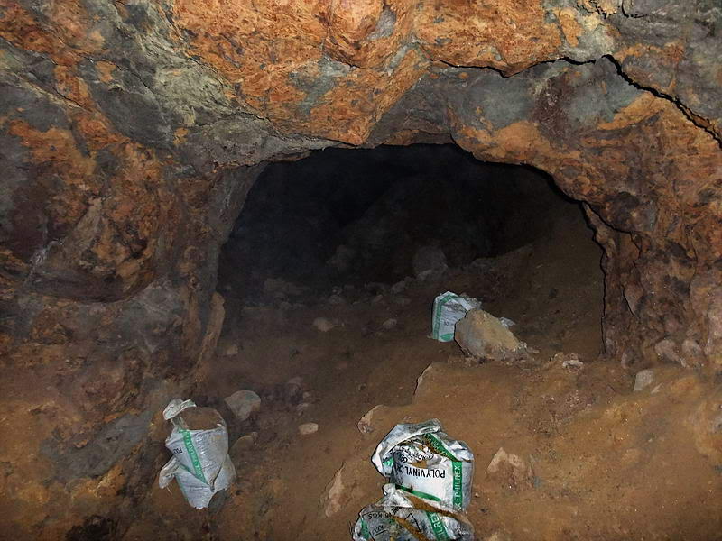
On the outside looking towards the entrance to Tunnel #1A.
Looking back towards the entrance we just came in.
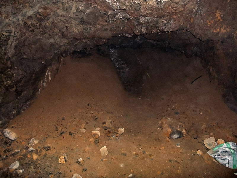
You can easily stand up in most of this tunnel. Humidity is quite high and
no concrete is visible anywhere. Near the entrance to the first lateral on
the left are bags of sifted soil. The owner said people had been working in
the tunnel years ago 'looking' for things. I saw no air vents anywhere in
this tunnel.
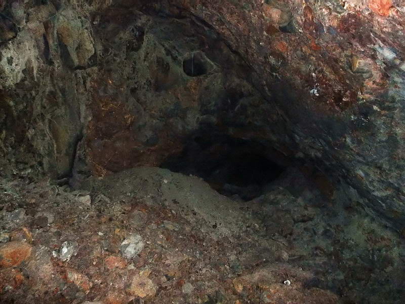
The entrance to the first lateral on the left.
Near the end of this lateral, we see a water-filled hole in the floor that
is the width of the tunnel. You can easily see the bottom through the clear
water. I did not measure it but I will estimate it at 5 to 6 feet at the
deepest. If you look closely you can see a little wall of neatly stacked
rocks which prevents anyone from going any further. Walls are for either
keeping something in or keeping something out. Not sure which scenario fits
here. (Mystery #1)
Approaching the water-filled hole and rock wall.
Note the stacked rock wall. The tunnel appears to continue past this point.
Back at the main tunnel, continue inside and have a look at the next lateral
which is on the right. This one is interesting in that it is low in places
and a bit up and down. When you reach as far as you can go you are
definitely not at the end. Bats are flying in and out of a 10 inch high gap
between the rock ceiling and the soil floor. Crawling forward and sticking
my light in here, I am reasonably sure that see a tunnel on both sides of me
that is parallel to the main tunnel #1A. This is why we feel that Tunnel
entrance #1B may be a second entrance to #1A. A bit of digging would get us
past here. (Mystery #2)
Proceeding down the second lateral.
Proceeding down the second lateral.
Getting narrow ahead. Look at that grey pile of soil. Has someone been
digging here?
As far as I can go but open ahead. Bats are coming in and out of here.
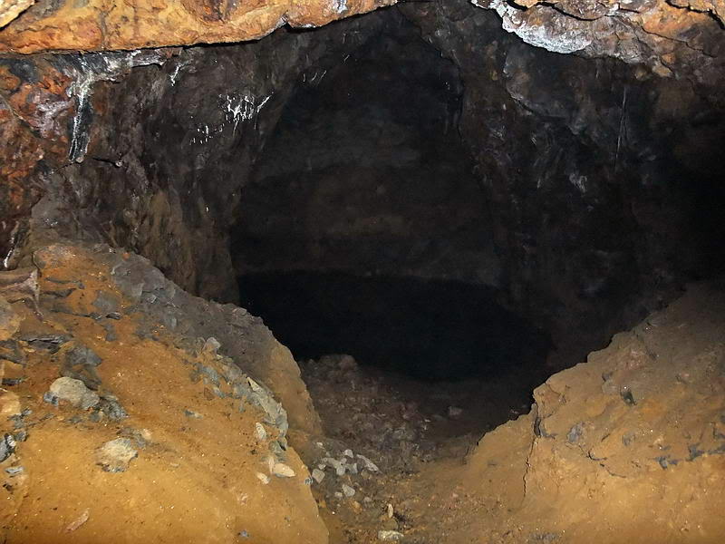
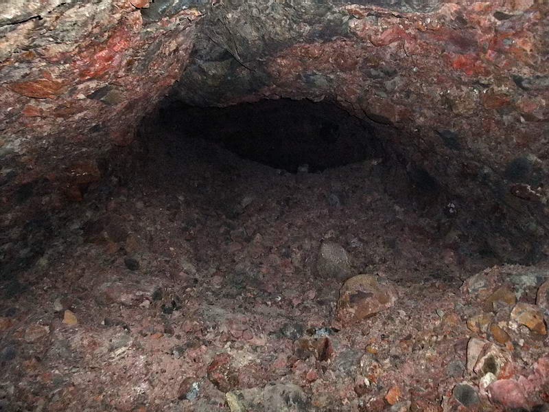
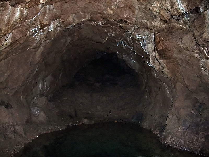
Back at the main tunnel, we continue on again. There is an area where you
slide over some rocks that have fallen from the ceiling. Another short
lateral appears on the right. After traveling quite a ways we come to the
end or more correctly, to as far as we can go today.
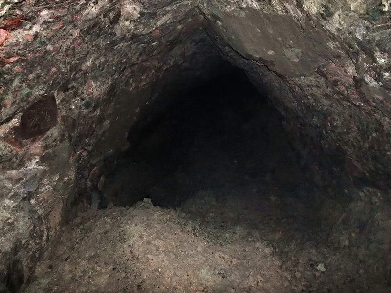
Nearing the end of the
main tunnel.
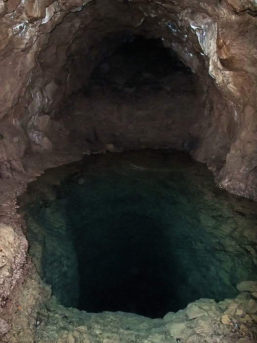
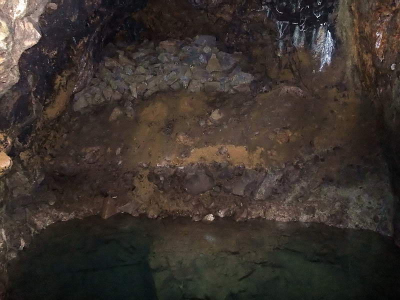
This is the farthest point we could go in this long tunnel.
A pool of water is in front of me and the tunnel may or may not be fully
collapsed past that. The rectangular hole is full of clear water. It looks
like a very professional construction job and I wonder why someone would go
to so much bother digging it. The tunnel floor is muddy, sloped, wet and
slippery. Venturing too close to the edge does not seem wise.
I would like to know how deep the hole is so I come up with this 'bright'
idea of using a chemical light stick that I always carry. I snapped the
stick and it glowed bright yellow. After tying a rock to it, I dropped it in
the middle of the hole. In 3 seconds it went out of sight and I saw nothing.
I turned off my flashlight and gave my eyes a couple minutes to adjust to
total darkness. The water is crystal clear so I expected at least a faint
yellow glow from down there. Nothing!!! Why dig such a hole and how deep is
it? (Mystery #3)
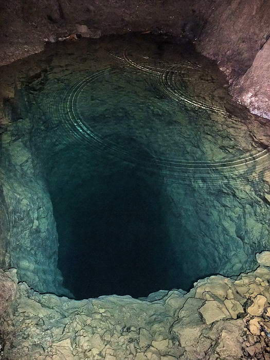
Close-up view down the rectangular hole.
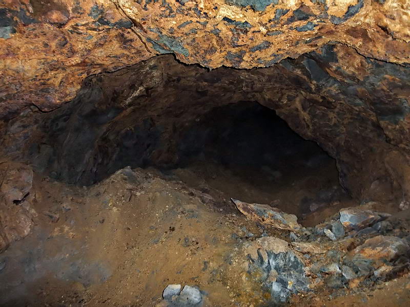
Closer view of as far as I could see past the hole. The tunnel appears to
continue further on.
GO TO PAGE 3
|